Welcome to the VI Lake info Page!
Updated November 30, 2016
All of the lakes listed have been fished and/or visited by Castaway members. GPS way points, stocking information (3N means triploid fish), road conditions, boat launch facilities (see pin on lake pictures for boat launch), camping sites, etc are current as of April, 2015. There are literally dozens of lakes in the central island area but our general rule has been to pick out lakes within an approximate 60 – 80 minute (speed?) drive from the bridge in Parksville. They have been divided into different regions: Nanaimo, Nanaimo South; Parksville South West, Qualicum West, Port Alberni North West, Port Alberni West. More areas and lakes will be added as we collect data while staying within the 60-80 minute driving range.
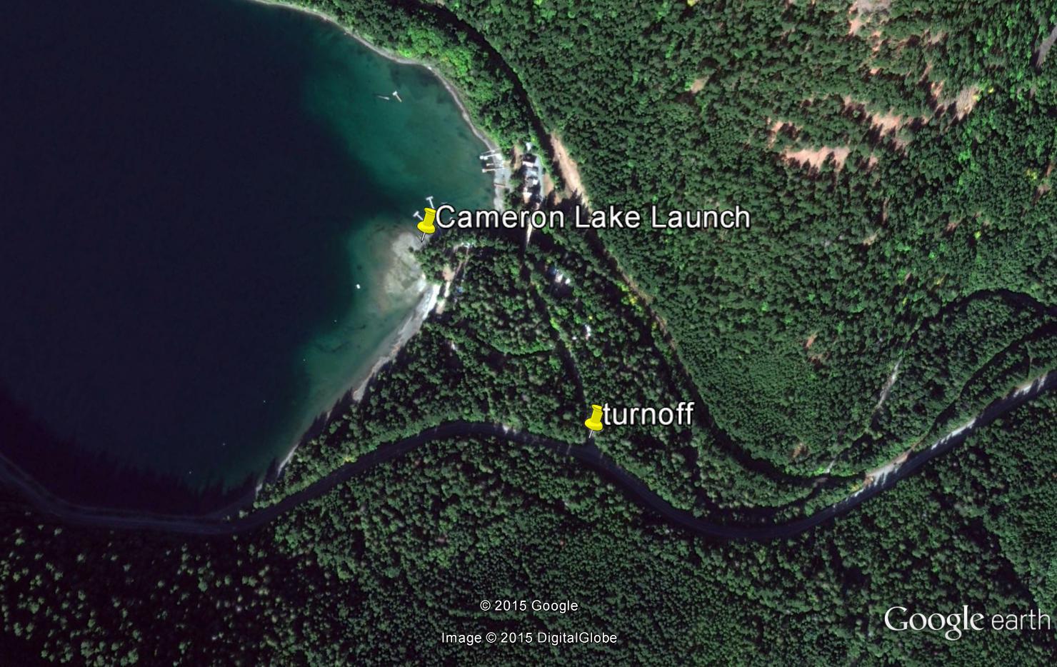
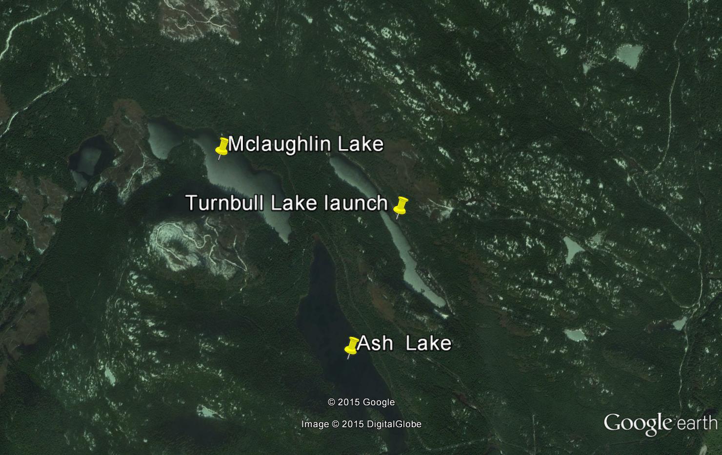
Wherever possible GPS way points are taken right at the boat launch area of each lake. Please note that some off roads might confuse your GPS other than when you are at your destination lake! Of special interest to club members might be the area we have dubbed “the golden circle” which includes Lowry, Mclaughlin, Ash, Turnbull, and Elsie Lakes. These lakes are in the Great Central Lake ‐ Ash River Valley area northwest of Port Alberni and are relatively close to each other and offer a wide variety of fishing and camping. The area is laden with still active logging roads (be careful) and some are gated but most are usually open all week. If you pay close attention to the directions given you should be fine.
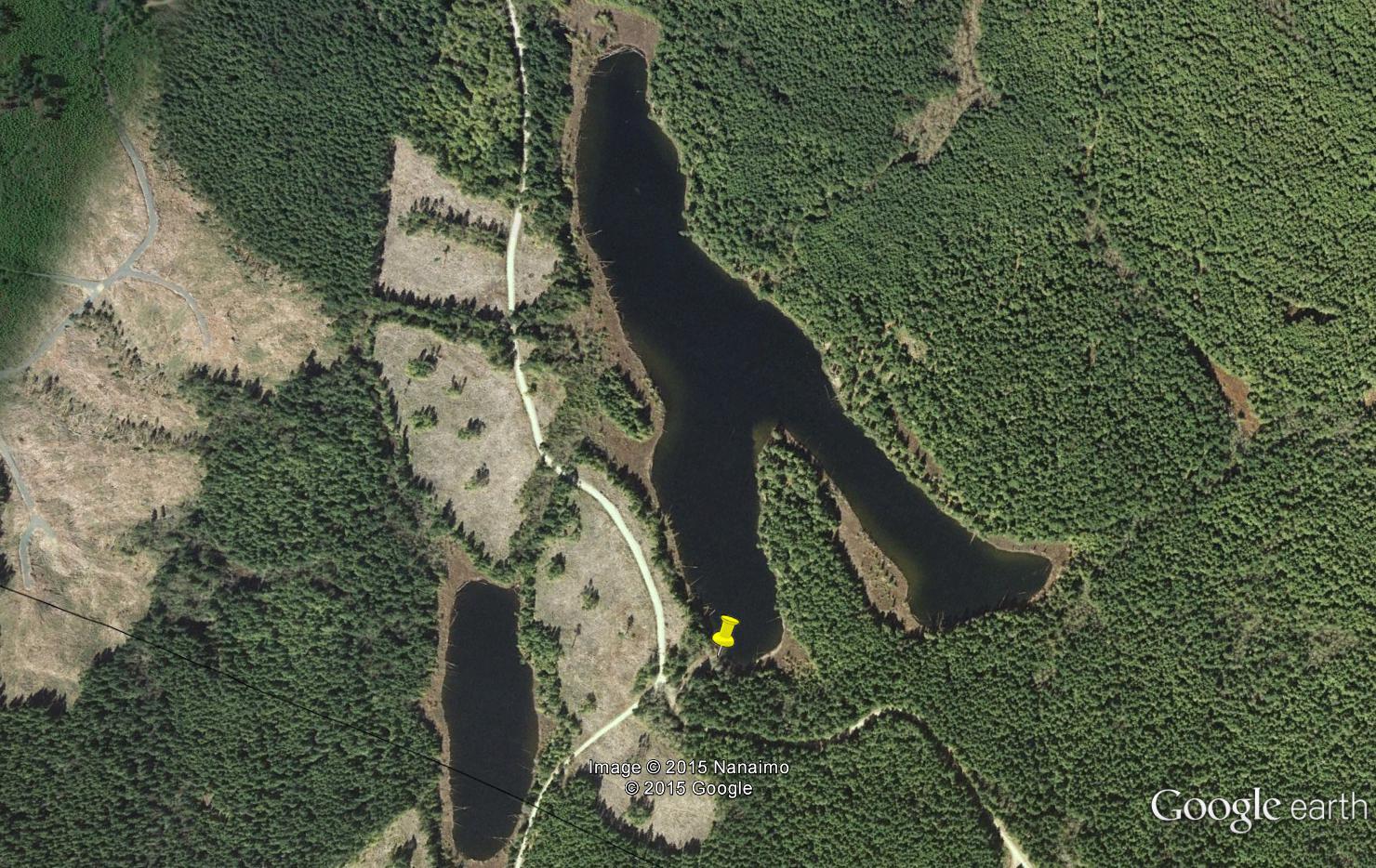
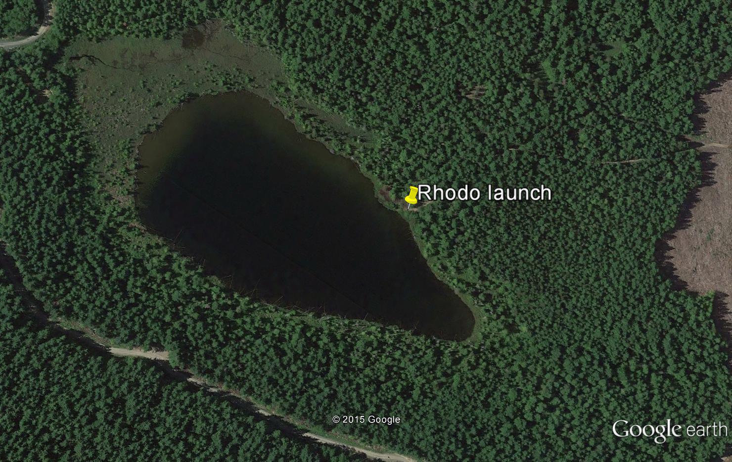
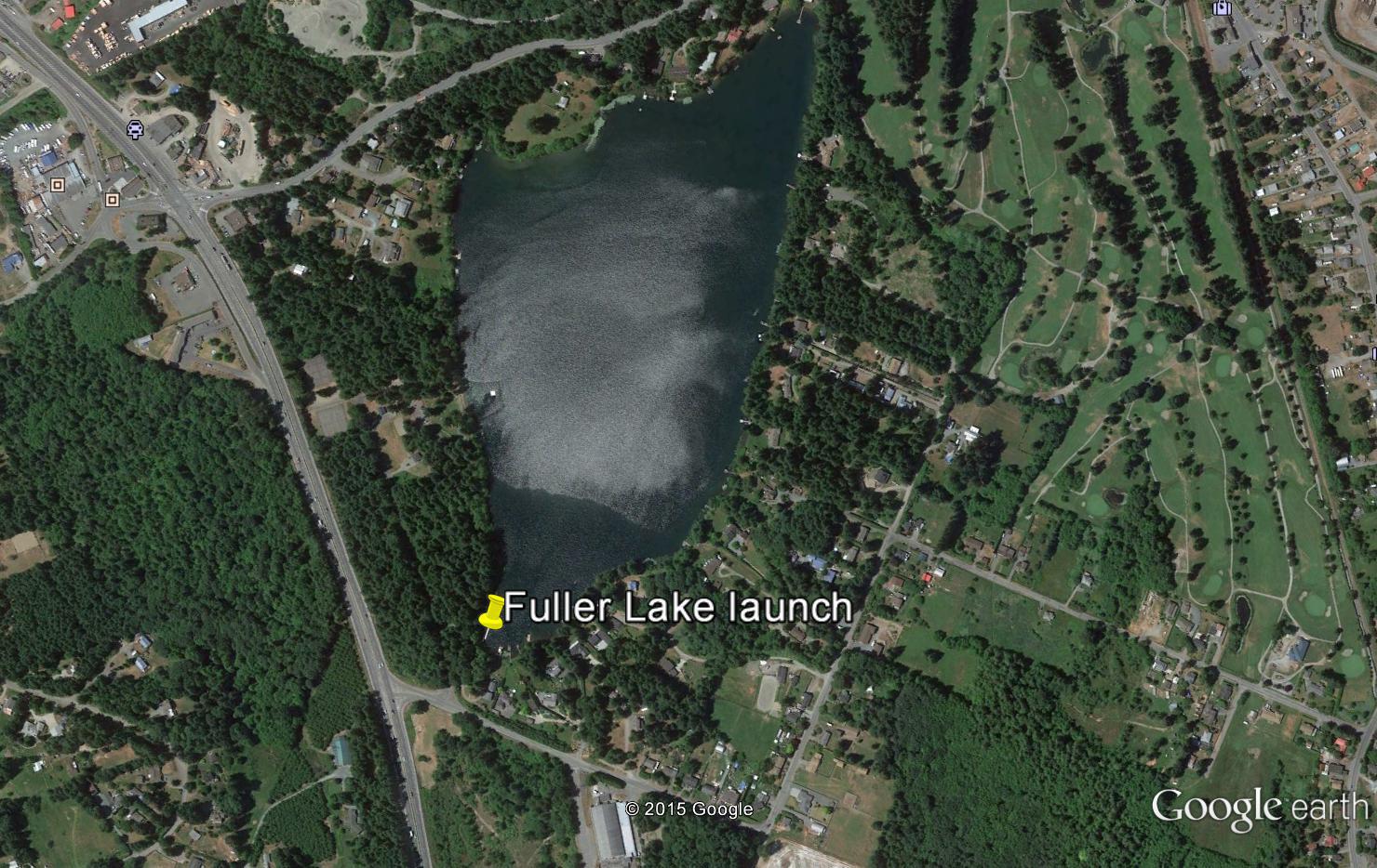
Note: 1) Yellow Push pins indicate the actual location of the boat launch.
2) Click on Picture images to enlarge
Parksville Area Lakes
Rowbotham Lake
General Area: Parksville West on the ridge east of Mt Arrowsmith
Directions to Lake: There are two ways to get to Rowbotham. The shortest and quickest way is via Winchester Road near Butterfly World in Coombs then follow Grafton Main logging road using your GPS. This route however is often not available as Timbers West have a locked gate just past the end of Winchester. An alternate but longer and more difficult way to Rowbotham is via Island Timberlands entrance on Nanoose Bay Road. Then follow the main road that follows the Englishman River. Stay right until you cross the Englishman River over the logging bridge. Turn right just over the bridge and follow 155M210 for a few miles before you start to climb up the mountain. At this point you should be using your GPS as the road has many branches and it’s easy to get lost. If you’ve followed the correct roads you will end up joining the Grafton Main road and your only a few miles from the lake at that point.
GPS Waypoints: N 49* – 19’ – 12.4 “; W124* – 18’ – 5”.
Road Conditions: Steep mountain logging road, 4 x 4 truck a virtual must. Near the top when you’re taking the connecting road from 155M210 to Grafton Main there is about a one-mile stretch that is quite overgrown so be prepared for scratches on your vehicle. There is the potential for improvements to the road in the future.
Launch Facilities: None at the moment. At the western end of the lake the road comes within 75 feet of the lake shore and there is a rough trail where you could carry a pontoon boat, float tube, or a very light aluminum boat down to the lakes edge.
Campsite: None
Species of fish: Trophy lake with good sized wild Rainbow trout. Targeted for future stocking.
Lake Data: maximum depth n/a; area: approximately 30 acres; elevation approximately 3,000 feet
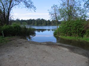
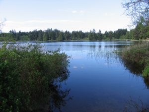
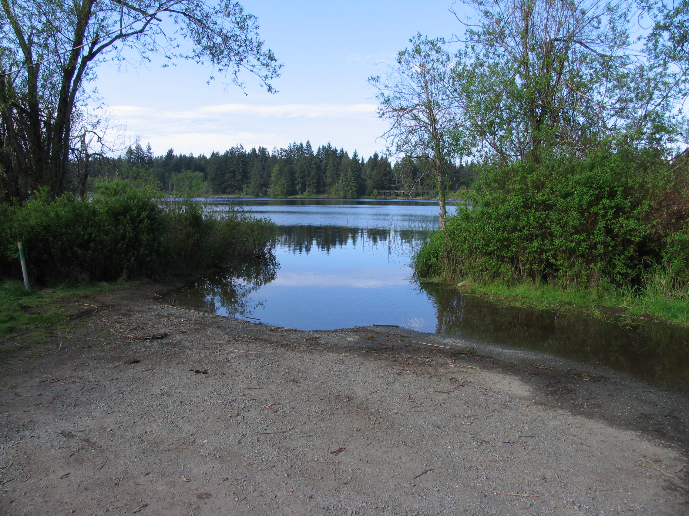
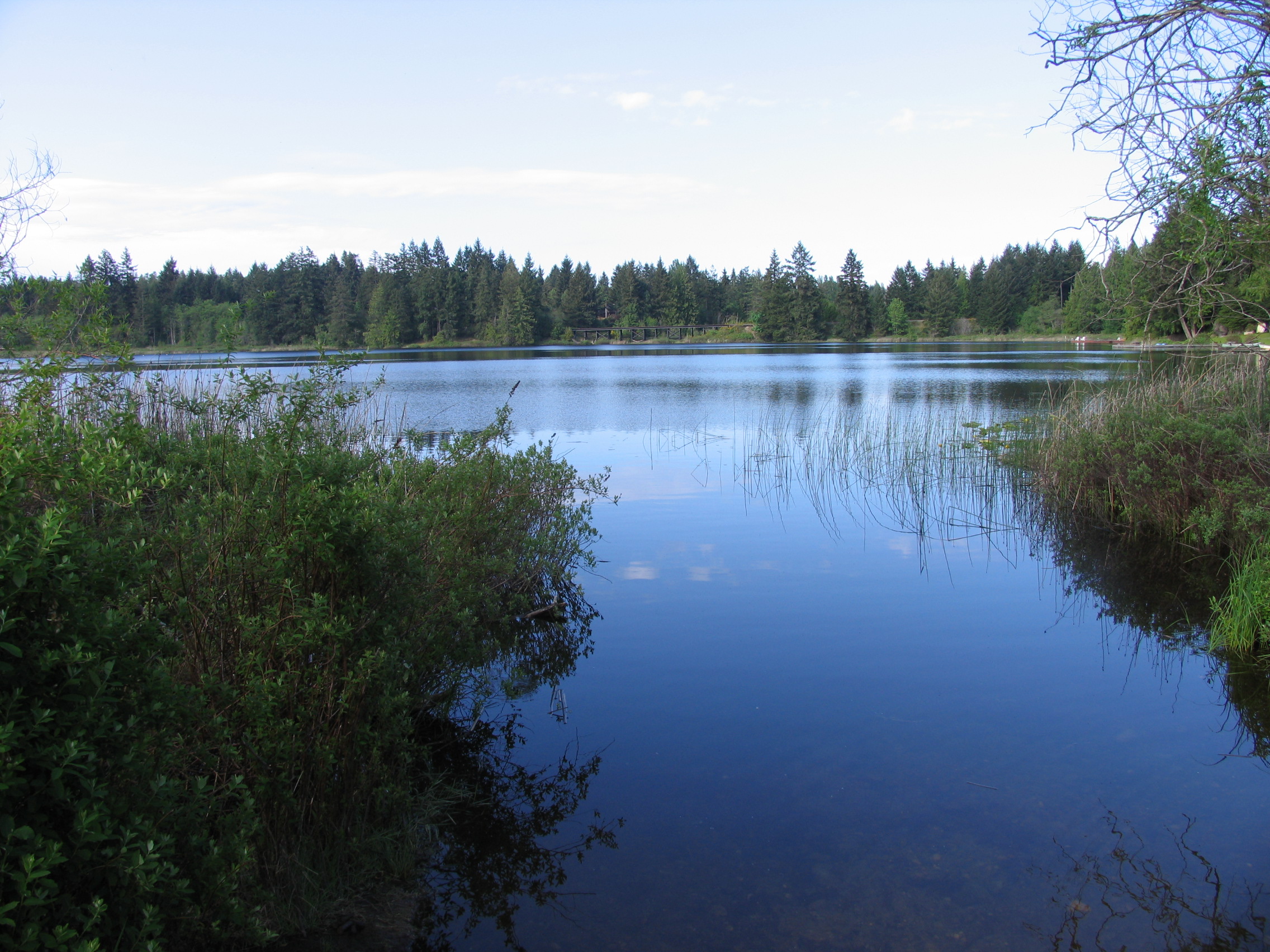
Boomerang Lake
- General Area Location: Parksville South West
- Directions to the Lake: Accessible only on weekends (no charge) through Island Timberlands gate, 1420 Island Highway (at Island highway and Northwest Bay Logging Road, turn right at the light just south of Big Boy Toys). Take 155 main road, turn left on 142 main (after last farm) and stay on this road to the lake. Approximately 25 minute drive from gate. Easy to find, you will see the Lake on your left‐ hand side but go past first left road to South Western end of lake at 142m139 turnoff as it’s a better place to launch a boat.
- GPS Way Points: Lat: 49″10′.35.4 N Long: 124″09′.14.7 W to best launch site [google-map-fb-popup id=”2″]
- Road Conditions: Reasonably good gravel road, car OK. Do not try to reach from Nanaimo as roads terrible and washed out. Quicker and easier as per above
- Type of Launch Facilities: Car top, inflatable, trailer OK but a little shallow
- Camp Sites at Lake: a few open areas, no facilities
- Species of fish found in the Lake: Cutthroat Trout. Last stocked 2004 but stocking goes back to 1934. Last 15 years 5.500 cutthroat but previously rainbow and brook trout. Size of fish is in the 9 ‐ 15 inch range, a few bigger ones
- General Information: Boat required. There are two boat launch areas, use the 2nd boat launch at the south arm of the lake.
- Maximum Depth: 37′ (360 m), Elevation:1,188′ (365 m), Area: 27 acres (10.9 Ha)
- Special Lake Restrictions: None known but check regulations
- click here to see the depth and contour map – hydrographBoomerang
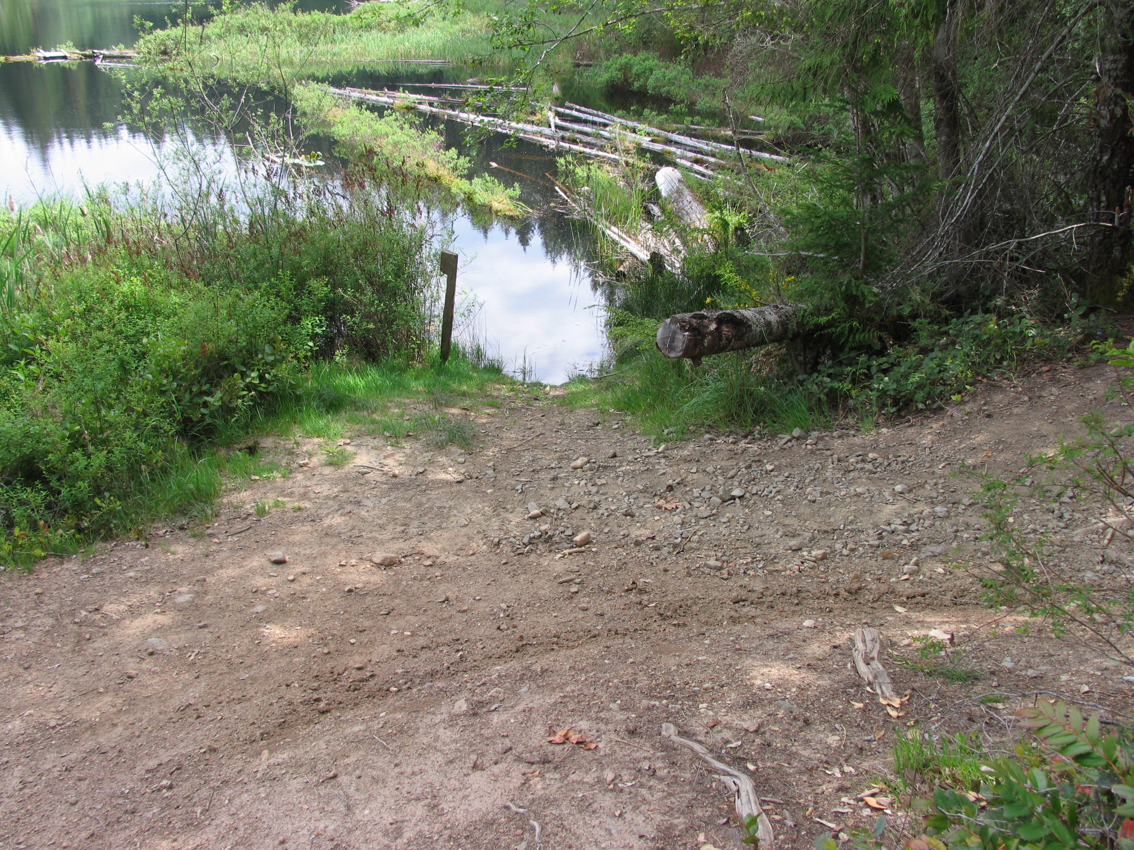
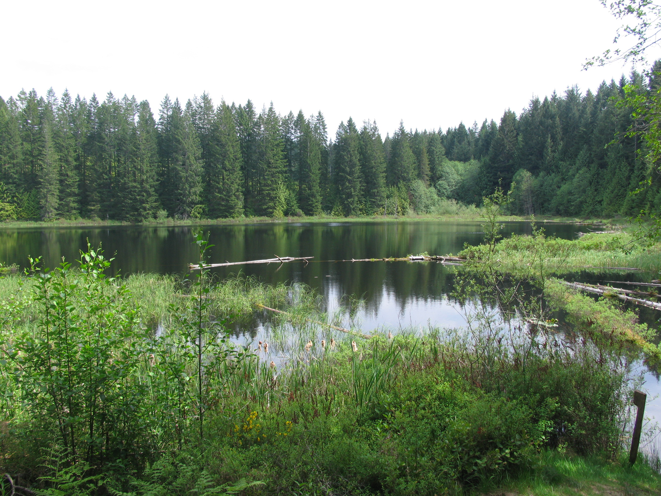
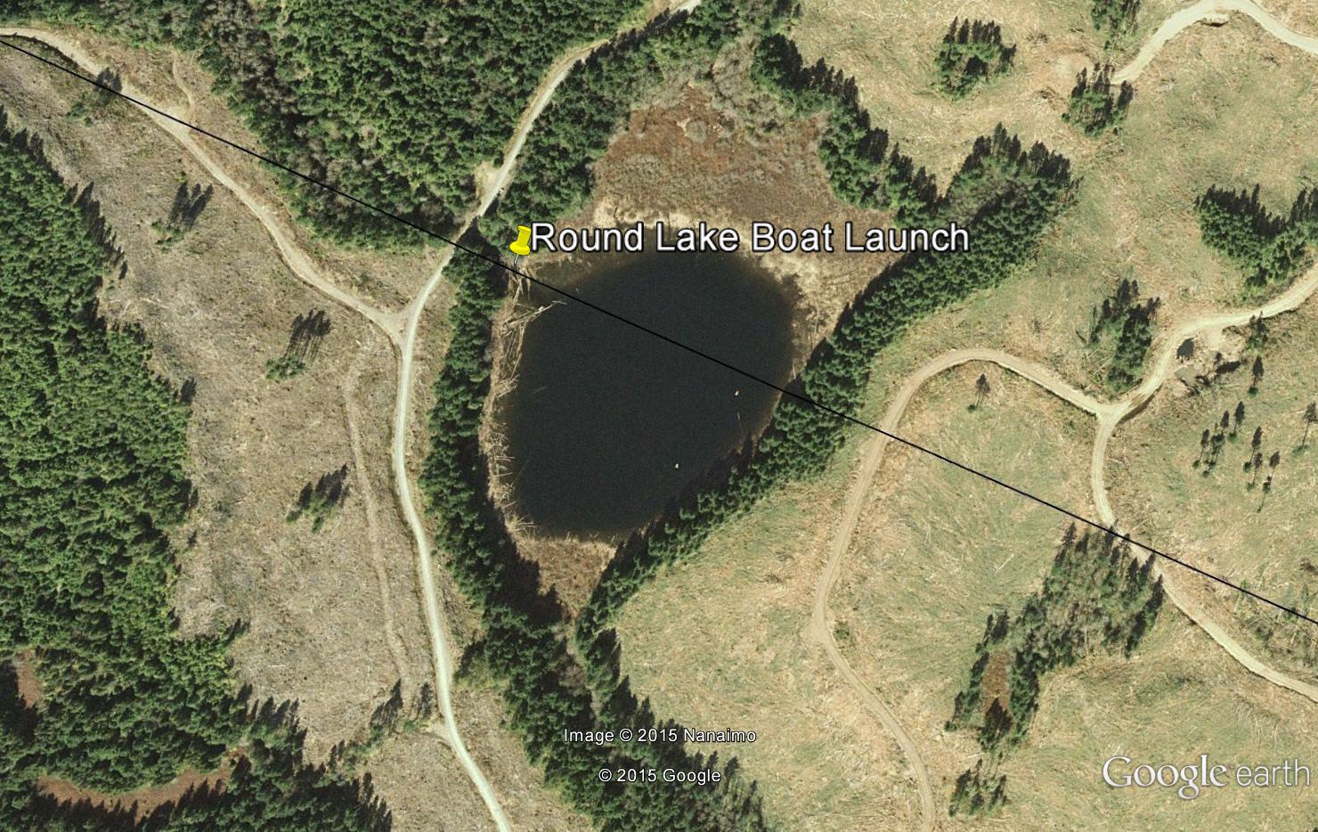
Round Lake
- General Area Location: Parksville South West
- Directions to the Lake: Accessible only on weekends (no charge) through Island Timberlands gate, 1420 Island Hwy (at Island highway and Northwest Bay Logging Road, turn right at the light just south of Big Boy Toys). Take 155 Main then left on 142 Main (after last farm) for 12 kms then turn left on 142M-124 (about 2 kms before Boomerang lake) and follow road for 3.0 kms. The lake will be on your right‐hand side approximately 25 minute drive from the gate.
- GPS Way Points: Long: 124″‐09’‐09.7 W, Lat: 49″‐12’‐06.9 N to launch site [google-map-fb-popup id=”9″]
- Road Conditions: Ok gravel road, car Ok if careful. Do not try to reach from Nanaimo as road is terrible and washed out. Quicker and easier as per above.
- Type of Launch Facilities: Car top or inflatable only, about 30′ to lake
- Camp Sites at Lake: none
- Species of fish found in the Lake: Cutthroat, 1997 ‐ 2006 5,094 yearling stocked, smaller fish in the 10″ ‐ 14″ range but possibly larger CT
- General Information: Boat required. A small (3.7 Ha, 9 acres) beautiful lake ideal for fly-°©‐fishing with extensive shoals, Maximum Depth: 33′ (10 m), Elevation 1,071′ (310 m), Area: 7.2 Acres (2.9 Ha)
- Special Lake Restrictions: None known but check regulations
Okay Lake
- General Area Location: Parksville South West
- Directions to the Lake: Accessible only on weekends (no charge) through Island Timberlands gate, 1420 Island Highway (at Island highway and Northwest Bay Logging Road, turn right at the light just south of Big Boy Toys). Take 155 main then left on 142 main (just after last farm). Now pay attention as the lake is tricky to find. After 3kms on 142 main, take a right on 142m-36. 15-20 minutes down this road you will see a sign on your left that reads “Cross Over” to 142 m-53-58. Turn left and the road will go up and down through logged off areas (go past the first hand turn) until you come to an intersection at 142m53. Turn right and follow until the road veers left over a small logging bridge. At this point the road goes up a steep hill until you come to an intersection, stay right a short distance until you see the lake on your right with a short road to the lake. To return you can follow the above in reverse or at the last intersection, stay right and the road will lead you down to 142 Main just north of Boomerang lake.
- GPS Way Points: Long: 124″‐11’‐58.1 Lat: 49″‐10’‐52.5 to launch site [google-map-fb-popup id=”4″]
- Road Conditions: Reasonably good, car OK if careful and you stay on the main roads, truck is best though
- Type of Launch Facilities: car top, inflatable only. Difficult for a trailer. It’s very shallow at launch and you will have to paddle your way through the weeds. Waders or high boots recommended as it is very muddy at the launch site.
- Camp Sites at Lake: Rustic but some nice spots to camp
- Species of fish found in the Lake: Rainbow and Cutthroat. 2,000 blackwater RB stocked 2010 ‐ 2014, previously stocked with CT. Rumour has it there are some nice bigger fish in this lake but most will be in the 10 ‐ 15″ range
- General Information: Boat required. Area: 10.3 acres (4.2 Ha),
- Elevation: 1,539′ (469 m), Max Depth: n/a
- Special Lake Restrictions: none known but check regulations


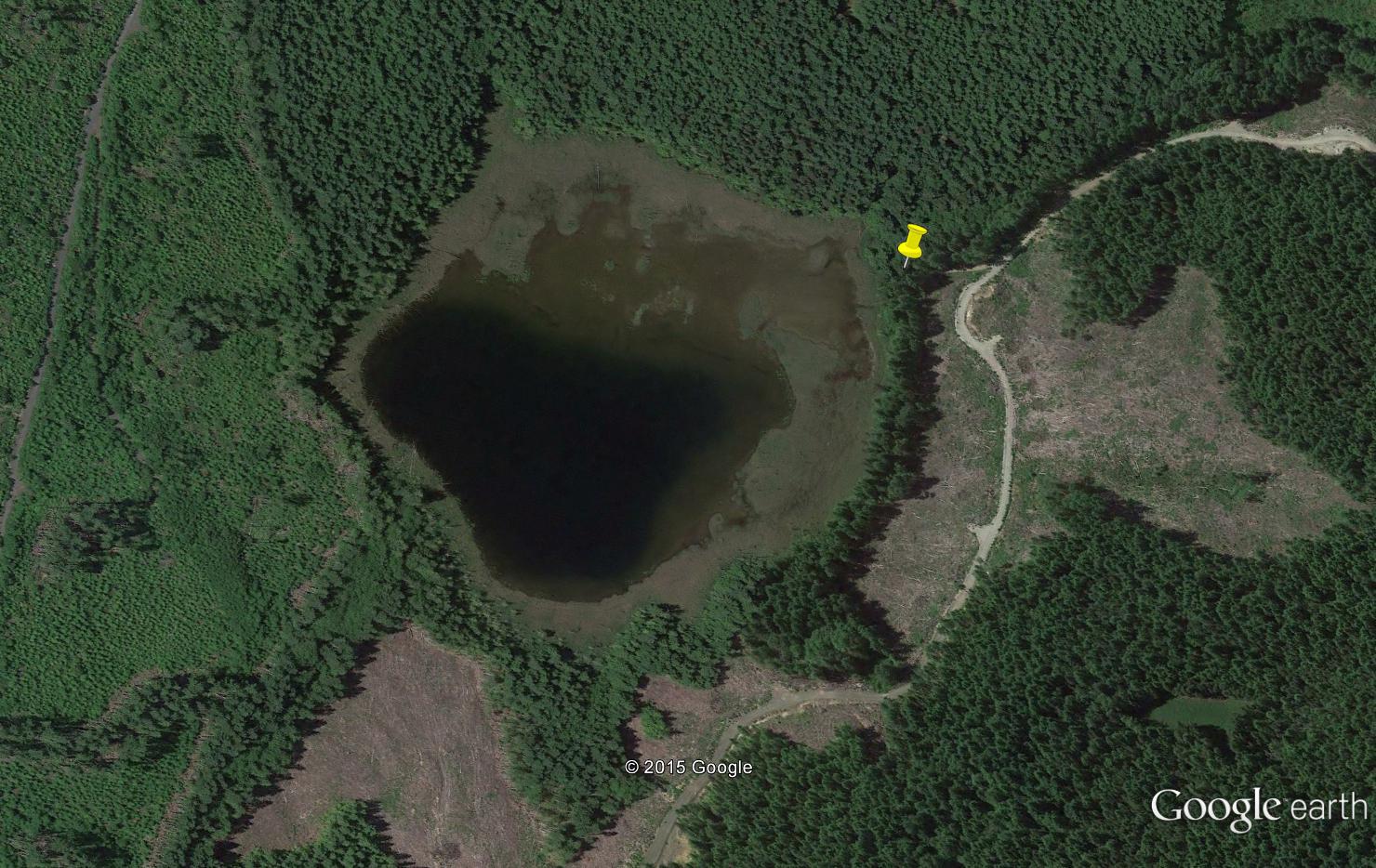
Rhododendron Lake
- General Area Location: Parksville South West
- Directions to the Lake: Accessible only on weekends (no charge) through Island Timberlands gate 1420 Island Highway (at Island highway and Northwest Bay Logging Road, turn right at the light just south of Big Boy Toys). Take 155 main to 155m‐72, turn left and follow to 155m‐72‐56. There is a short trail down to the lake on the west side but difficult to fish here but beautiful wild Rhododendrons in ecological reserve. Carry on past the trail parking area and turn left at the Hydro Lines. There is a rough road to the lake.
- GPS Way Points: Long: 124″‐16′-°©‐59 W, Lat: 49″‐10’‐59 N [google-map-fb-popup id=”5″]
- Road Conditions: 4 x4 truck recommended
- Type of Launch Facilities: Car top or inflatable only??, difficult road to launch area
- Camp Sites at Lake: None
- Species of fish found in the Lake: Cutthroat, Rainbow, Steelhead. 2010‐ 2014 1,400 CT (3N) planted. 2004 ‐ 2006 1,500 yearling Cutthroat planted
- General Information: Boat required. Elevation: 1,540′ (468 m), Area: 59 Acres (5.5 Ha), Max Depth: 16′ (4.8 m)
- Special Lake Restrictions: None known but check regulations
Nanaimo Area Lakes
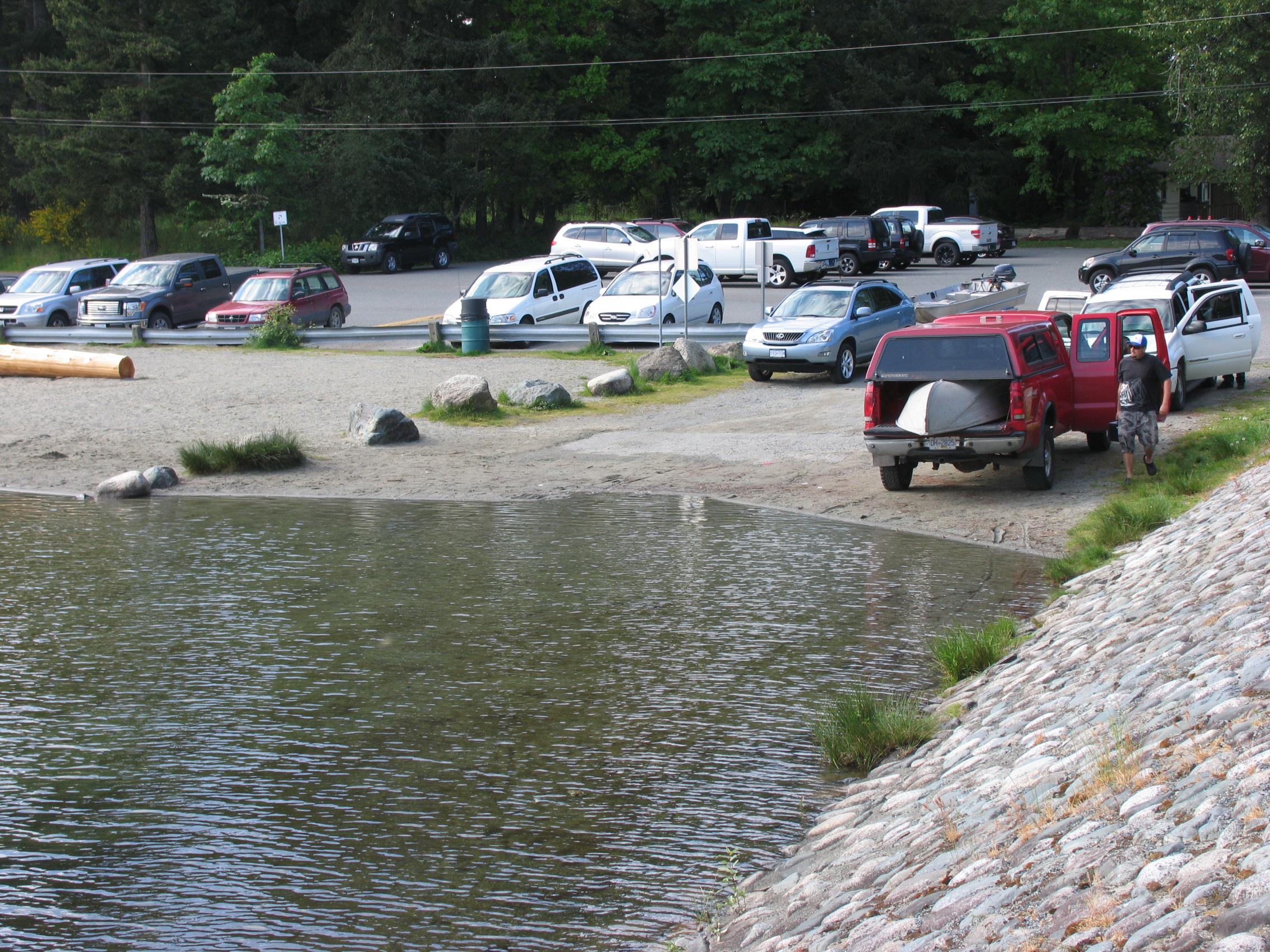
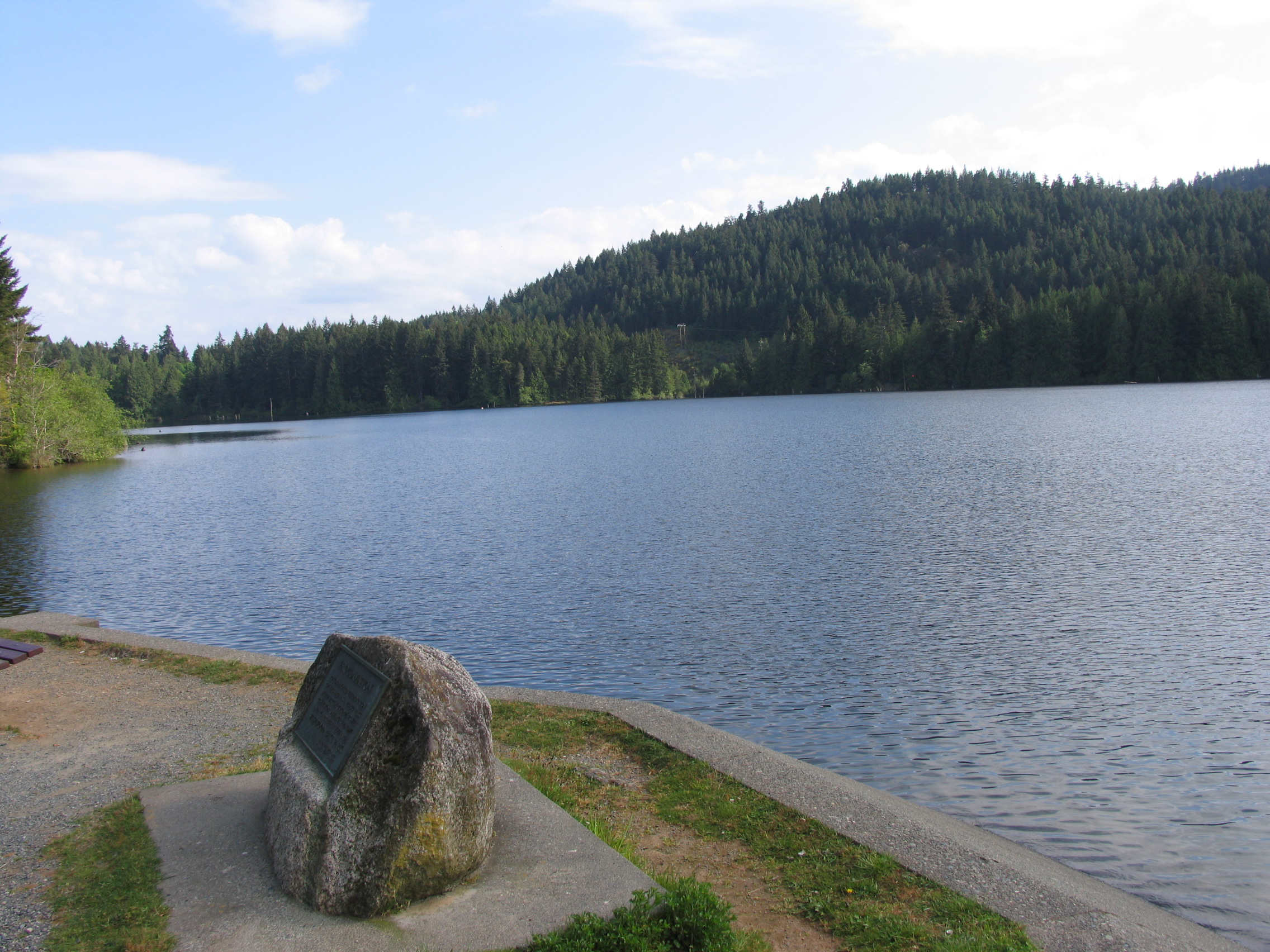
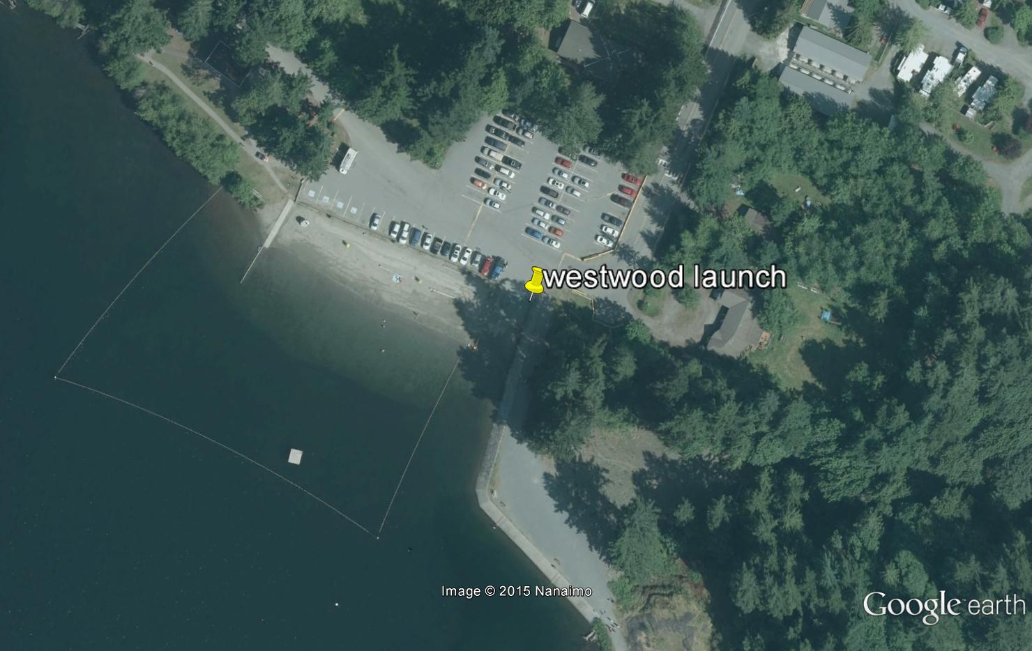
Westwood Lake
- General Area Location: Nanaimo West
- Directions to the Lake: Turn right at Island Highway and Jingle Pot Road. Proceed to Westwood Road then to lake. Alternative from the north is to exit Island Highway at Mostar which runs into the other end of Jingle Pot Road.
- GPS Way Points: Long: 123″‐59′.49.1 W Lat: 49″‐09’‐47.1 N [google-map-fb-popup id=”6″]
- Road Conditions: Paved to lake
- Type of Launch Facilities: good public boat launch but a little shallow
- Camp Sites at Lake: Numerous, family picnic and beach areas
- Species of fish found in the Lake: Westwood is stocked twice a year with Fraser Valley Rainbow (3N). Stocking: 2010 ‐ 2015 37,600. Lots of action with 9 ‐12” fish but apparently there are bigger ones in the lake up to 2 pounds
- General Information: Popular recreational lake best fishing is April ‐ June and Sept ‐ October. Elevation: 530′ (161.5 m), Maximum Depth: 23′ 7 m), Area: 155 acres (62.7 Ha). Fishing from shore possible in numerous places.
- Special Lake Restrictions: None known but check regulations

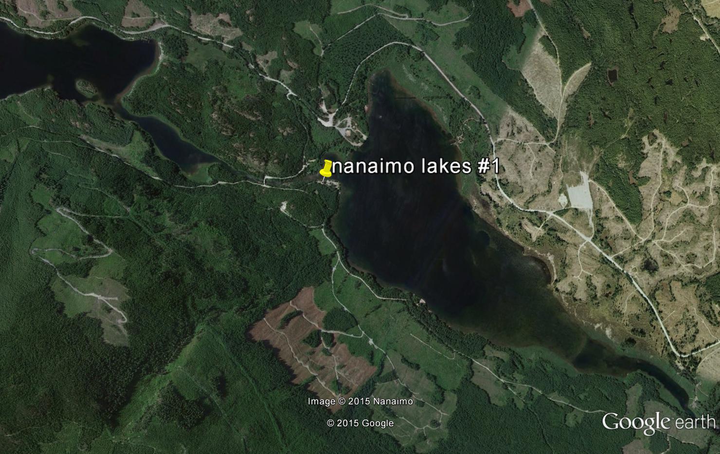
Nanaimo Lakes # 1
- General Area Location: Nanaimo South West
- Directions to the Lake: Travelling south on Highway 1 west of Nanaimo: Turn left on College Drive (top of the long hill and first light past Jingle Pot Road), right on Wakesiah Ave, right on Nanaimo Lakes Road (joins Harewood Mines Road) which then becomes South Fork Road), turn right on Nanaimo Lakes Road to lake # 1. From Highway 1 south of Nanaimo: Take the Nanaimo Lakes Road just before you go over the Nanaimo River bridge (Bungy Jumping) and drive to Lake # 1. From Parksville, the west route is quickest.
- GPS Way Points: Launch site at Windy Point Campground: Lat: 49″‐05’‐46.5 N Long: 124″‐10’42.0 W [google-map-fb-popup id=”7″]
- Road Conditions: Paved all the way to Nanaimo Lake # 1. Gravel beyond
- Type of Launch Facilities: Trailer OK but very steep. 4 x 4 truck recommended
- Camp Sites at Lake: Many, lovely campground at Windy Point
- Species of fish found in the Lake: Cutthroat, 2002 ‐ 2006 25,000. No current data available. Short, beautiful river section connects 1st and 2nd lakes
- General Information: Surface area: 489 acres (196 Ha), Max Depth 62′ (19 m), elevation: 650′ (198 m)
- Special Lake Restrictions: None known but check regulations
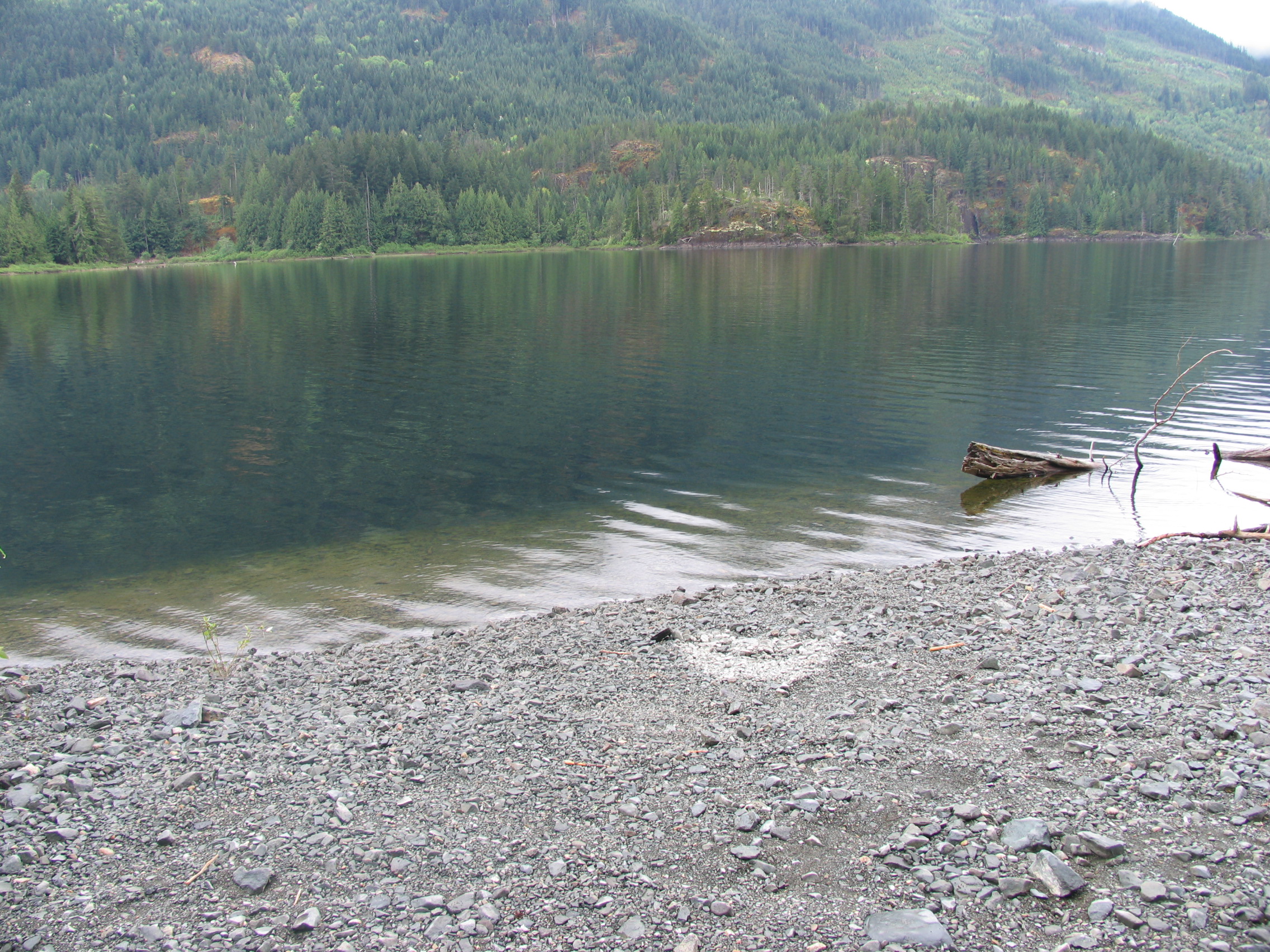
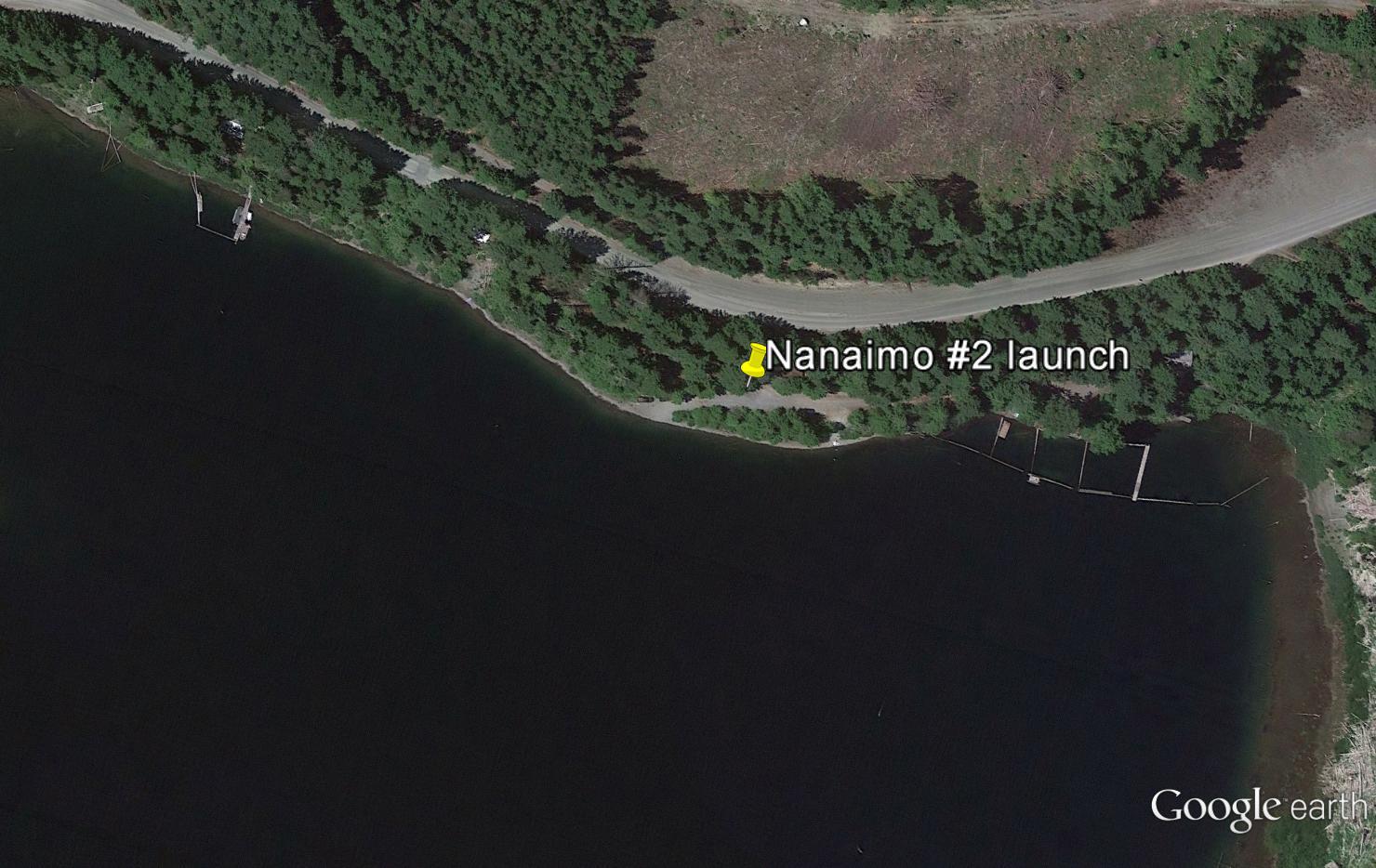
Nanaimo Lakes # 2
- General Area Location: Nanaimo South West
- Directions to the Lake: See the directions for Nanaimo Lakes # 1. Lake # 2 is a short distance (1 ‐1.5 miles) up the road
- GPS Way Points: Lat: 49″‐ 06’‐00.2 N Long: 124″‐12’‐10.4 W [google-map-fb-popup id=”7″]
- Road Conditions: Paved to first lake. Good gravel beyond
- Type of Launch Facilities: 4 x 4 required. Steep, rough rocky launch site but trailer OK
- Camp Sites at Lake: None
- Species of fish found in the Lake: Cutthroat stocked in lake # 1
- General Information: Tricky to see access road to lake. There are a few cabins near the main road. Go past them to the boat launch area. Elevation: 636′ (194 m), Area: 425 acres (172 Ha), Max Depth: 144′ (44 m)
- Special Lake Restrictions: None known but check regulations
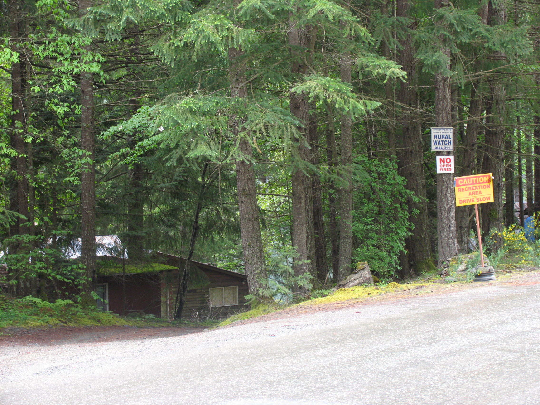
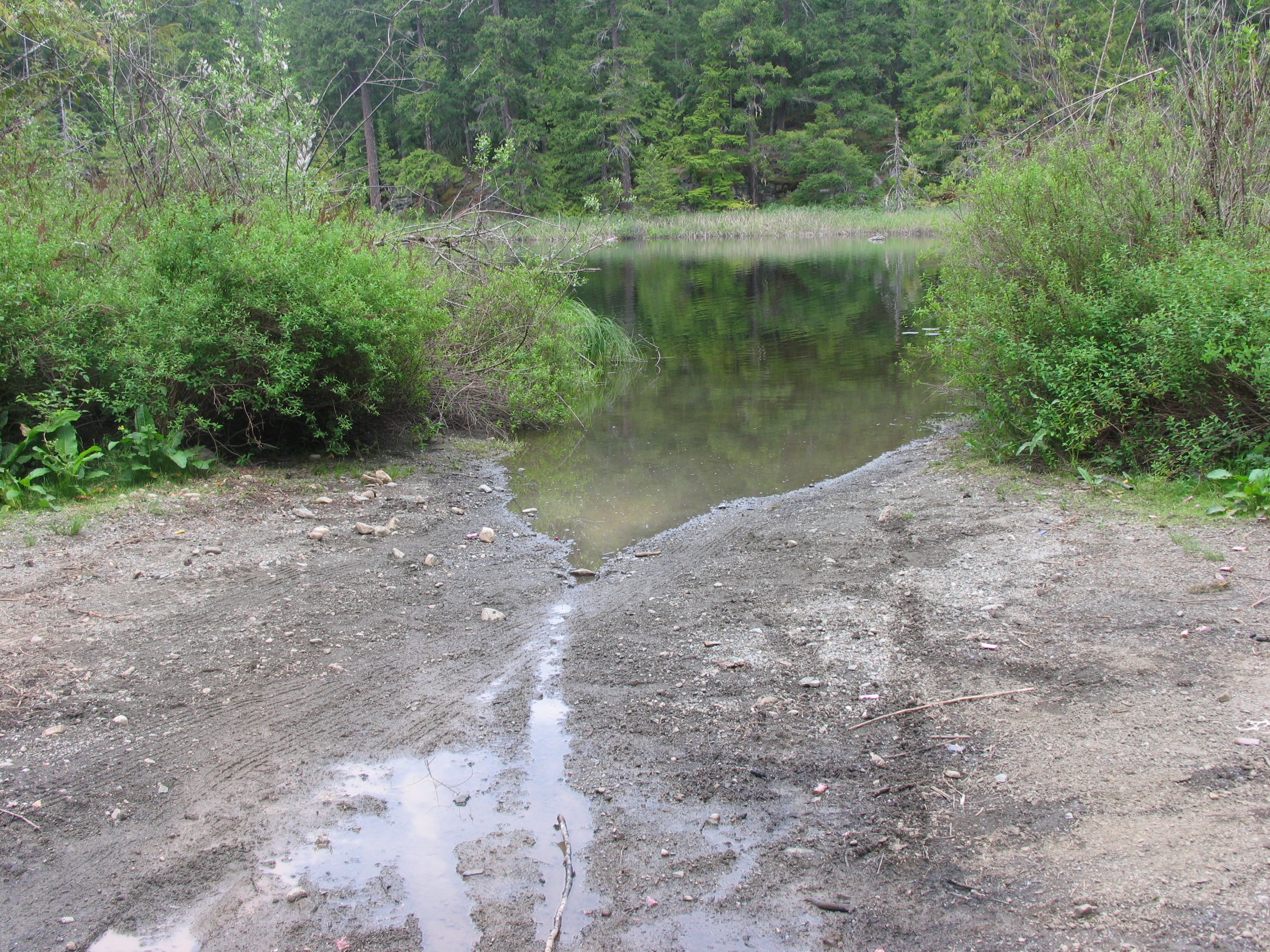
Turn left for boat launch when you see these cabins in picture above.
Green Lake
- General Area Location: Nanaimo Northwest
- Directions to the Lake: Turn off Highway 1 at Mostar, left on Metral, left on Dumont, right on Jenkins Road (across from the Black Bear Pub). Drive to Dunbar City Park to launch.
- GPS Way Points: Lat: 49″-14’‐00.0 N Long: 124″‐04’‐00 W [google-map-fb-popup id=”8″]
- Road Conditions: Paved, car good
- Type of Launch Facilities: mud/gravel, shallow, trailer etc Ok
- Camp Sites at Lake: None
- Species of fish found in the Lake: Fraser Valley Rainbow (3N), 2010 ‐ 2015 20,900, generally smaller fish 9 ‐ 12″, odd bigger one to 14″. Also small mouth bass
- General Information: Elevation: 305′ (93 m), Area: 33 acres (13. 4 Ha), Max Depth: 29.5′ (9 m). Fairly round lake, deepest part is right in the middle
- Special Lake Restrictions: No gas motors, electric motors or rowing only

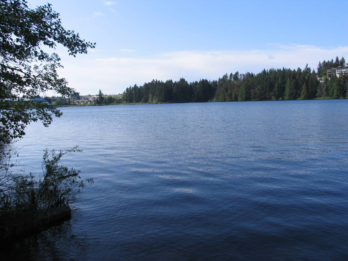
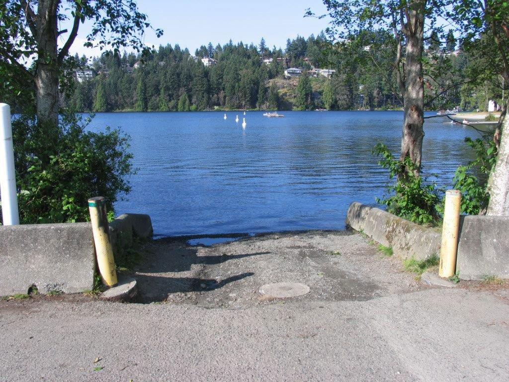
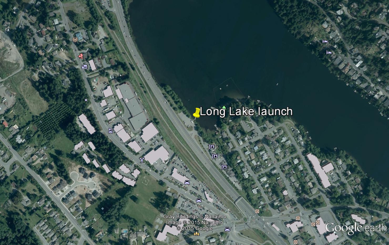
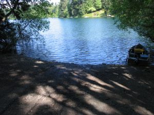
Long Lake
- General Area Location: Nanaimo North
- Directions to the Lake: On the Old Island Highway between Mostar (N) and Norwell Drive (S). Boat launch is right off the highway.
- GPS Way Points: GPS Way: Lat: 49″‐12’‐50.0 N Long: 124″‐01’‐00 W [google-map-fb-popup id=”10″]
- Road Conditions: Paved, car good
- Type of Launch Facilities: Car top/inflatable, trailer Ok
- Camp Sites at Lake: None
- Species of fish found in the Lake: Surprisingly good fishery right in the city! Fraser Valley Rainbow (3N), stocked 2010 ‐ 2015 27,100. Fish 9 ‐ 12″, some bigger 14‐16″. Also small mouth bass that can reach 4‐5 lbs.
- General Information: Elevation: 364′ (111 m), Area: 83 acres (34 Ha), Max Depth: 46′ (14 m)
- Special Lake Restrictions: Electric motors only
[ezcol_divider]
Nanaimo South Area Lakes:
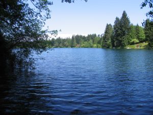
FULLER LAKE
- General Area Location: Chemainus
- Directions to the Lake: 47 minutes south from Parksville on Highway 1. 2 minutes past the Chemainus turn‐off, turn left off the highway at Fuller Lake Park Road (Fuller Lake arena). Lake is there right after you turn off the highway.
- GPS Way Points: Long: 123″‐ 43’‐16.5 W Lat: 48″‐54’‐15.7 [google-map-fb-popup id=”11″]
- Road Conditions: Paved Highway to turn‐off
- Type of Launch Facilities: Good, gravel, little steep, trailer Ok, park on street
- Camp Sites at Lake: Further up the lake is a park with picnic sites
- Species of fish found in the Lake: Fraser Valley Rainbow (3N), 2010 ‐ 2015 38,900 planted. Rainbow apparently caught every year in the 5‐6 pound range. Also Smallmouth Bass in lake.
- General information: Elevation: 175′ (53.3 m), Area: 59 acres (24 Ha), Max Depth: 56′ (17 m)
- Special Lake Restrictions: Electric motors only


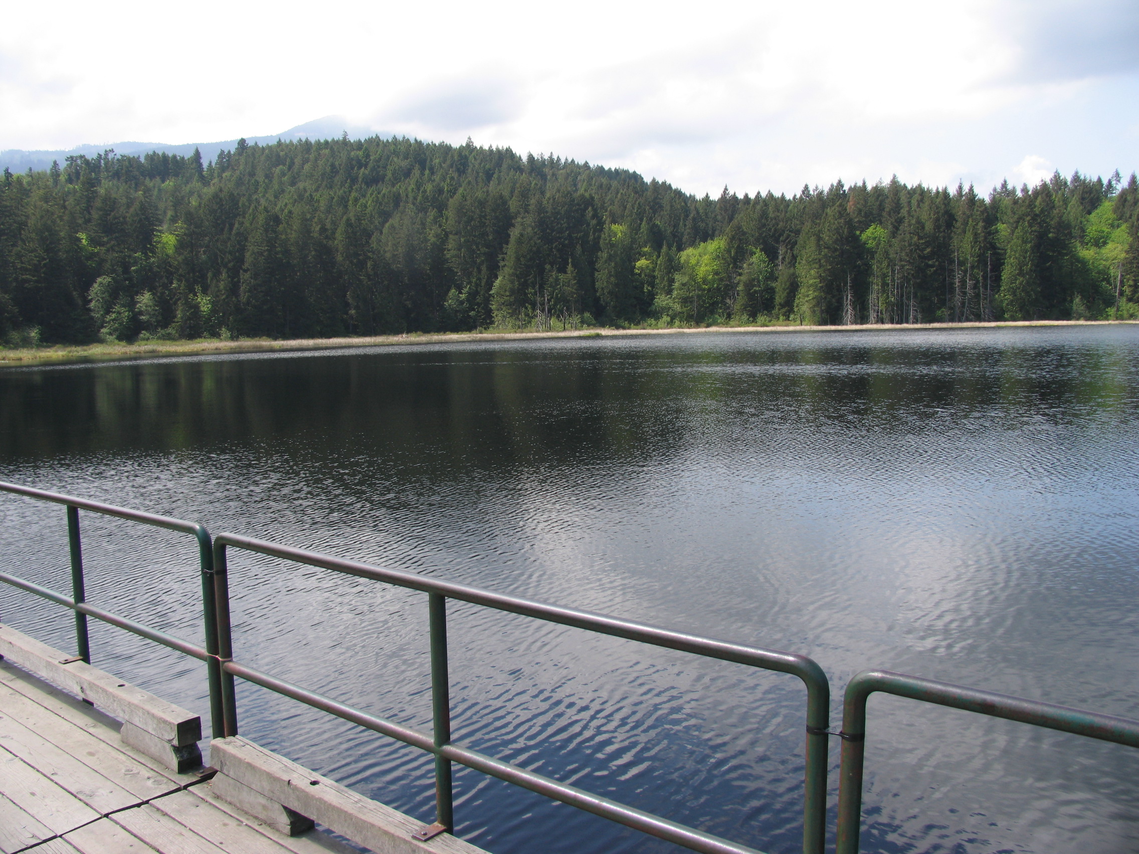
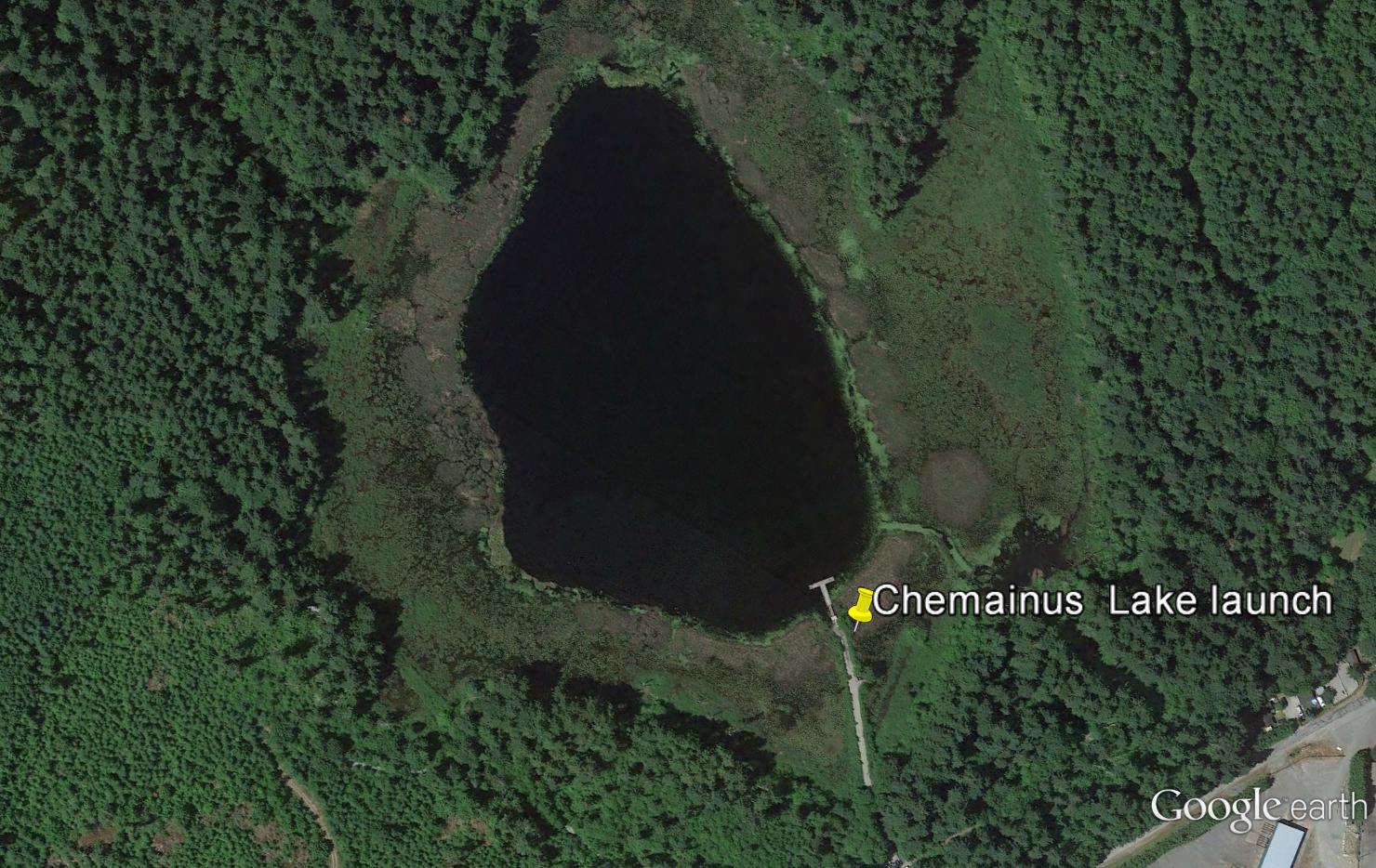
Chemainus Lake
- General Area Location: Chemainus
- Directions to the Lake: 45 minutes south of Parksville on Highway 1. Turn right on River road which is in the industrial area BEFORE the Chemainus turnoff. Less than 1 Km to the park and launch site.
- GPS Way Points: Long: 123″‐45’‐03 W Lat: 48″‐54’‐48.4 N [google-map-fb-popup id=”12″]
- Road Conditions: Paved
- Type of Launch Facilities: Car top. Not suitable for trailer
- Camp Sites at Lake: None
- Species of fish found in the Lake: Fraser Valley Rainbow (3N). 2010 ‐ 2015 17,186 planted. Lake also contains Small Mouth Bass. Fish in the 9″ ‐ 14″ range
- General Information: Elevation: 272′ (83 m), Area: 10.5 acres (4.3 Ha), Max Depth: 26′ (7.9 m). There is a fairly new fishing platform at the boat launch
- Special Lake Restrictions: None known but check regulations
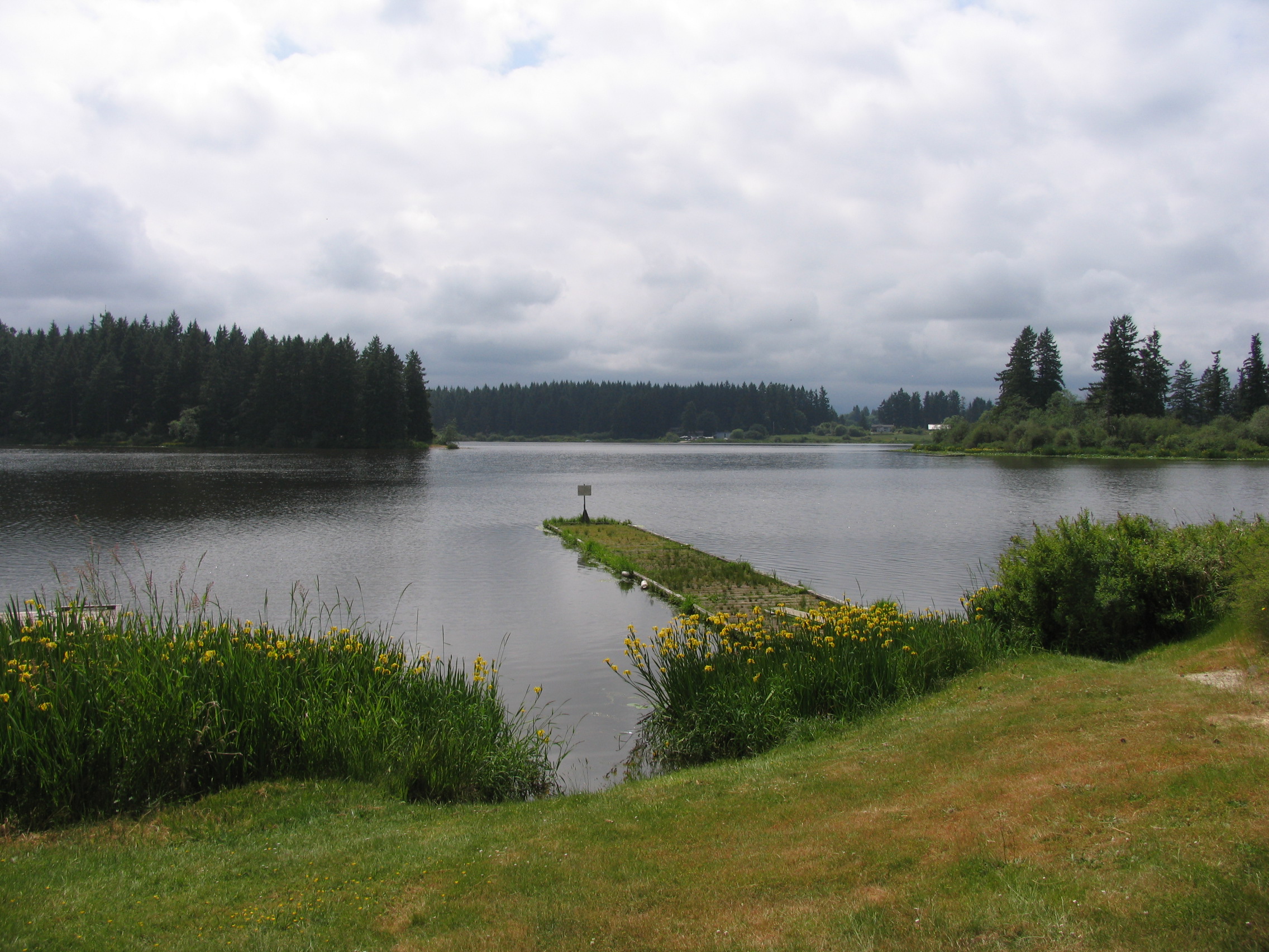
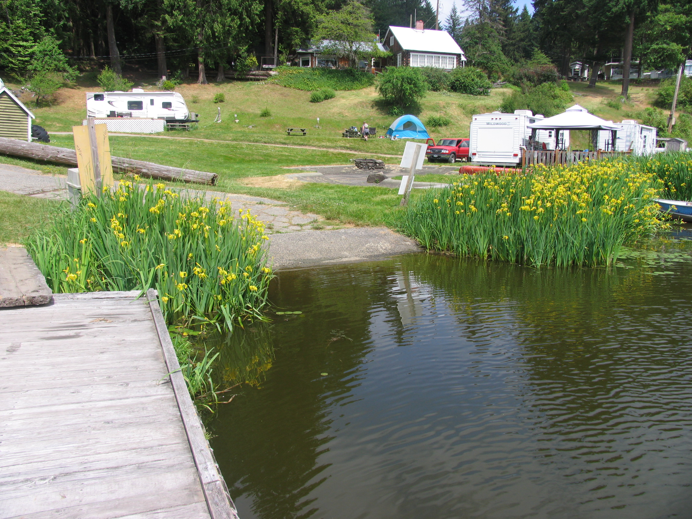
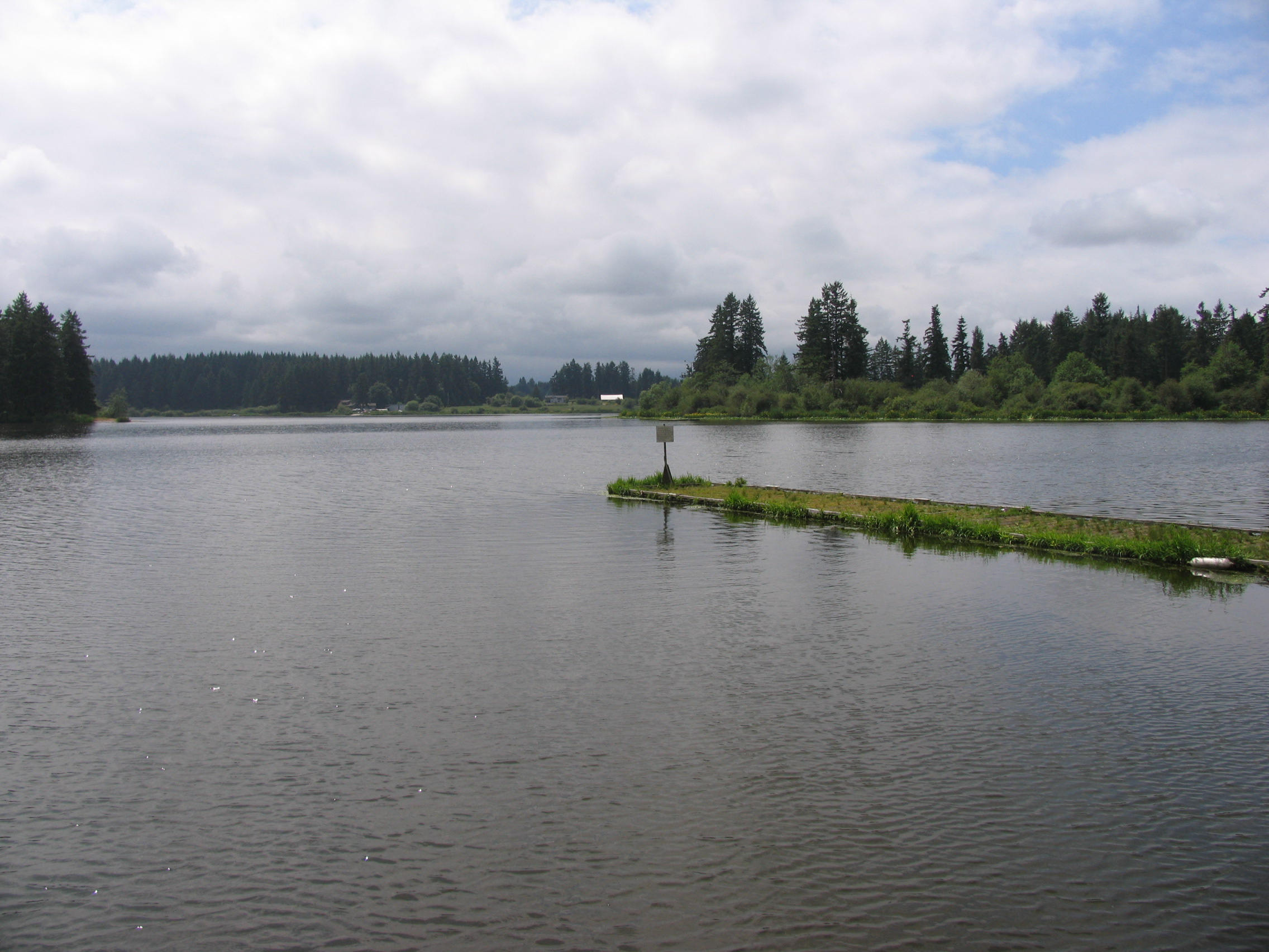
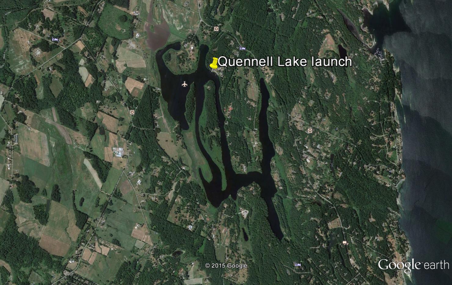
Quennell Lake
- General area Location: Ladysmith (Cedar/Yellowpoint)
- Directions to the Lake: From the Island Highway south of Nanaimo take the Cedar Road exit then left on Yellow Point Road, right on Enefer to Zuiderzee Campground. From the Island highway north of Ladysmith turn right on Cedar Road then right on Yellow Point Road then left at Enefer. Another option is to turn off of Yellow Point Road on Ritten Road (2.5 km past the outstanding Crow & Gate English Pub) and proceed 1 km till you see a small blue parking sign. See comments below about launching.
- GPS Way Points: Long 123″-49′-36.1 W Lat; 49″-04′-48.8 N
- Road conditions-Paved
- Type of Launch facilities: Two free launch areas for car tops or inflatables only. One is very muddy and not ideal while the other on Ritten road requires a lengthy carry. The best spot is the Launch at Zuiderzee Campsite with a charge of $5.00 for a boat and trailer and $3.00 for an inflatable or car top. Good launch site and dock for car top, inflatable, or boat and trailer. They also rent 12′ aluminum row boats for $5.00 per hour with a two-hour minimum.
- Camp sites at Lake: Commercial, inquire at office
- Species of fish found in the lake: Blackwater AF3N Rainbow (all female triploids). 2010-2015 33,400 rainbow trout planted. Prolific lake with rainbow and cutthroat trout to 5lbs, small mouth bass to 7lbs
- General information: Elevation 105′ (32m), Area: 296 acres (120 ha), Max depth: 23′ (7m). Trout best in the spring and fall, bass in summer. Fairly shallow lake with many bays and arms. Best to fish the Eastern side of the lake which is the deepest of all the arms. NOTE: This lake has very dark and muddy water with lots of algae. Probable cause is run-off from local farms.
- Special Lake Restrictions: None known but check regulations
Qualicum West
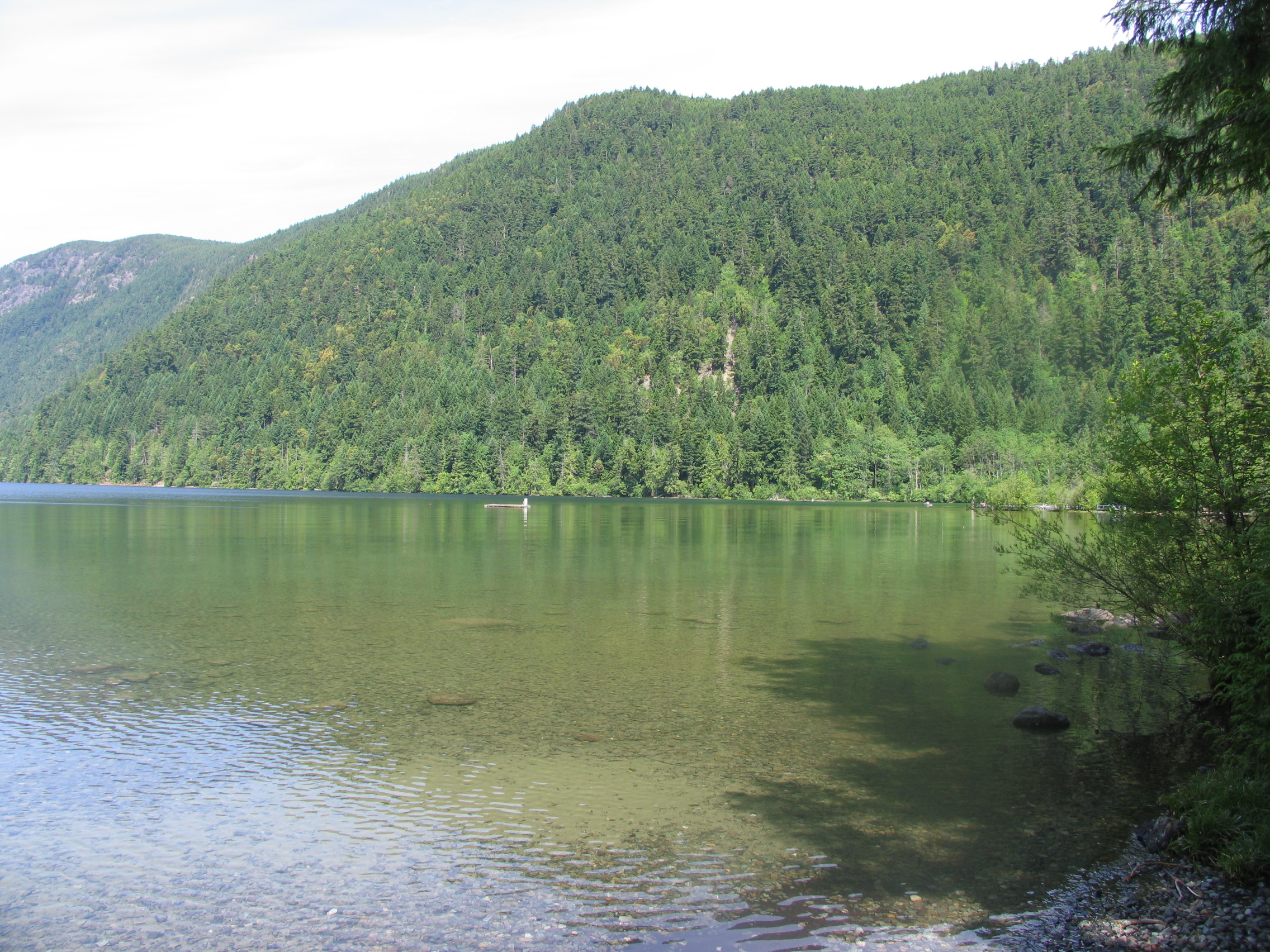
Cameron Lake
- General Area Location: Qualicum West Alberni Highway
- Directions to the Lake: Follow Highway 4 toward Port Alberni. Just as you see the lake turn right on the gravel road and proceed to the resort in the eastern end of the lake. There is a fee for the boat launch but inflatables can be launched anywhere on the beach for free. It should be noted that it is a best practice to use a good boat on this often windy lake.
- GPS Way Points: Long: 124″‐35’‐05.2 W Lat: 49″‐17″‐27.1 N [google-map-fb-popup id=”13″]
- Road Conditions: Good, paved highway, short road to resort
- Type of Launch Facilities: Trailer Ok 12 dollar fee
- Camp Sites at Lake: no public campsites
- Species of fish found in the Lake: Blackwater Rainbow trout (5,700 planted 2003), Tzenzailut Rainbow trout (5,700 planted 2003), Cutthroat trout (stocking discontinued), Brown trout (wild no stocking), Kokanee (wild no stocking). The lake apparently is very good at producing wild fish and the stocking program has been discontinued. With the exception of Brown trout, most of the fish are in the 9″ ‐ 14″ size but there are some much bigger. However, every year Brown trout are caught up to 18 pounds. To get the bigger fish, a down-rigger is recommended.
- General Information: Elevation: 633′ (193 m), Area: 1,179 acres (477 Ha), Max depth: 141′ (43 m). Use caution as lake is known for high winds.
- Special Lake Restrictions: None Know but check regulations
- click to see the depth and contour chart– hydrographcameron3
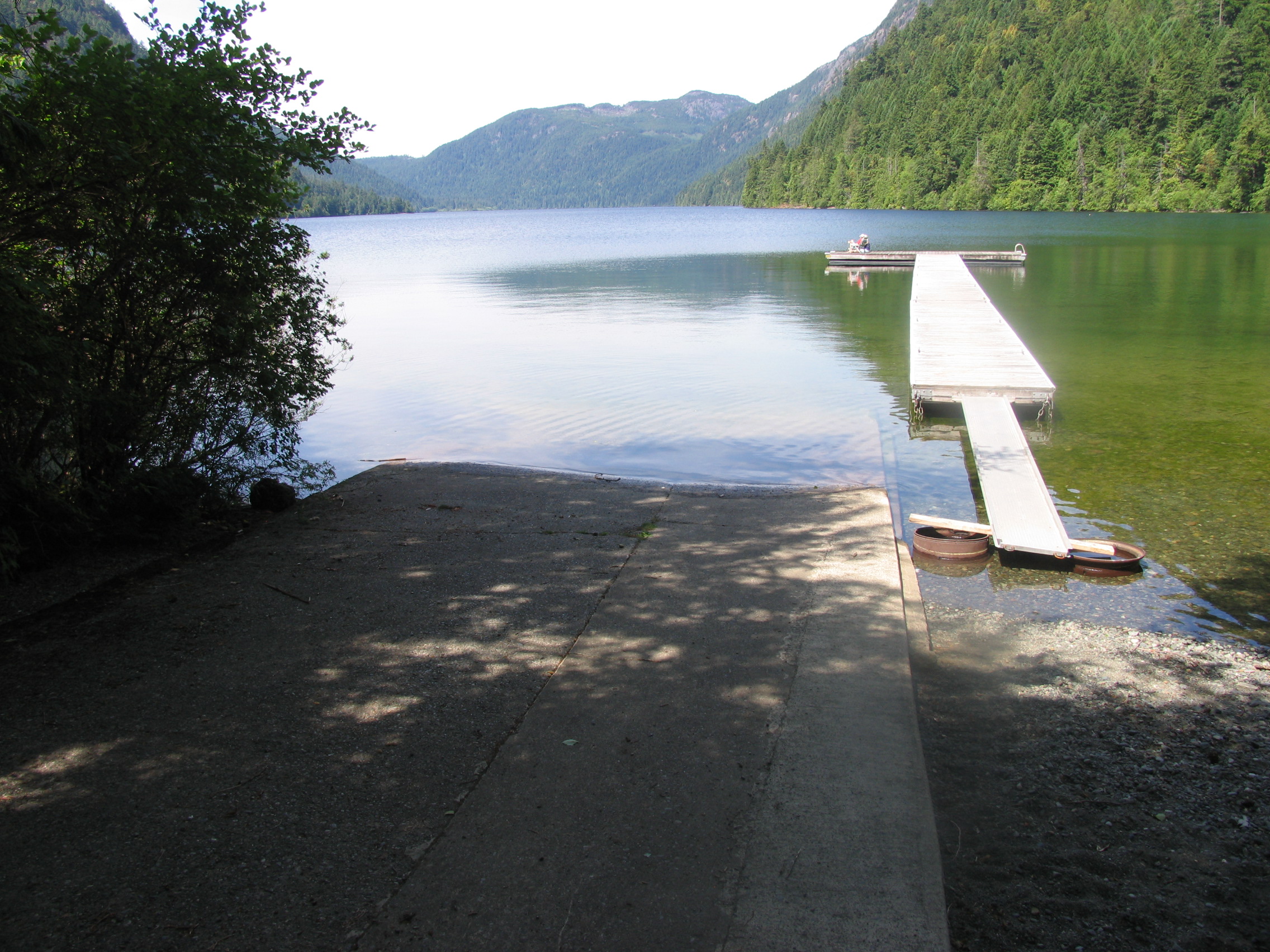
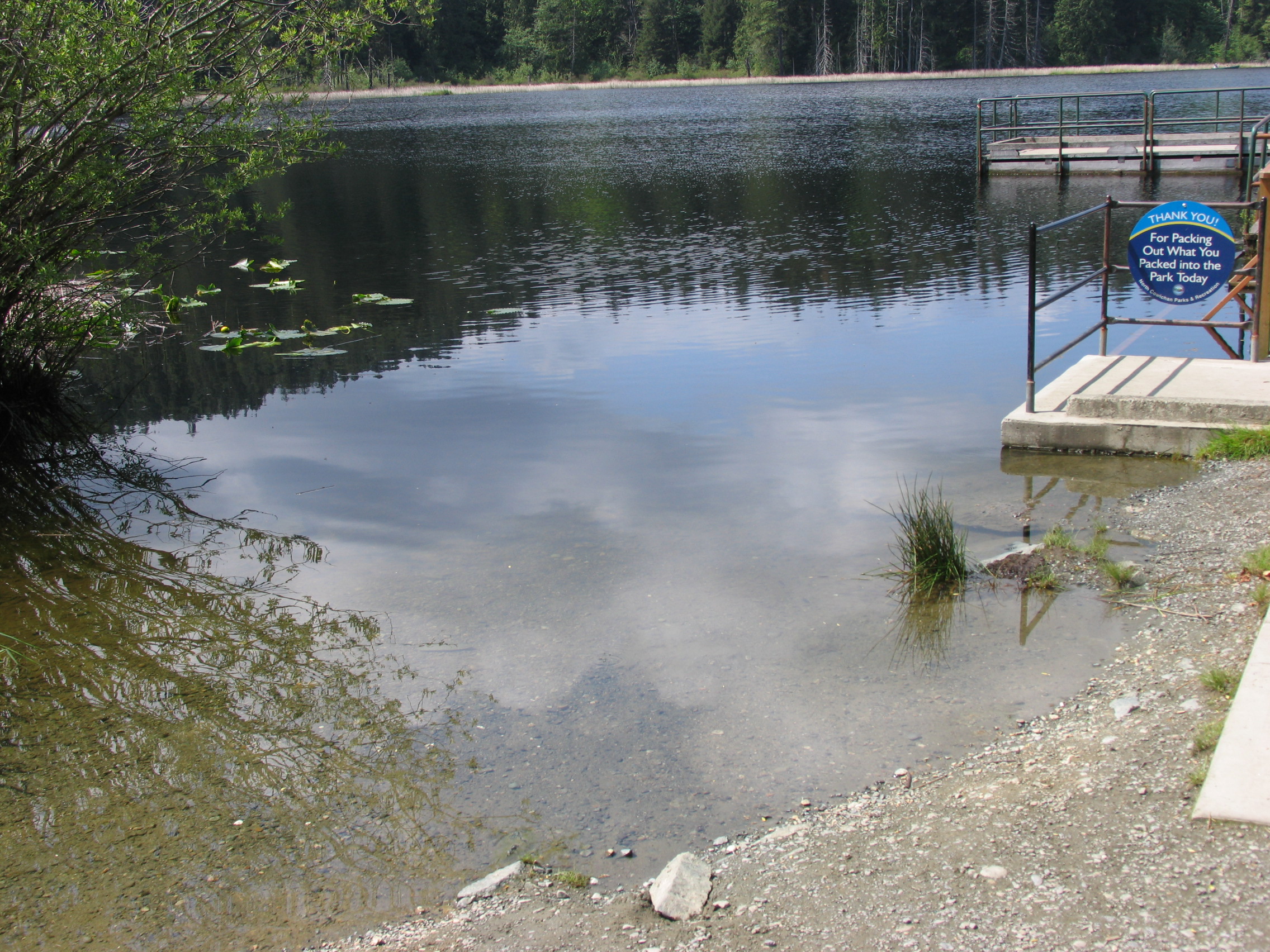
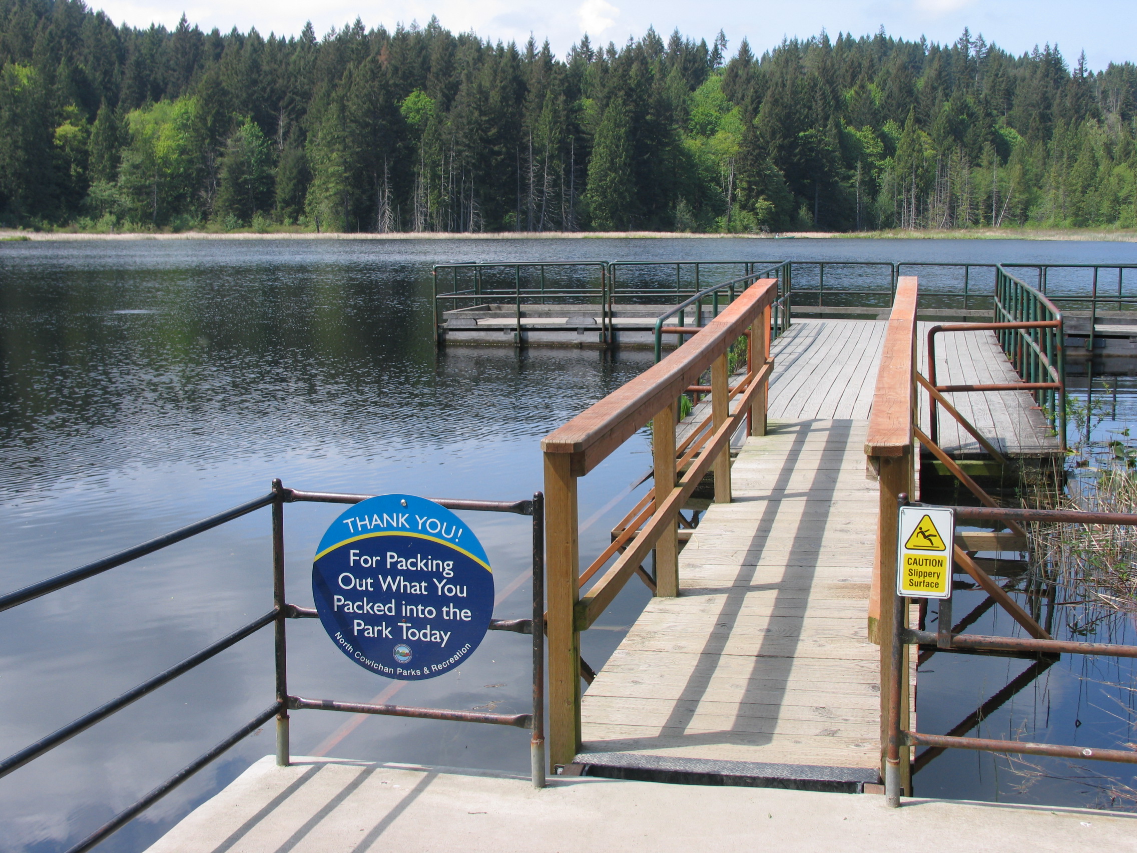
Loon Lake
- General Area Location: Qualicum West Alberni Highway
- Directions to the Lake: Follow Highway 4 (to Port Alberni) past Cameron Lake. As you start to climb what is known locally as “the hump” watch for a logging road on your right hand side (Summit Lake road) at the top of the hill. A short distance from the highway you will cross railway tracks. Take an immediate right and follow the rough road to Loon Lake (sometimes referred to as Summit Lake in some books). There are actually two lakes with the road leading to Loon Lake. Summit Lake is a short hike from Summit Lake south down the railway tracks.
- GPS Way Points: Long: 124″‐42’‐04.4 W Lat: 49″‐15’‐07.3 N [google-map-fb-popup id=”22″]
- Road Conditions: Truck recommended but car ok IF you are careful.
- Type of Launch Facilities: Car top/Inflatable recommended, gravel and mud boat launch entry is rough, small trailer is ok but challenging. If you’re launching a trailer use high boots or hip waders as entry to lake is quite shallow
- Camp Sites at Lake: A few spots where camping/picnic would be ok. A few tables around the lake trail
- Species of fish found in the Lake: Cutthroat Trout, 2000 ‐ 2008, 2,500 planted. Fish are in the 14 ‐ 16″ range with some bigger ones caught every year. Could find no reports on current stocking however in a recent fishing trip there appeared to be an abundance of yearling Rainbow trout in the 9 ‐ 11″ size.
- General Information: Elevation: 1,200′ (366 m), Area: 17 acres (7 Ha), Max Depth: 46′ (14 m). There a hiking trail around Loon Lake with numerous places to fish from shore.
- Special Lake Restrictions: Electric motors only

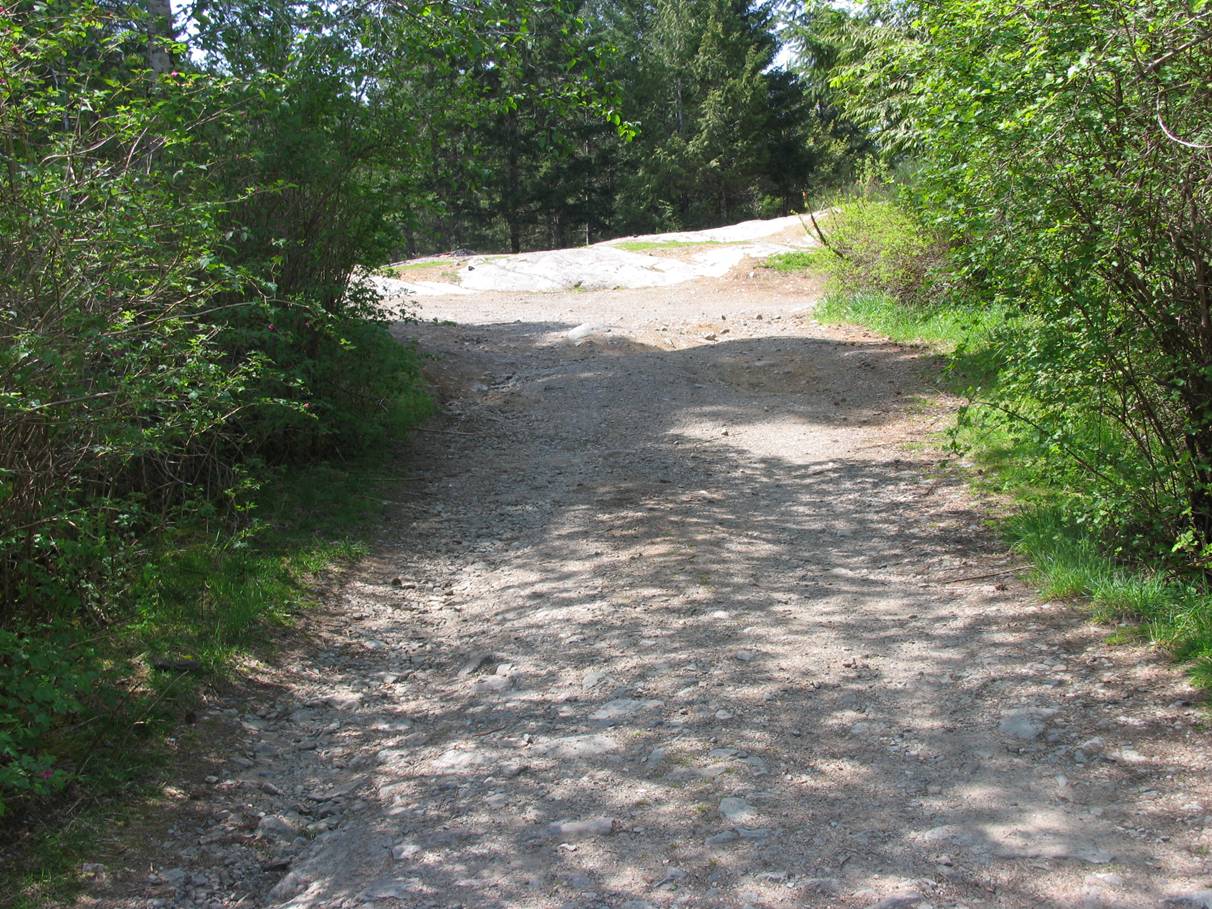
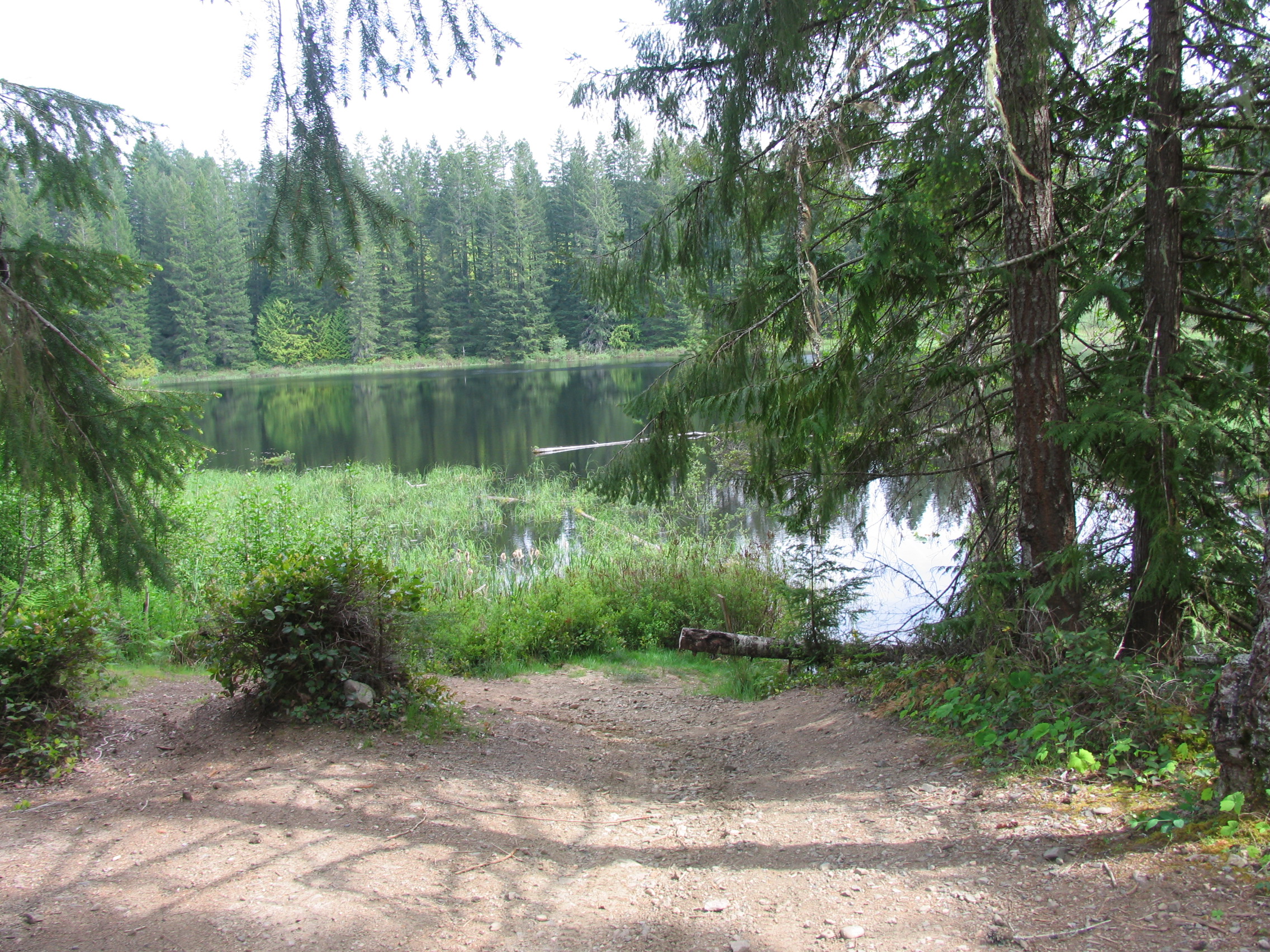
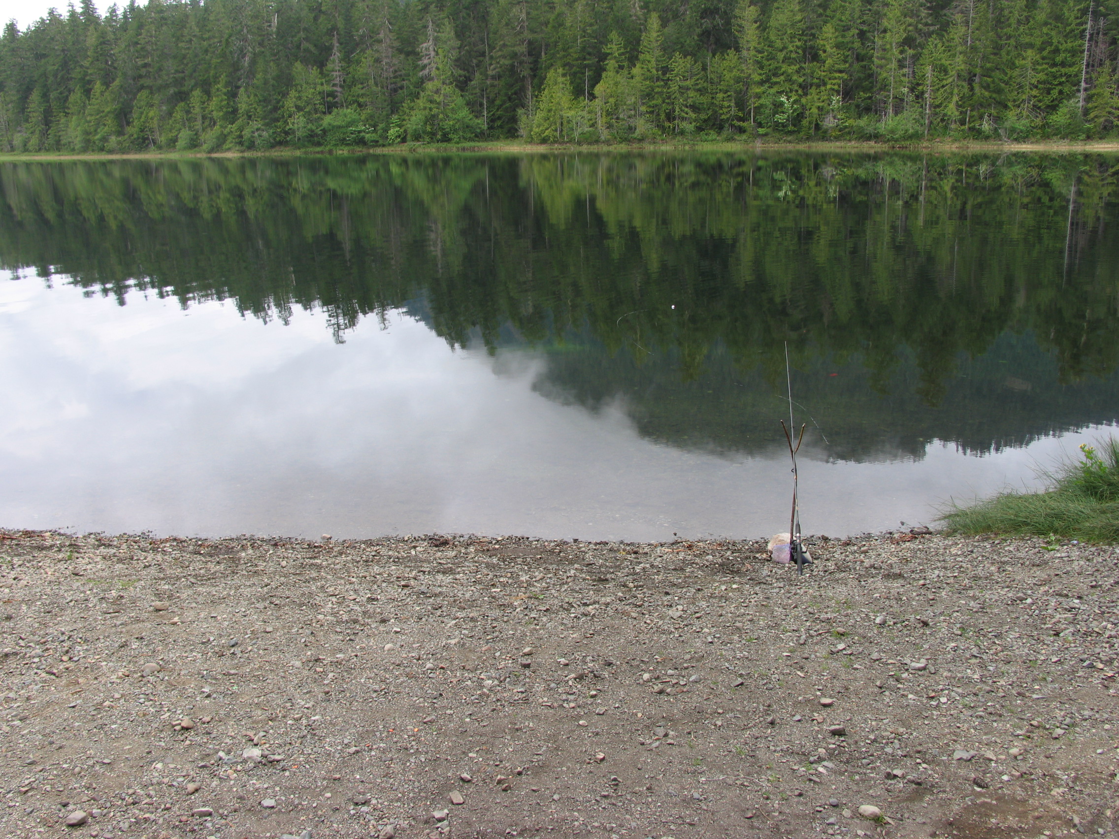
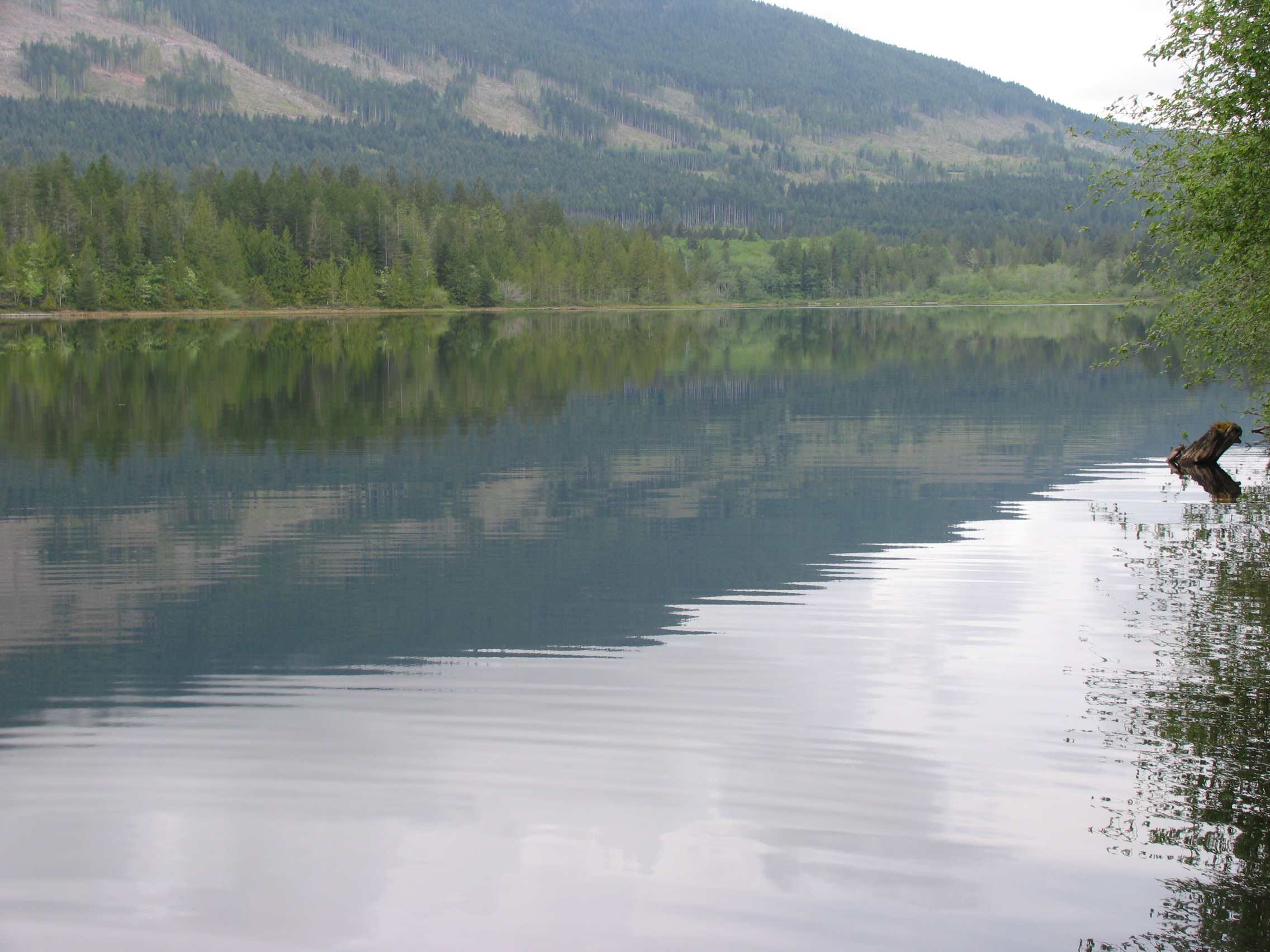
Images of the Boat Launch area (Click on image to zoom in):
[ezcol_divider]
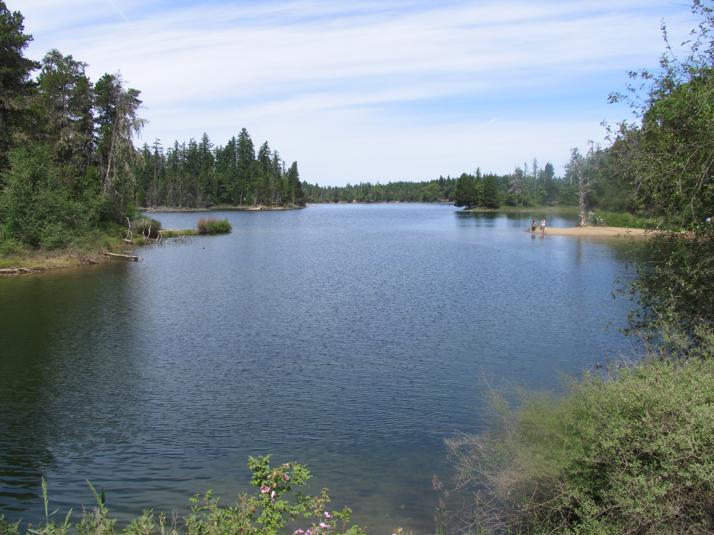
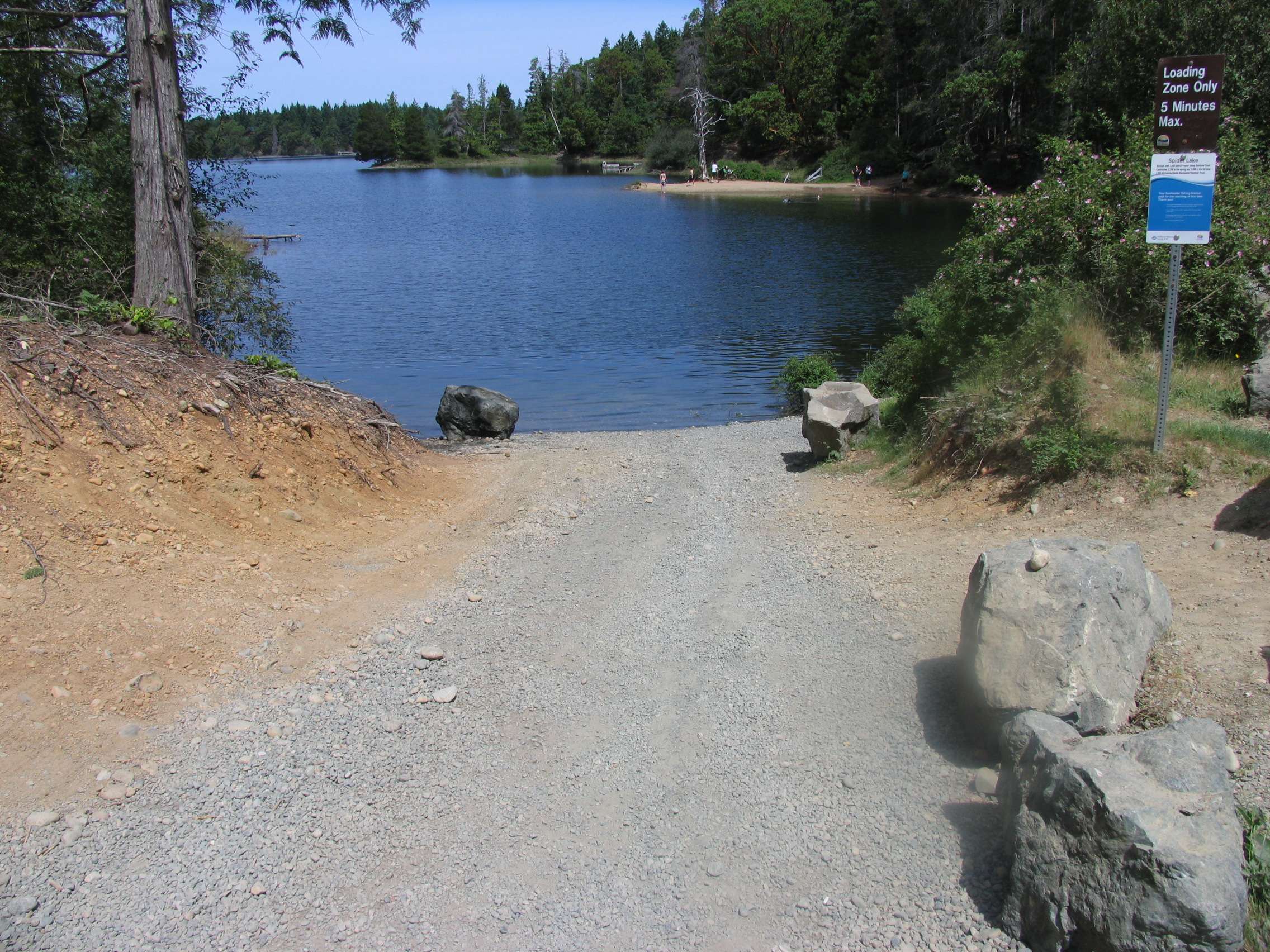
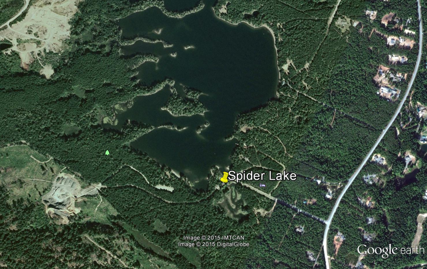
Spider Lake
- General Area Location: Qualicum North West
- Directions to the Lake: From the inland Island Highway (19) cutoff to Qualicum Beach travel north 5 miles (8 klms) and then turn west at the Horne Lake exit. Take an immediate left on Spider Lake road. Follow signs on gravel road to boat launch.
- GPS Way Points: Long: 124″‐37’‐22.4 W Lat: 49″‐ 20’‐35.2 N [google-map-fb-popup id=”14″]
- Road Conditions: Paved all the way. last part is on gravel.
- Type of Launch Facilities: Car top/Inflatable, boat trailer located at the edge of Spider Lake Provincial Park
- Camp Sites at Lake: Day‐use park only
- Species of fish found in the Lake: Blackwater & Fraser Valley Rainbow, Small mouth Bass that can reach 5 lbs. From 2010 ‐ 2015 35, 200 Rainbow were planted and average 12 ‐ 14″ but 5 pounders are not unheard of.
- General Information: Elevation: 459′ (140 m), Area: 109 acres (44 Ha), Max Depth: 43′ (13 m)
- Special Lake Restrictions: No power boats, rowing only
- click to see the depth and contour chart-hydrographspider2

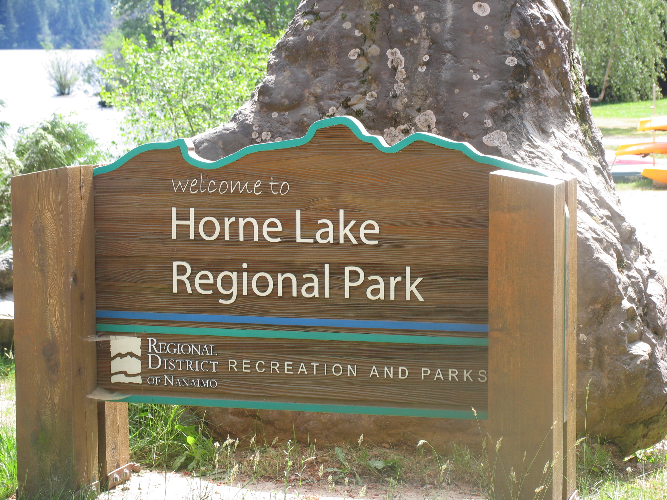
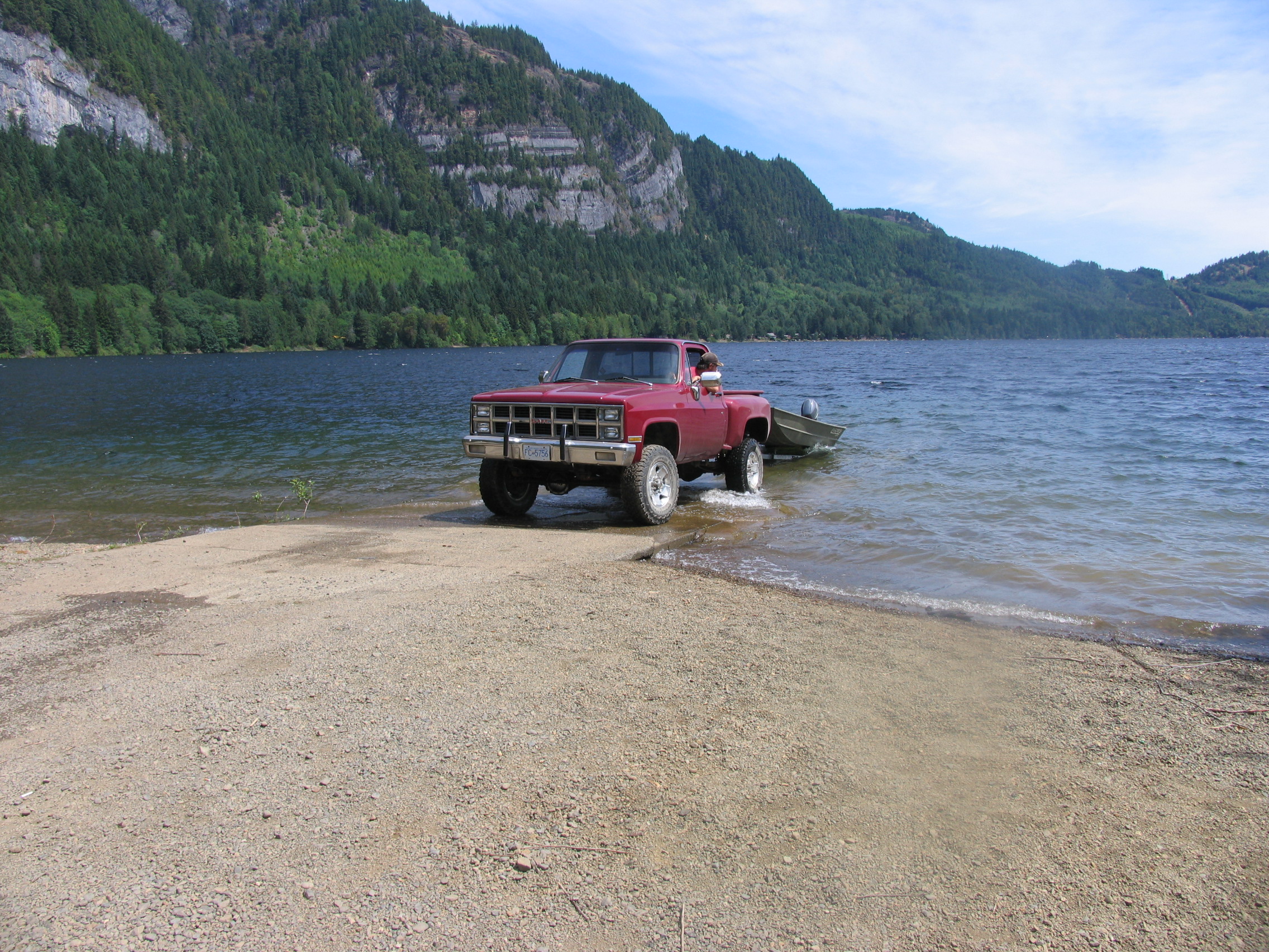
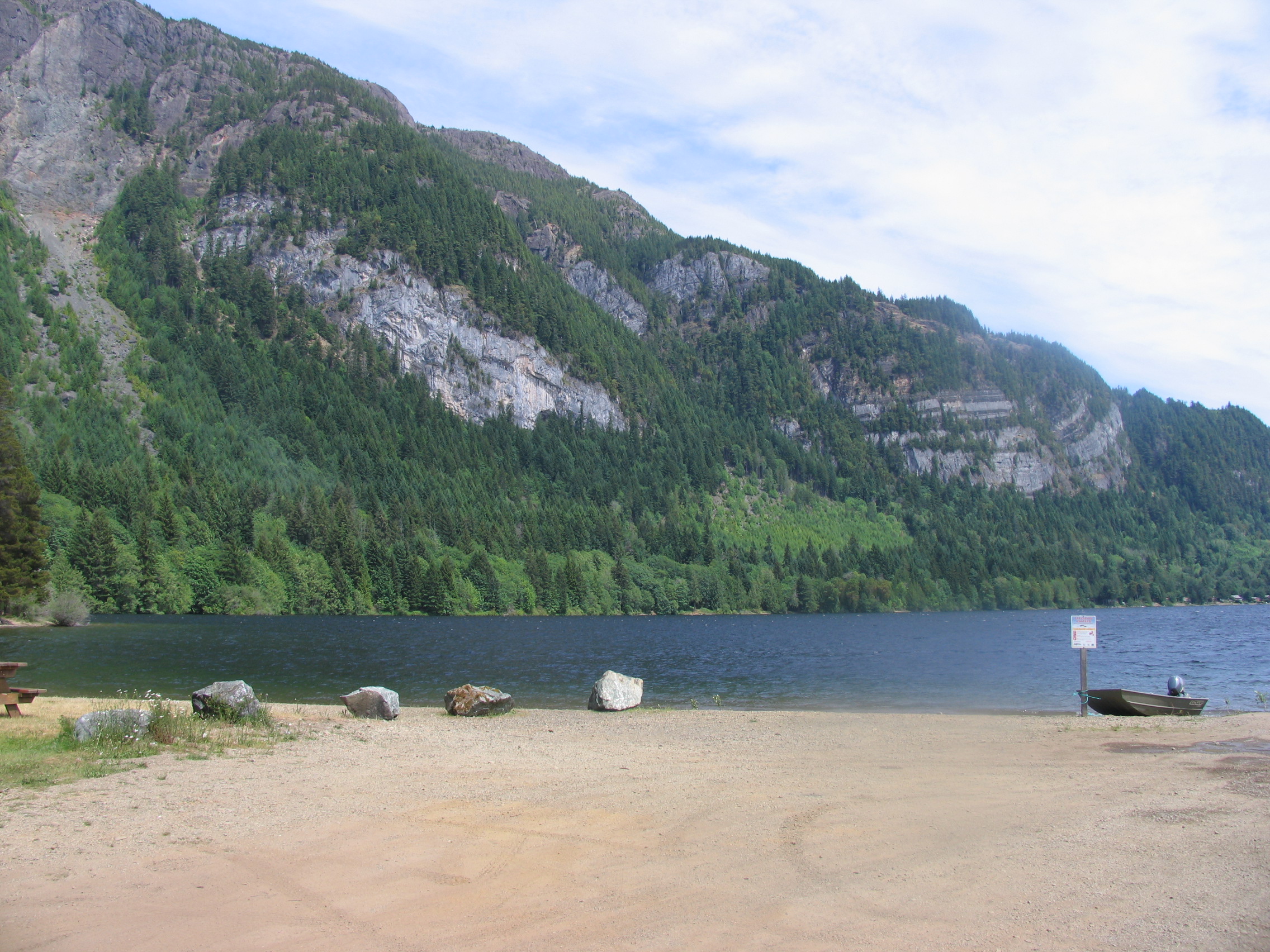
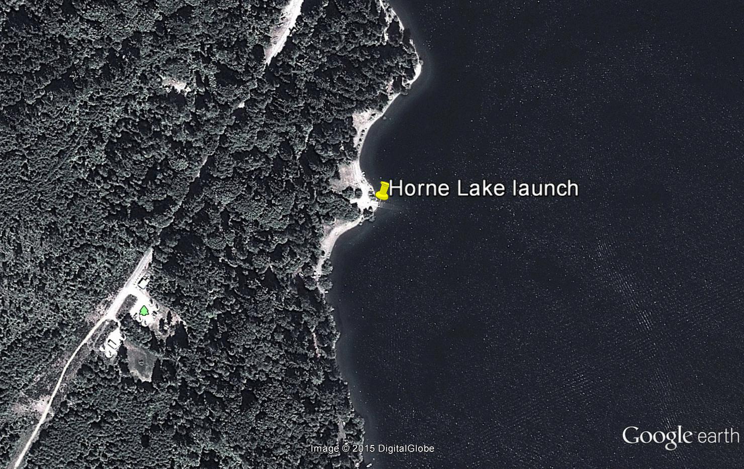
Horne Lake
- General Area Location: Qualicum North West
- Directions to the Lake: From the inland Island Highway (19) cutoff to Qualicum Beach travel north 5 miles (8 kms) and then turn west at the Horne Lake exit. Proceed on Horne Lake road (gravel) and stay right when you get to the lake. The road will take you to Horne Lake Regional Park.
- GPS Way Points: Long: 124″‐44’‐23.2 W Lat: 49″‐20’‐57.6 N [google-map-fb-popup id=”15″]
- Road Conditions: washboard, dusty road but car is ok.
- Type of Launch Facilities: Good boat launch. Car top/Inflatable, trailer OK
- Camp Sites at Lake: Camping, picnic sites, and beach at Horne Lake Regional Park which is near Horne Lake Caves Provincial Park
- Species of fish found in the Lake: Cutthroat, Rainbow, Kokanee, Steelhead. From 2005 ‐ 2007 45,000 Cutthroat were planted.
- General Information: Elevation: 404′ (123 m), Area: 2,371 acres (960 Ha), Max Depth: 131′ (40 m).
- Special Lake Restrictions: None known, check regulations
- Click to see the depth and contour chart-hydrographhorne2
Port Alberni North West “The Golden Circle”
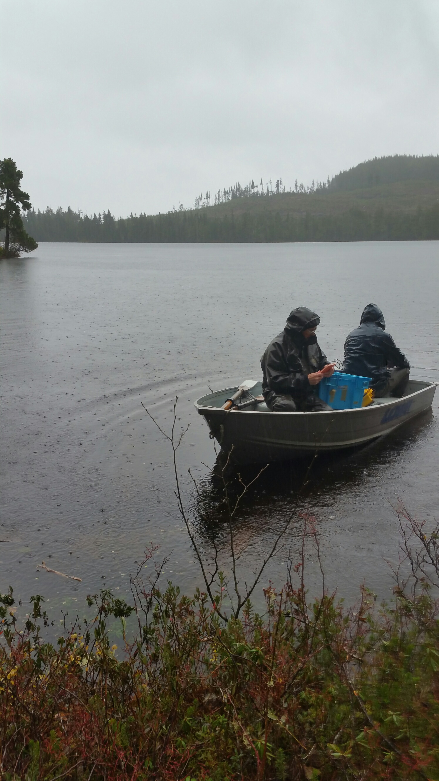
This amazing area contains numerous lakes in a relatively small area of the Ash River valley. There are two ways to approach this area from our starting point, the bridge on Highway 4 in Port Alberni to our Central Point, the bridge over the beautiful Ash River. Option # 1: 45 minute Drive: Starting at the bridge drive on highway 4 in Port Alberni, then turn right on Great Central Lake road to the village at Great Central Lake (17 kms). Turn right over the bridge (Sproat River) onto the Ash River Main (gravel) staying right for 14 kms and you will see Dickson Lake on your left. Go over the bridge (Ash River flowing out of Dickson Lake) for 2 kms and the Ash River Main goes left and over the bridge (OUR CENTRAL POINT) over the Ash River which is 33 kms from the bridge in Port Alberni . Option # 2: 40 minute drive: The alternate way is to turn right after the bridge in Port Alberni onto Beaver Creek road and follow it to the end of the pavement. From there stay on the Comox (Toba) Main road (gravel) until you come to a 3-way intersection. Turn left and it’s 3 kms to another intersection where you will see the bridge over the Ash River on your right (OUR CENTRAL POINT). This distance is 31 kms from the bridge in Port Alberni. There is more pavement and traffic driving in option # 1 but option 2 is a bit quicker. For variety try going in one way and returning the other. The above are directions to the Ash River Valley area using the ASH RIVER BRIDGE as the CENTRAL POINT. There are many other roads which lead to Lowry Lake, McLaughlin Lake, Ash Lake, Turnbull Lake, Dickson Lake, and the largest of this group, Elsie Lake. It can be confusing navigating all the roads so we recommend that you follow the directions for each particular lake that you wish to fish. Some of them are on the same road while others aren’t and there are numerous dead end roads so pay attention.
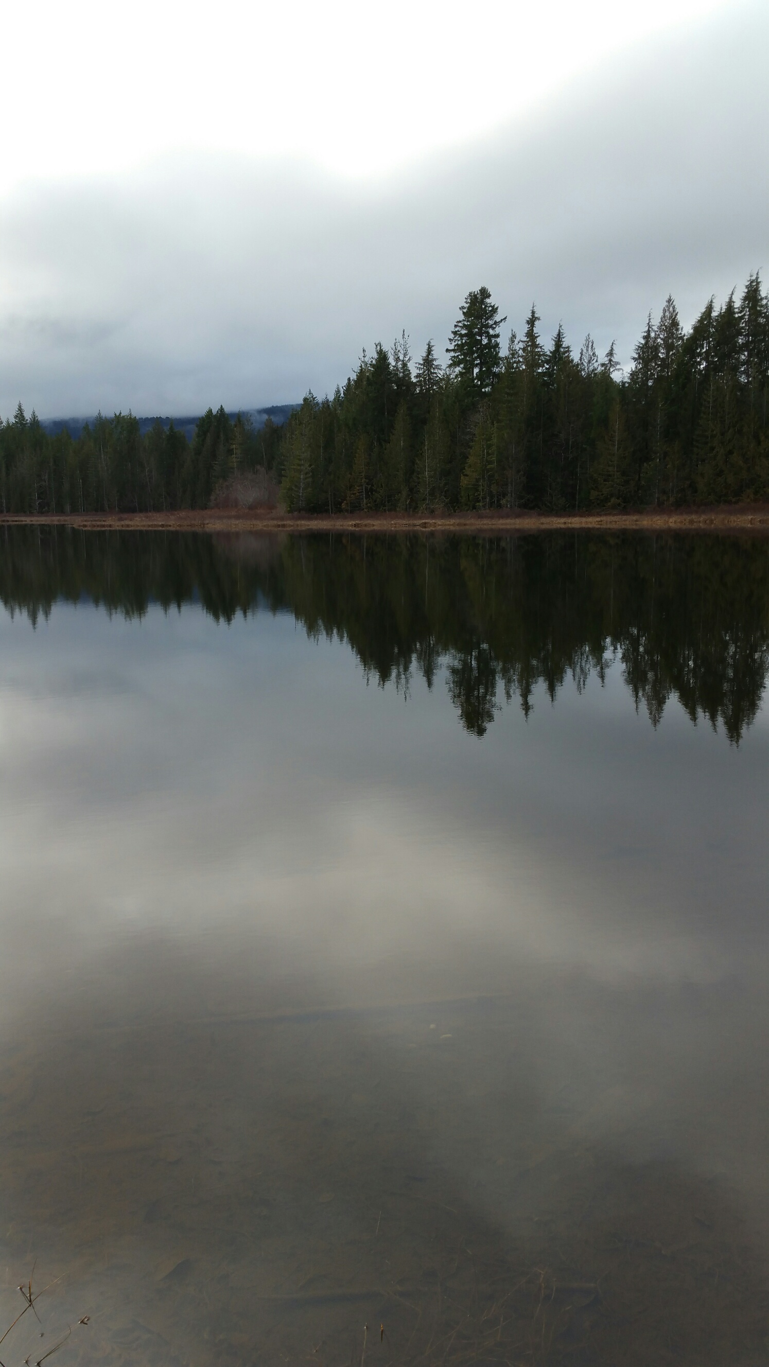
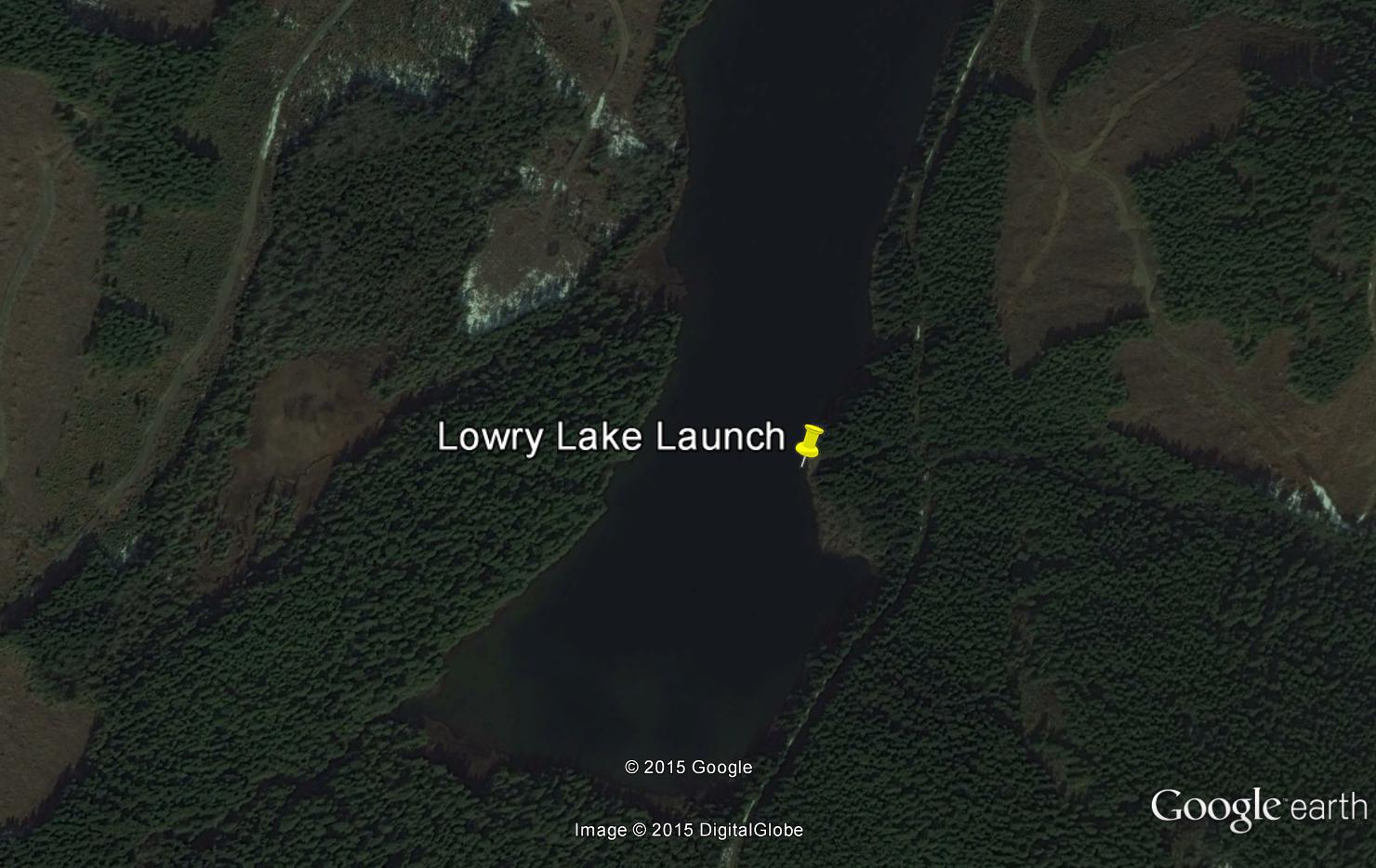
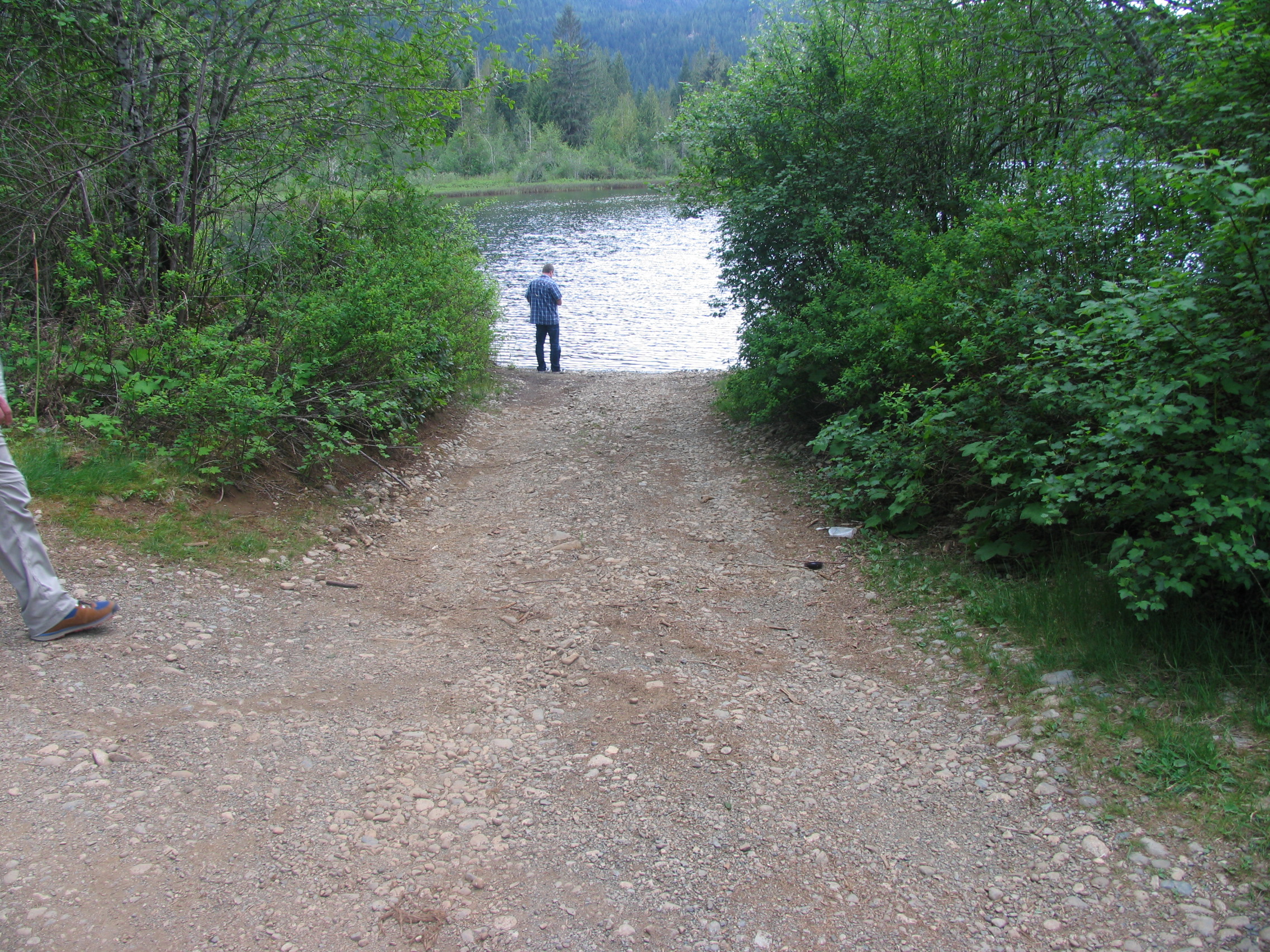
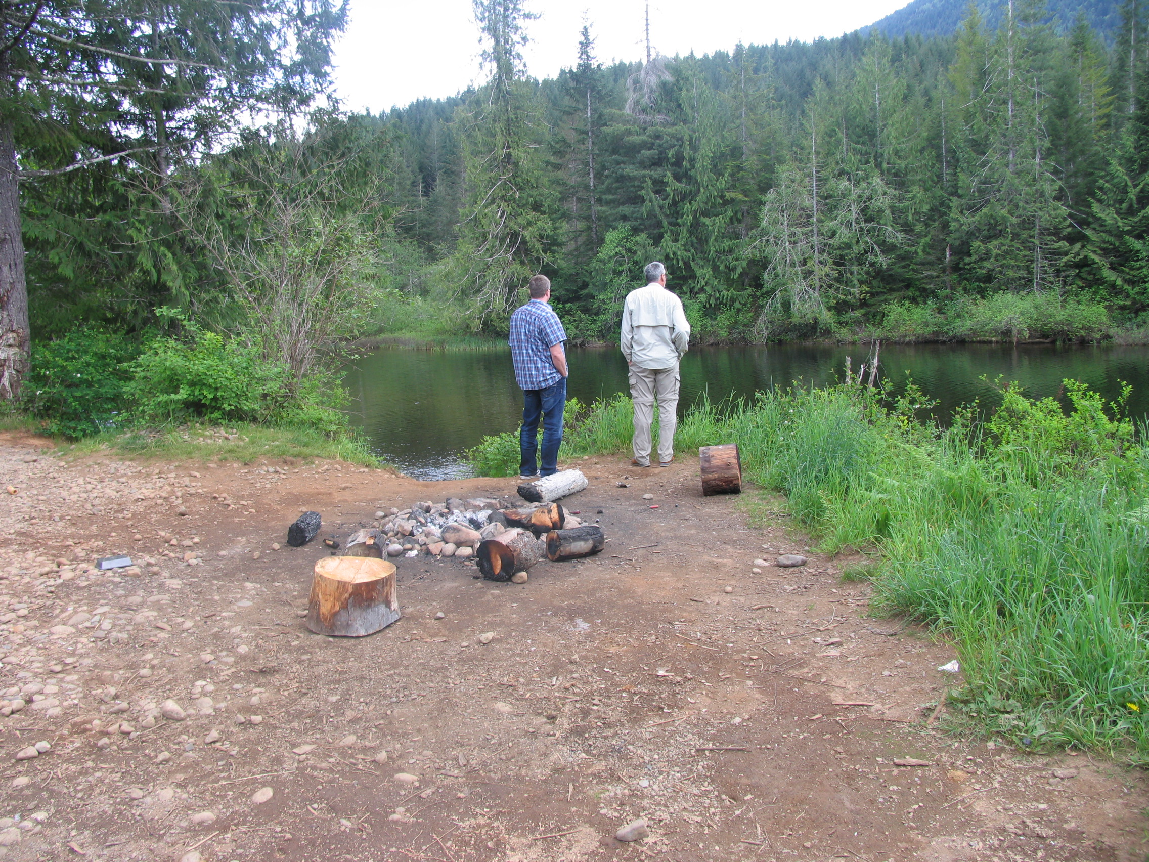
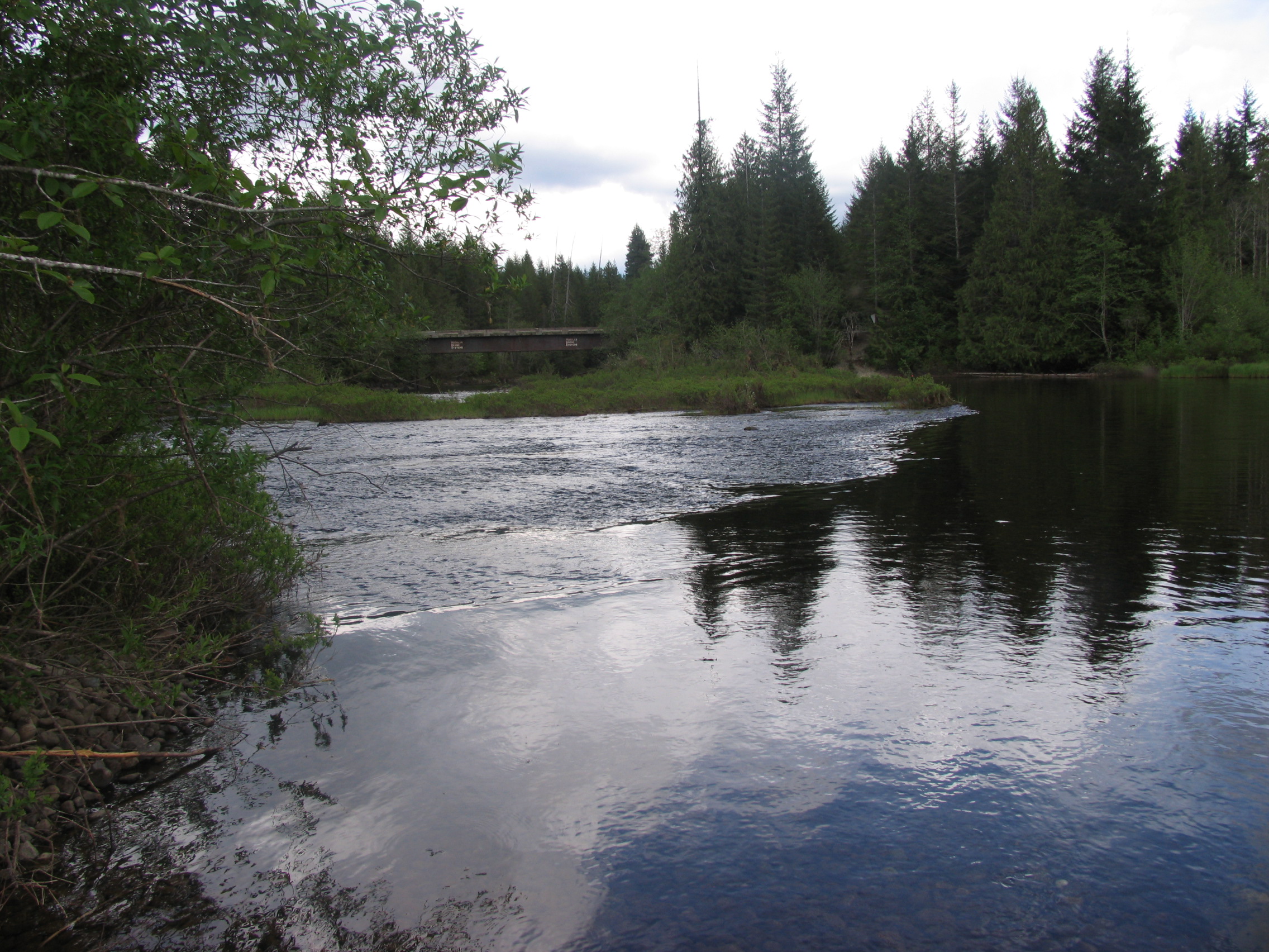
Lowry Lake
- General Area Location: Great Central Lake ‐ Ash River Valley
- Directions to the Lake: From the bridge in Port Alberni take Highway 4 and turn right onto Great Central Lake road for 17 kms. At Great Central lake turn right on the bridge over the Sproat River onto the Ash River Main. Travel 7 kms to the cutoff for Lowry Lake where you turn left onto branch # 83 (turning right takes you past Dickson Lake). Stay right for 10 kms on # 83 (past Browns Bay road) until you come to another “Y” intersection. Stay right again (you’re still on branch 83) and it’s about 1 km to Lowry Lake and a left turn to the recreation site. Total Distance from PA bridge to campsite: 35 kms
- GPS Way Points: Long: 125″‐ 07’‐58.3 W Lat: 49″‐23’‐13.8 N [google-map-fb-popup id=”16″]
- Road Conditions: Reasonable gravel road to Lowry. Branch # 83 continues on past Lowry (little bit rougher) and goes by small Lois Lake on your left then joins branch # 105 past McLaughlin Lake (see separate info) and Ash Lake (See separate info) where you join up again with the Ash River main, just a short distance north of our central point, the main bridge over the Ash River. From this point you can turn left and go by Turnbull Lake (see separate info) and beyond or turn right and head for Elsie lake or Dickson Lake (see separate info). Note: If you intend to only fish Dickson, Ash, McLaughlin, Turnbull, or Elsie lakes stay on the Ash River main as the Lowry route is longer.
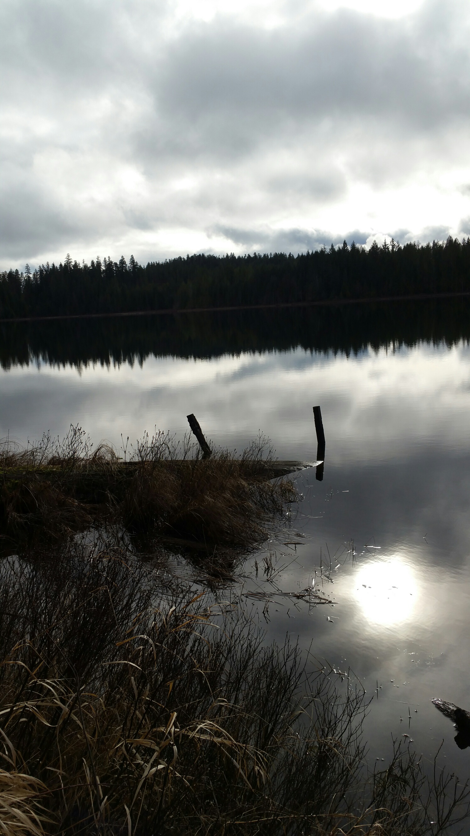
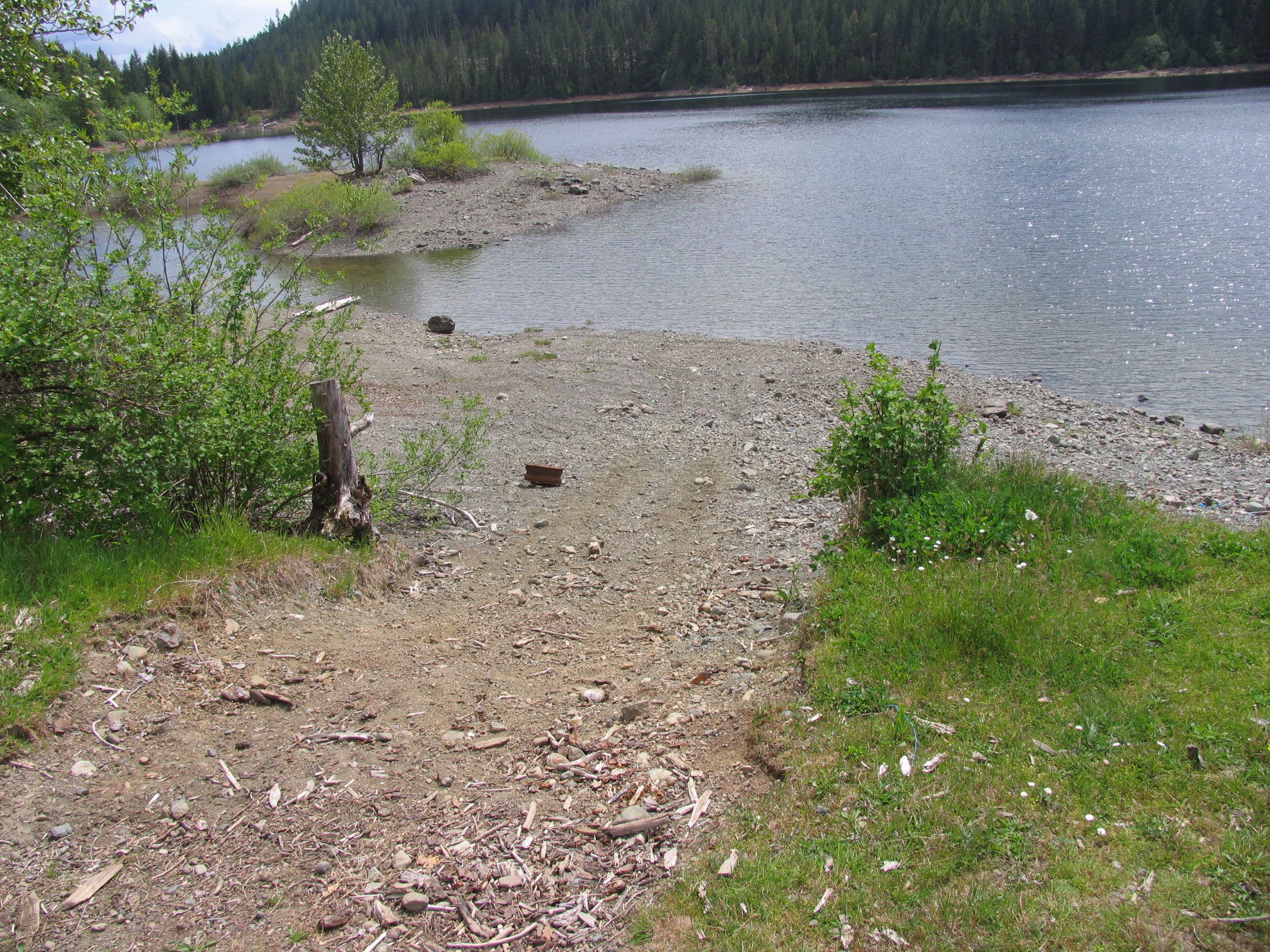
- Type of Launch Facilities: Very good, deep gravel launch site with small dock. Suitable for trailer, car top, inflatable, etc
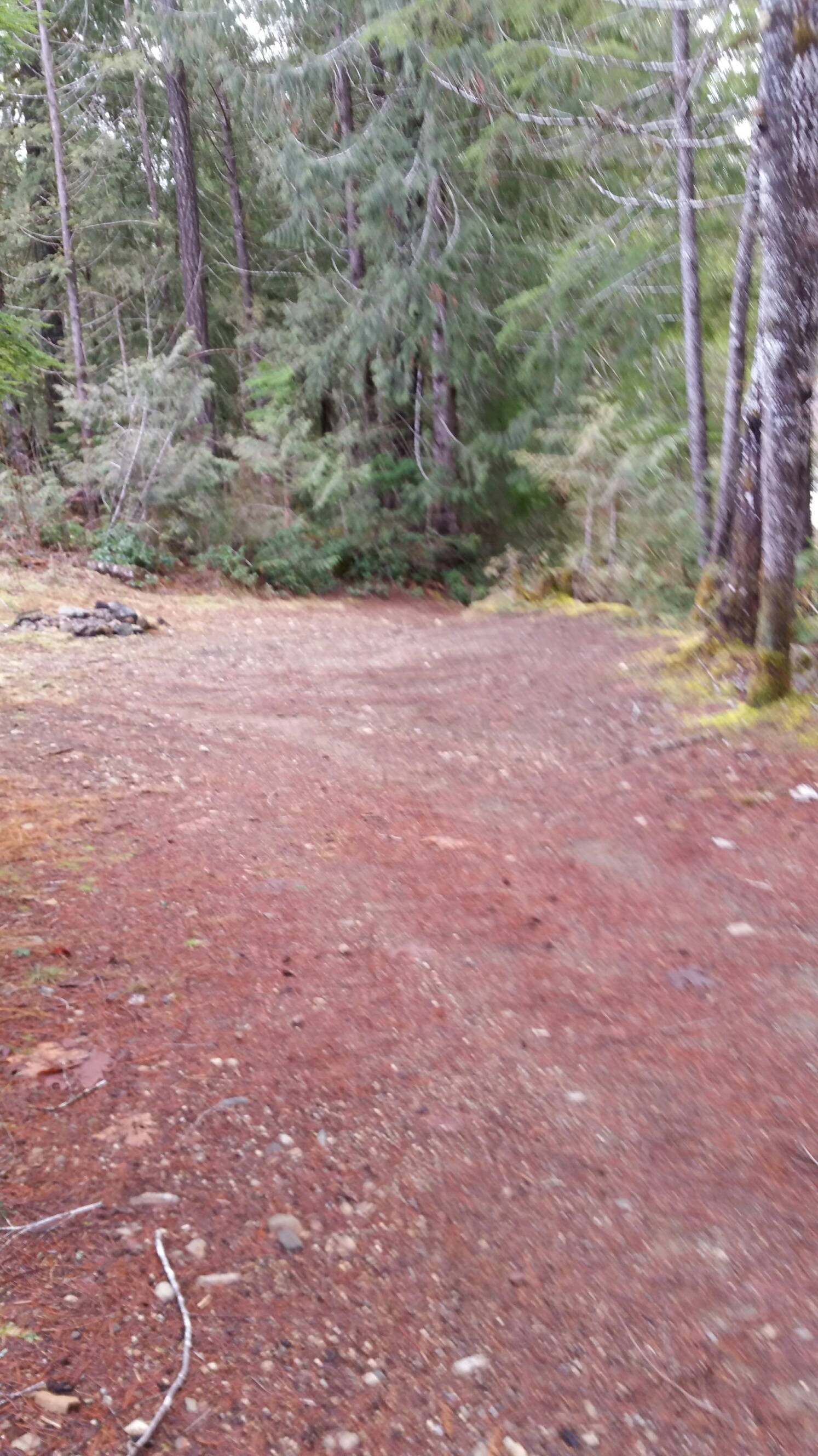
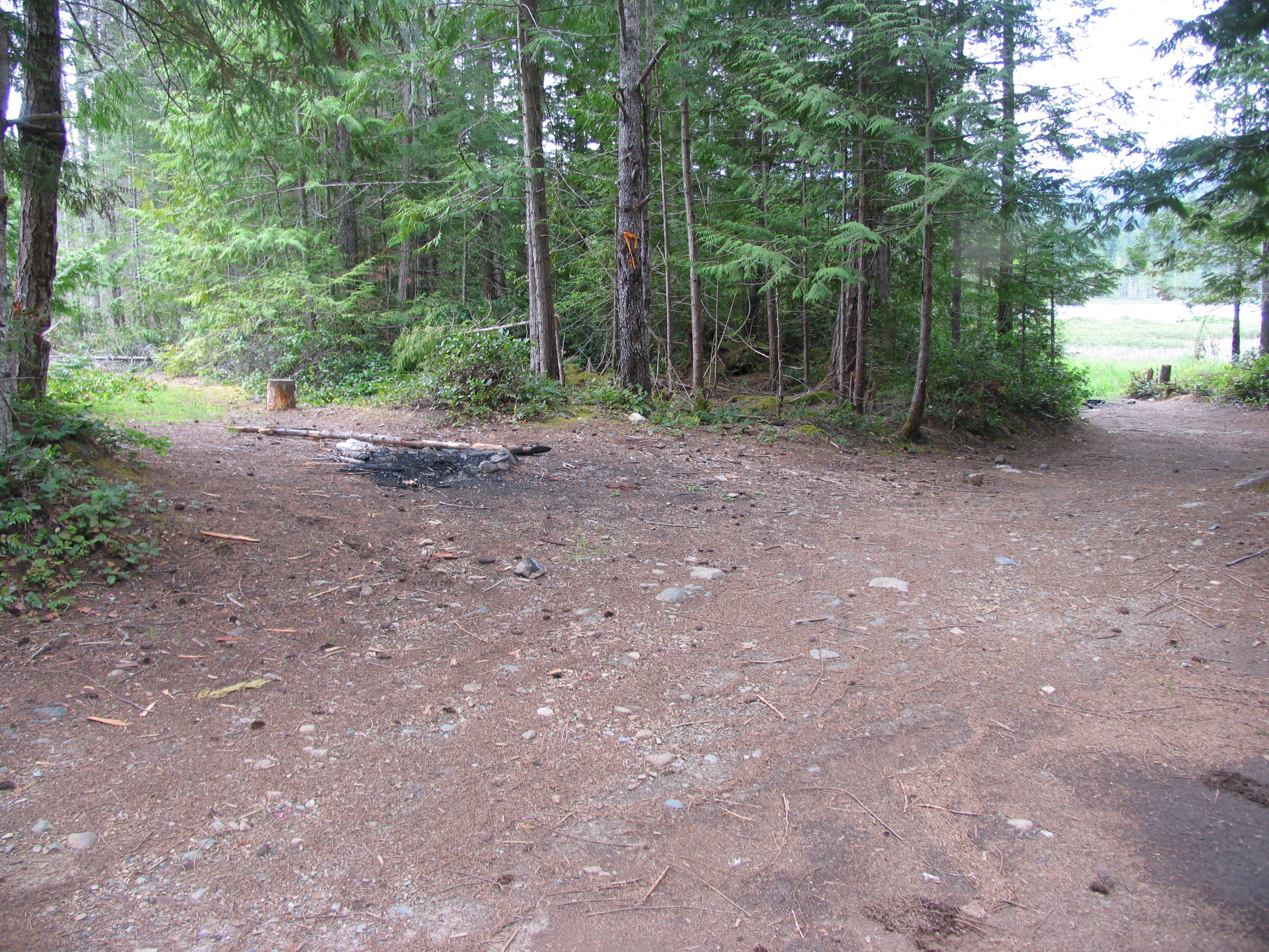
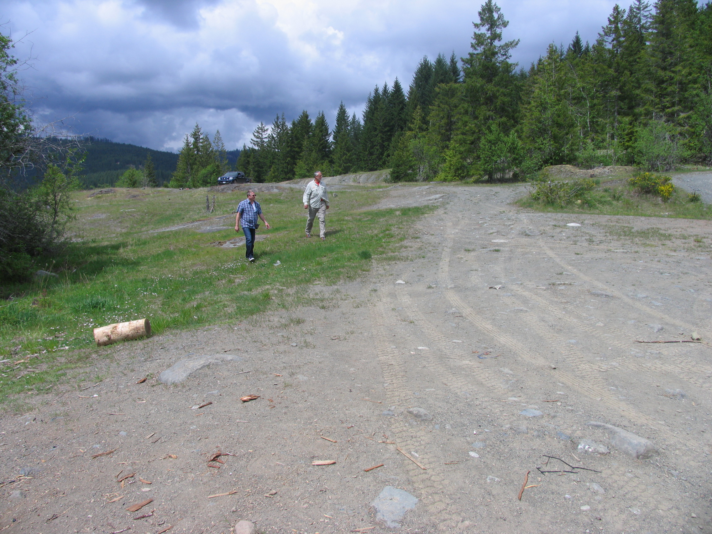
- Camp Sites at Lake: Several nice wilderness campsites including fire pits and outhouses. Probably the best facilities of all these Ash River Valley lakes
- Species of fish found in the Lake: Cutthroat, Rainbow, Kokanee. No recent stocking information found but there are some nice fish in this lake. We caught one nice rainbow of 17″.
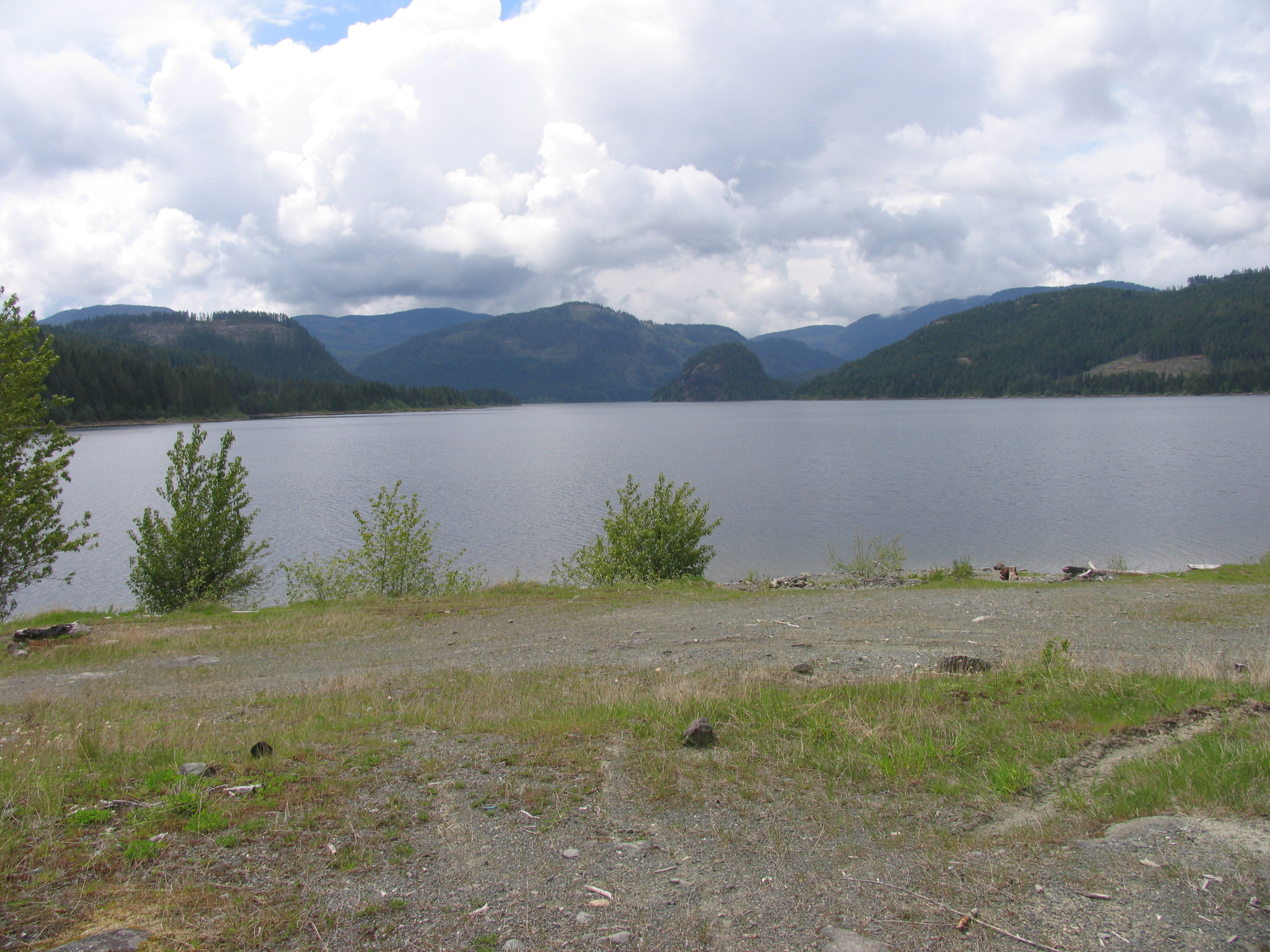
- General Information: This is a beautiful lake perhaps a mile long and good for fly‐fishing. Area: 114 acres (46 Ha), Max Depth: 36′ (11 m), Elevation: 479′ (146 m)
- Special Lake Restrictions: None known but check regulations
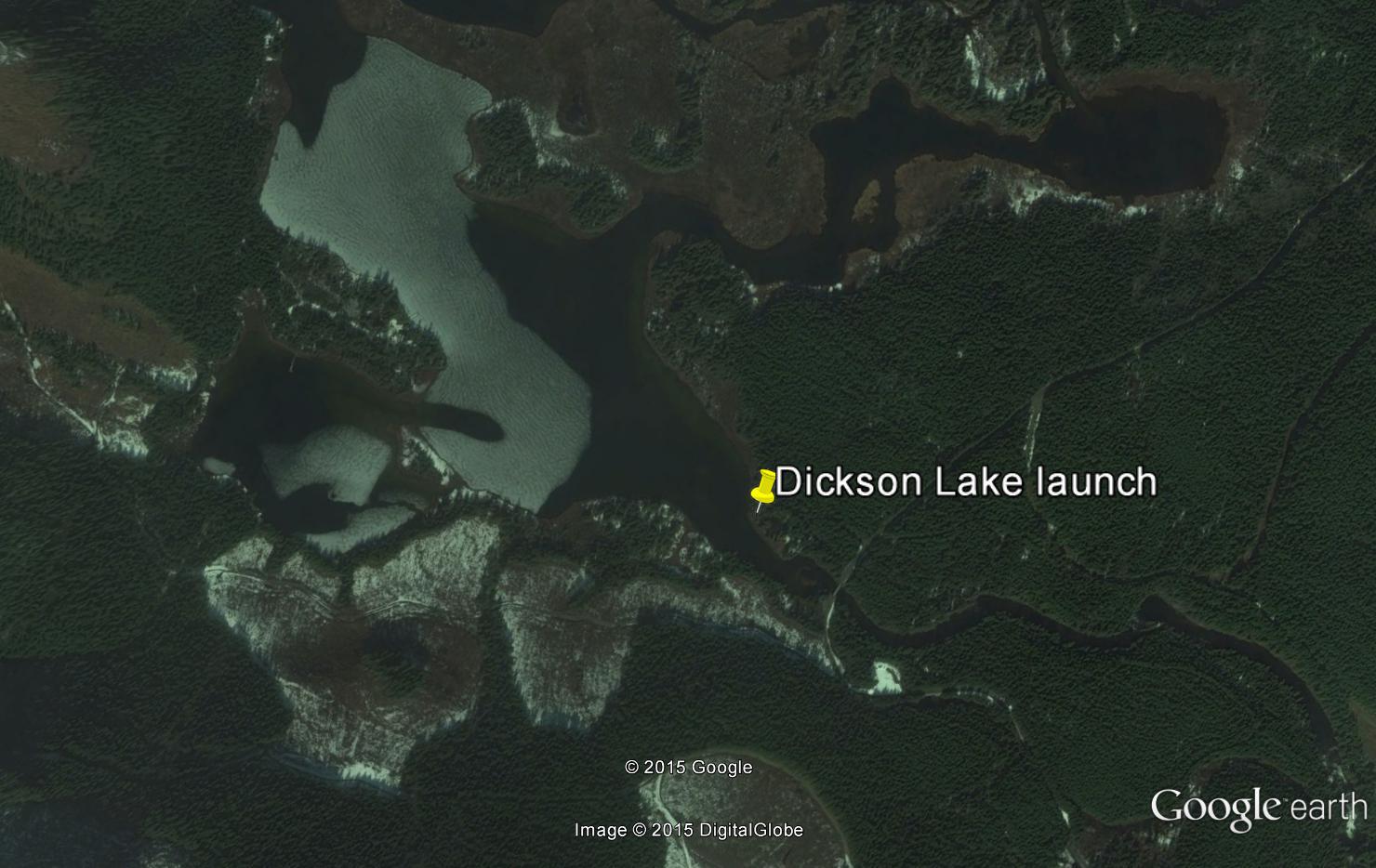
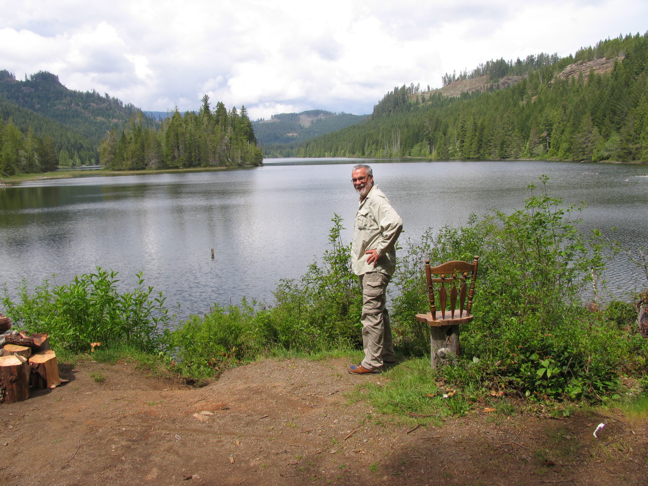
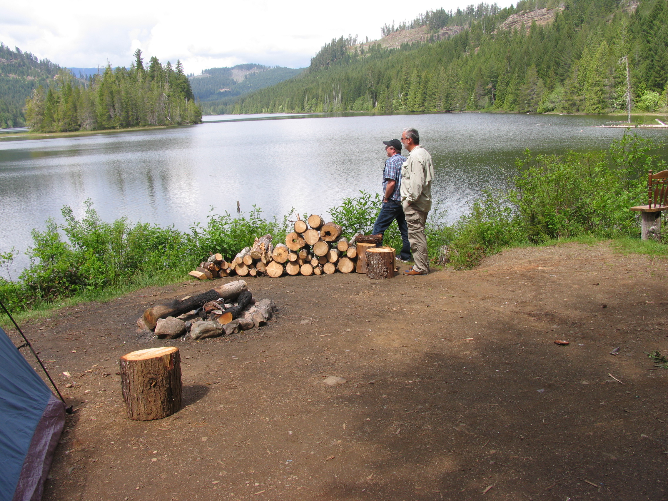
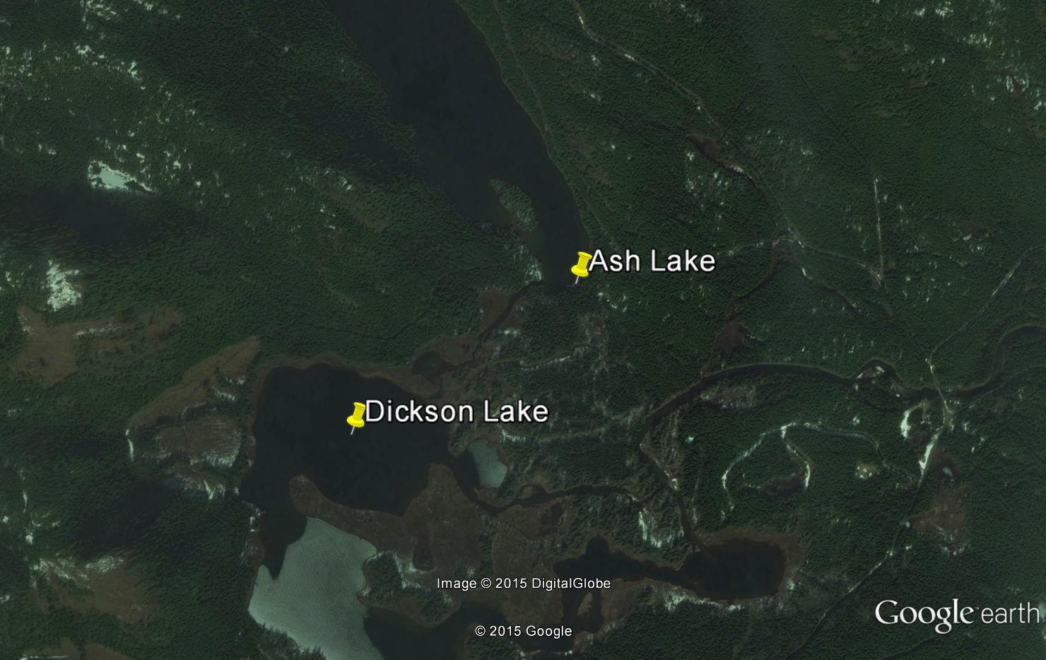
Dickson Lake
- General Area Location: Great Central Lake ‐ Ash River Valley
- Directions to the Lake: From Great Central Lake travel on the Ash River main for 14 kms (staying right at the turnoff for Lowry Lake at 7 kms) where you will see the lake on your left and cross over the bridge where the Ash River exits Dickson Lake. Immediately past the bridge you will see a dirt road to the left. It leads to a launch site and wilderness camping area. Total Distance from PA bridge to campsite: 31.5 kms. (Note: there is a second way to this lake but it’s longer and more difficult so not recorded).
- GPS Way Points: Long: 125″‐05’‐00 W Lat: 49″‐24’‐00 N [google-map-fb-popup id=”17″]
- Road Conditions: Ash River main is a reasonable gravel road suitable for a car but a truck is best. The first left‐hand turn‐off to the lake has potholes and water if it’s been raining.
- Type of Launch Facilities: Car top/inflatable best but a trailer works also but the launch is very shallow. Hip waders recommended.
- Camp Sites at Lake: Several wild camping spots available at the launch site and along a short trail which follows the Ash River exiting the lake.
- Species of fish found in the Lake: Cutthroat, Rainbow, Steelhead. No recent stocking information found
- General Information: Good fly‐fishing lake with many bays and weed areas. Elevation: 656 ‘ (200 m), Area: 295 acres (119 Ha), Max Depth: 53’ (16.1 m)
- Special Lake Restrictions: No fish over 50 cm, bait ban, single barbless hook
Ash Lake
- General Area Location: Great Central Lake ‐ Ash River Valley
- Directions to the Lake: From Great Central Lake travel on the Ash River main (past Dickson Lake) for 16 kms (33 kms from the bridge in Port Alberni) and cross over the Ash River bridge (our CENTRAL POINT). A short distance past the bridge turn left on branch # 105. Just before Ash Lake, turn left on branch # 102 that runs past the south end of Ash lake (short distance) where there are several spots to camp. Total Distance from PA bridge to campsite: 35 kms.
- GPS Way Points: Long: 125″‐05’‐14.7 W Lat: 49″‐24’‐ 42.2 N
- Road Conditions: Ash River main is a reasonable gravel road suitable for a car but best in a truck. Branch # 105 is a little rougher but a car OK if careful.
- Type of Launch Facilities: Car top/inflatable. No trailer launch located
- Camp Sites at Lake: Several wild camping spots available at the south eastern end (branch # 102) of Ash Lake and about mid‐lake on # 105. There is a small fishing dock at the south‐east end otherwise no facilities
- Species of fish found in the Lake: Cutthroat, Rainbow, Dolly Varden. No recent stocking information found since 2005 when 500 Rainbow were stocked. Apparently the lake does yield a few large fish every year.
- General Information: Good fly‐fishing lake and the best spot is apparently the northern tip of the island found in the south east corner of the lake. Elevation: 675 ‘ (206 m), Area: 160 acres (65 Ha), Max Depth: 108’ (33 m)
- Special Lake Restrictions: No restrictions found but check regulations
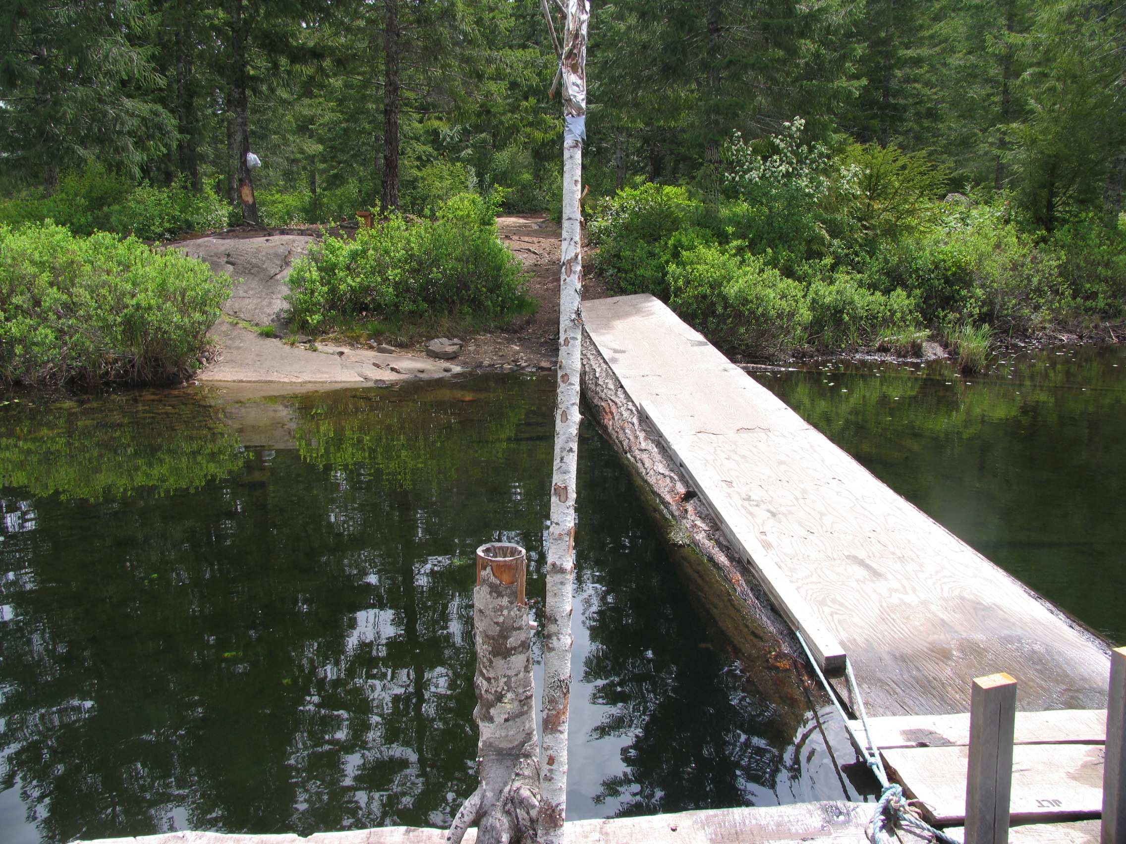
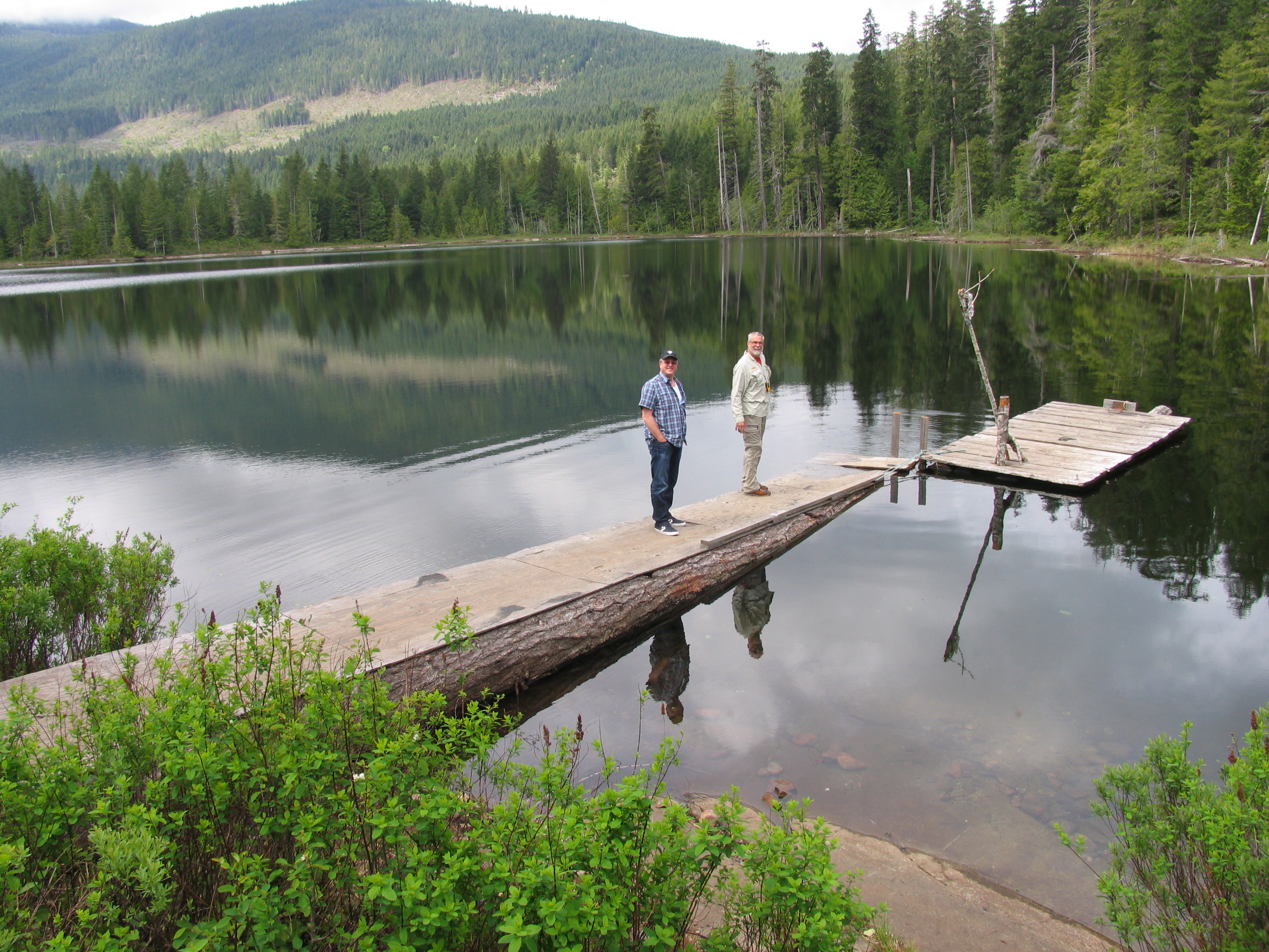
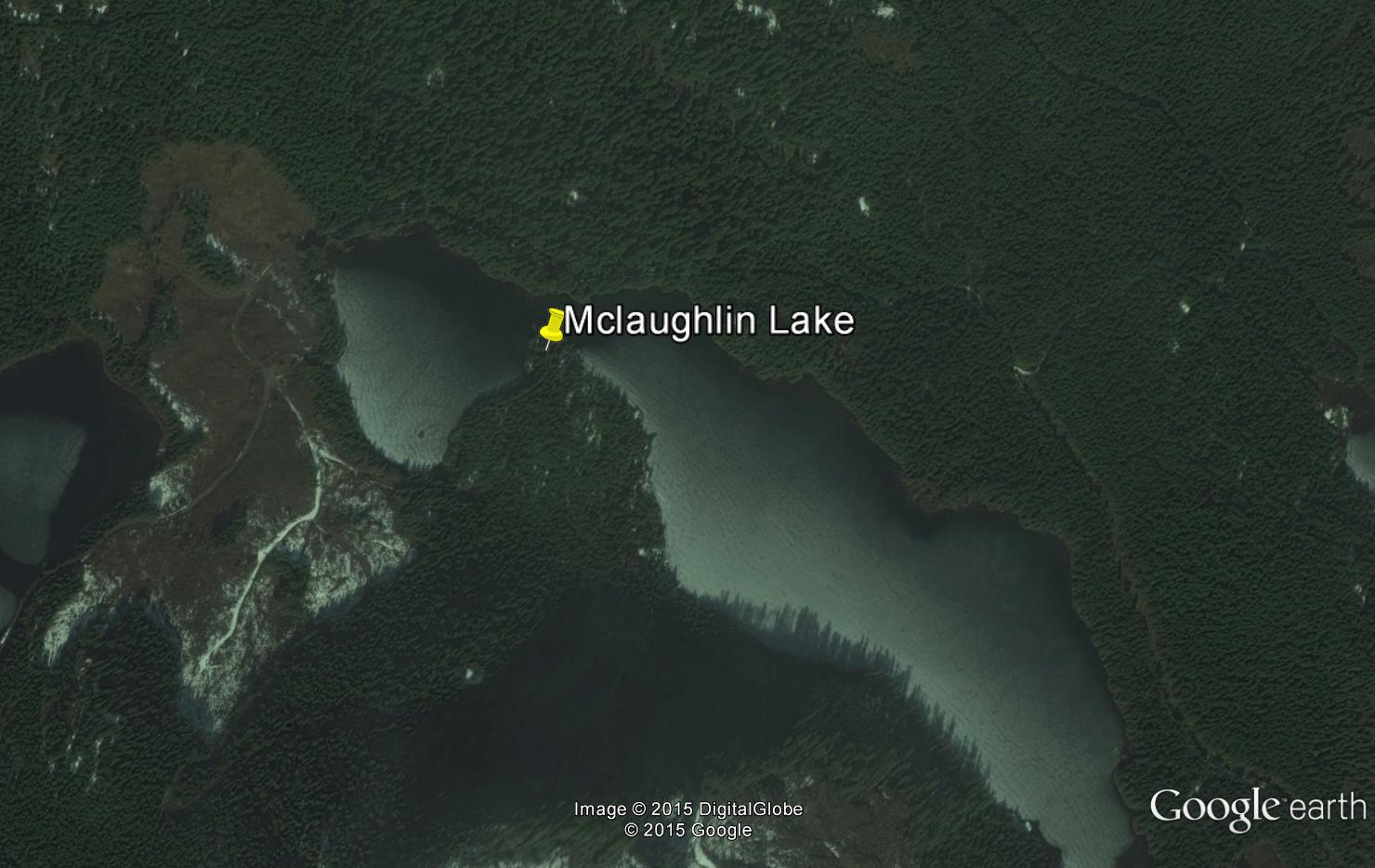
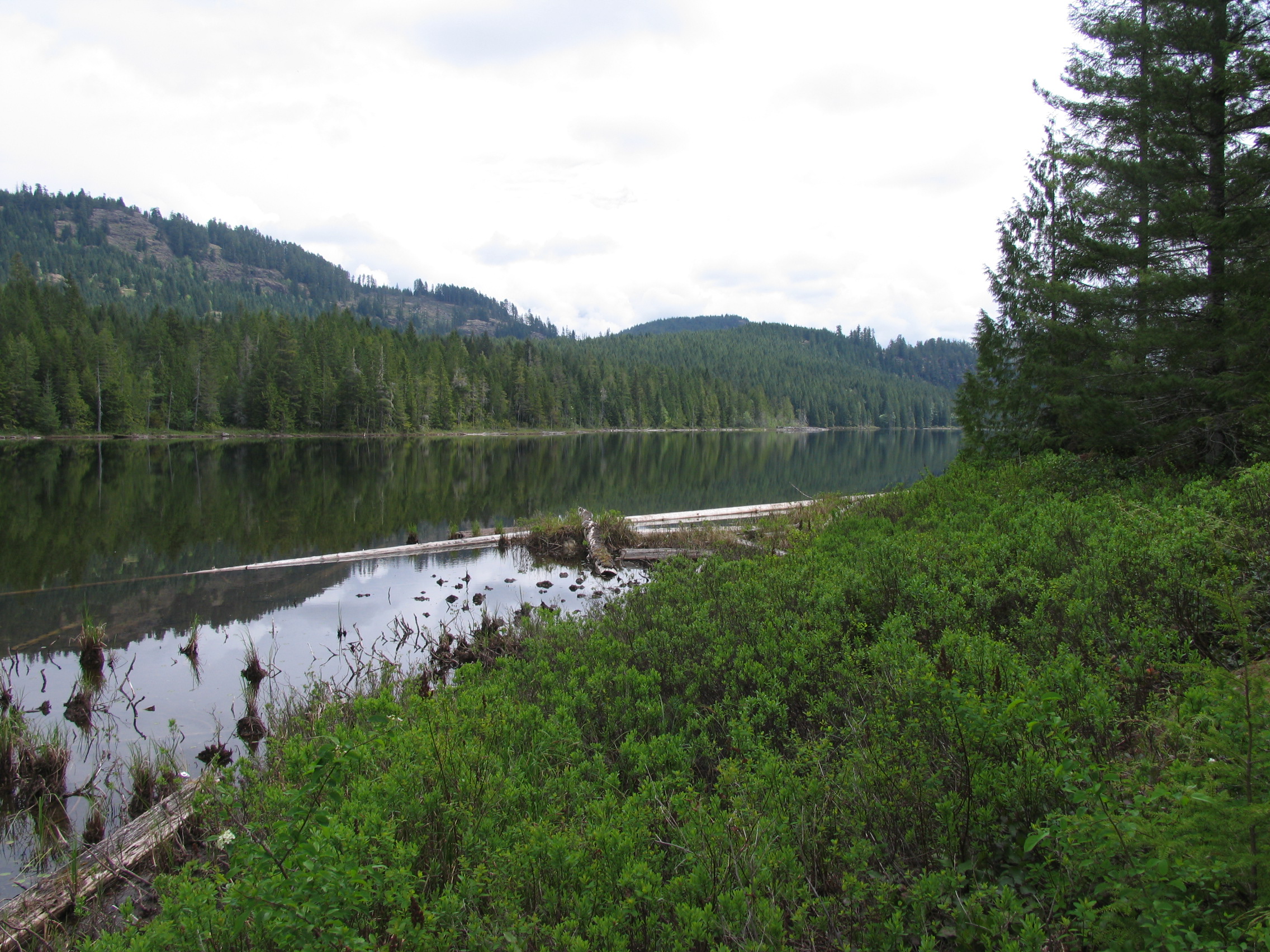
McLaughlin Lake
- General Area Location: Great Central Lake ‐ Ash River Valley
- Directions to the Lake: From Great Central Lake travel on the Ash River main for approximately 16 kms staying left and crossing over the Ash River bridge (our central point). A short distance past the bridge turn left on branch # 105. Drive past Ash Lake on your left to McLaughlin Lake which is just past Ash Lake. Go past McLaughlin Lake branch # 105 runs into branch # 83 from Lowry Lake. At the Y intersection stay left and go up a short hill, then left which takes you down to the western end of the lake and two camping areas which are 6 kms from the Ash River bridge. Total distance from the PA Bridge to campsite: 41 kms
- GPS Way Points: Long: 125″‐07’‐33.5 W Lat: 49″‐25’‐ 33.3 N [google-map-fb-popup id=”18″]
- Road Conditions: Ash River main is a reasonable gravel road suitable for a car but a truck is best. Branch # 105 is a little rougher, car OK if careful. However, to get to the wilderness camping and car top boat launch areas on McLaughlin, a 4×4 truck is highly recommended.
- Type of Launch Facilities: Car top/inflatable. No trailer launch known
- Camp Sites at Lake: To access follow branch # 105 past McLaughlin Lake to where the road joins up with branch 83 (from Lowry Lake) and before little Lois lake on your right). You are now west of the lake and stay left at the “Y” intersection then left again DOWN to the lake. Several good wilderness camping spots available including a extended fishing dock.
- Species of fish found in the Lake: Cutthroat, Rainbow, Dolly Varden, Brown trout. No recent stocking information found since 2007 when 1,000 Cutthroat were stocked. Apparently there are a few large fish in the lake including a 17 lb Brown trout caught in 2003
- General Information: Good fly‐fishing lake with lots of shoals. The camping areas and fishing dock are on a point which juts out into the lake at the north west part of the lake and apparently a very good fishing area. Elevation: 720 ‘ (219 m), Area: 101 acres (41 Ha), Max Depth: 91’ (28 m)
- Special Lake Restrictions: No restrictions found but check regulations
Turnbull Lake
- General Area Location: Great Central Lake ‐ Ash River Valley
- Directions to the Lake: From Great Central Lake travel on the Ash River main for approximately 15 kms staying left and crossing over the Ash River bridge (our central point). Instead of turning left on branch # 105 (Ash, McLaughlin Lakes) stay on the Ash River road a few klms until you come to Turnbull Lake. Total distance from bridge in PA: 36 kms
- GPS Way Points: Long: 125″‐06’‐00 W Lat: 49″‐25’‐ 00 N [google-map-fb-popup id=”19″]
- Road Conditions: Ash River main is a reasonable gravel road suitable for a car but a truck is best
- Type of Launch Facilities: Car top/inflatable from spots along Ash River road
- Camp Sites at Lake: None known
- Species of fish found in the Lake: Cutthroat, Rainbow, Dolly Varden. No recent stocking information, last stocked 2004 ‐ 2008 with 1,500 Cutthroat. Apparently there are a few large Dollies in the lake to 5 lbs
- General Information: Not a suitable trolling lake but good fly‐fishing along the shoals in the east end. Elevation: 869′ (265 m), Area: 57 acres (23 Ha), Max Depth: 39′ (12 m). If you carry‐on past Turnbull on Ash River road you will come to the west end of Elsie lake. However there are no launching facilities on the west end of Elsie so refer to the two other options shown for that lake
- Special Lake Restrictions: No restrictions found but check
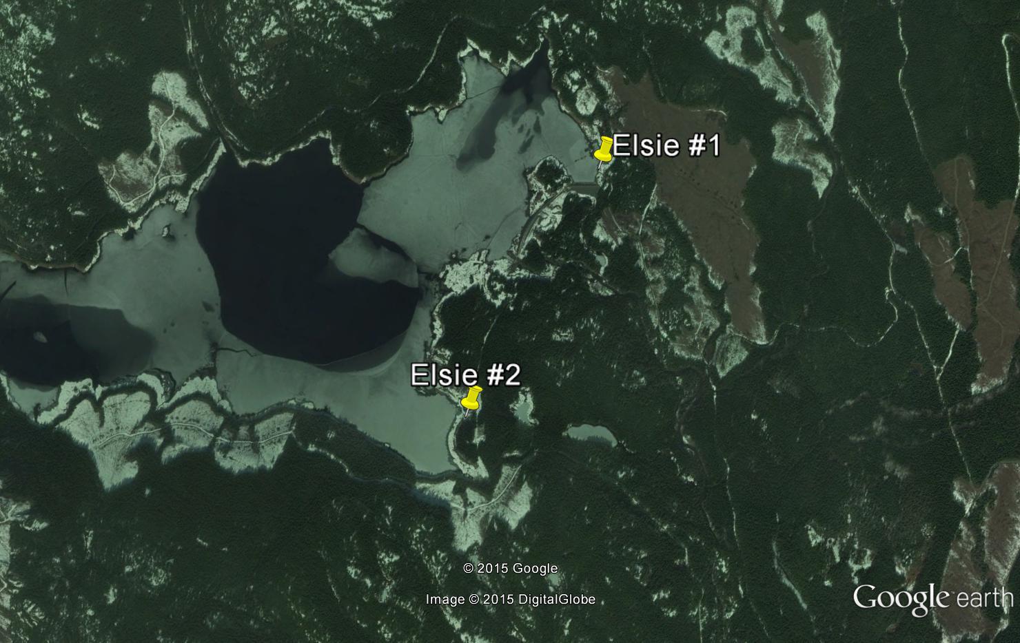
Elsie Lake
- General Area Location: Great Central Lake ‐ Ash River Valley
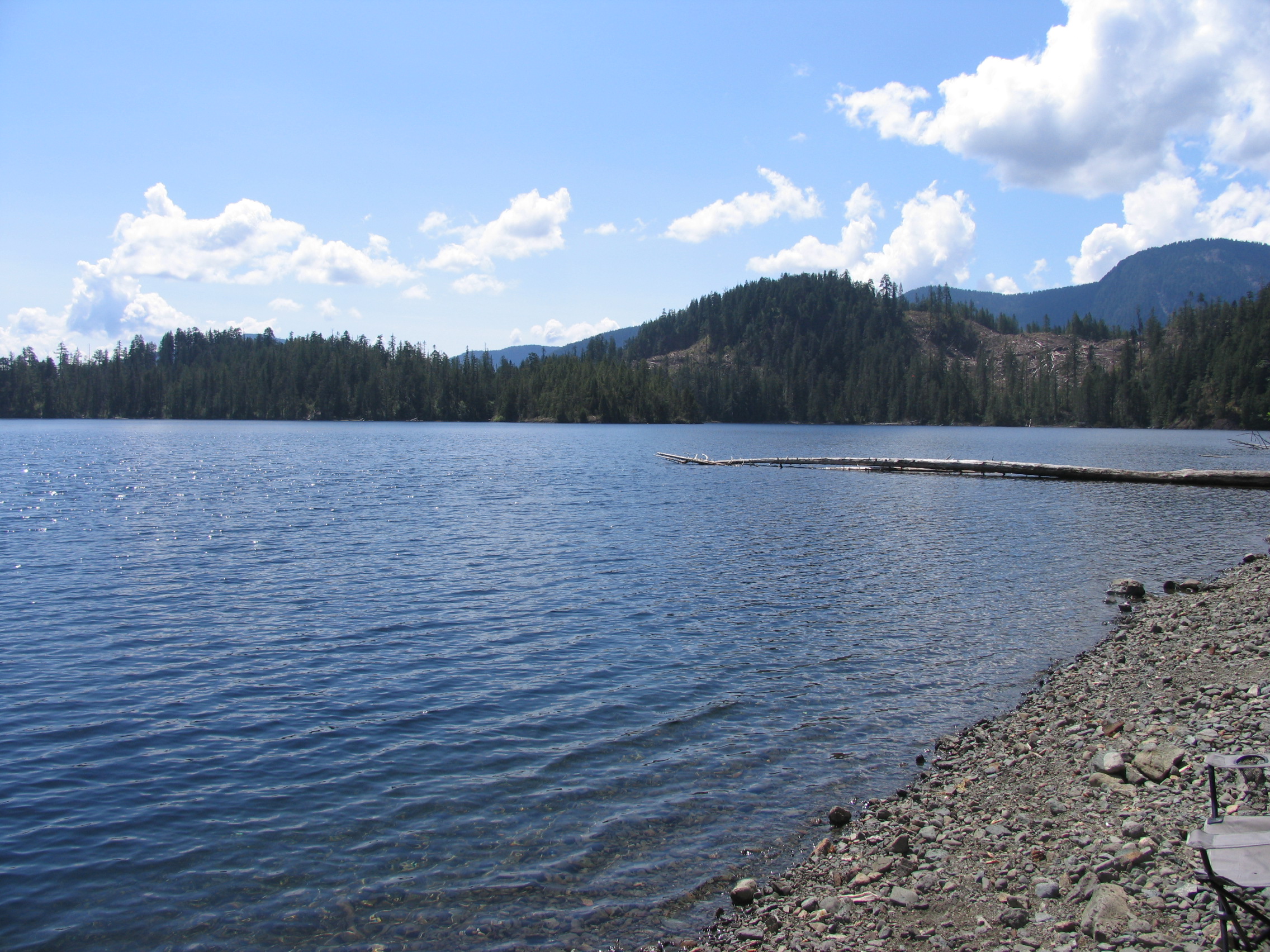
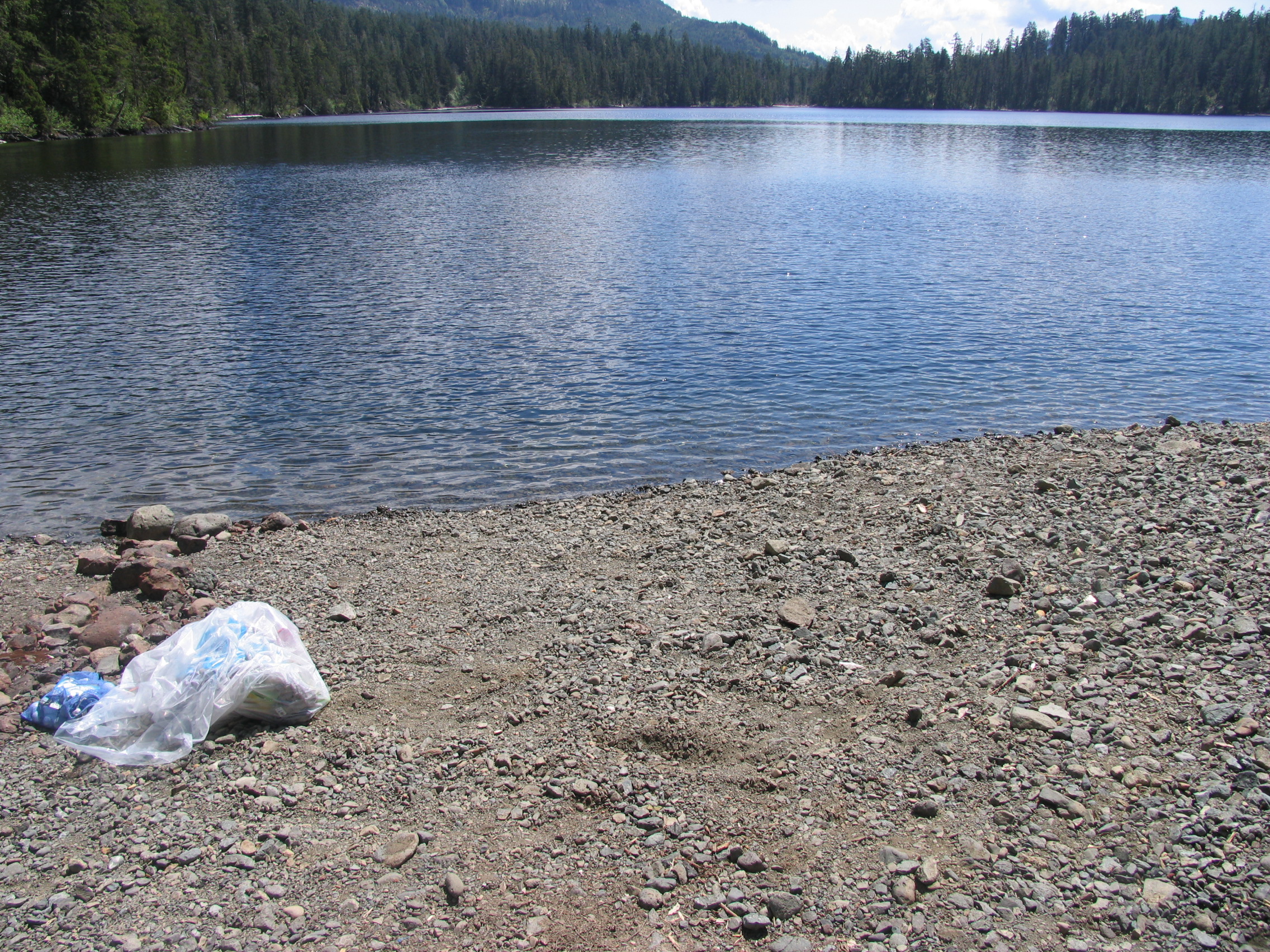
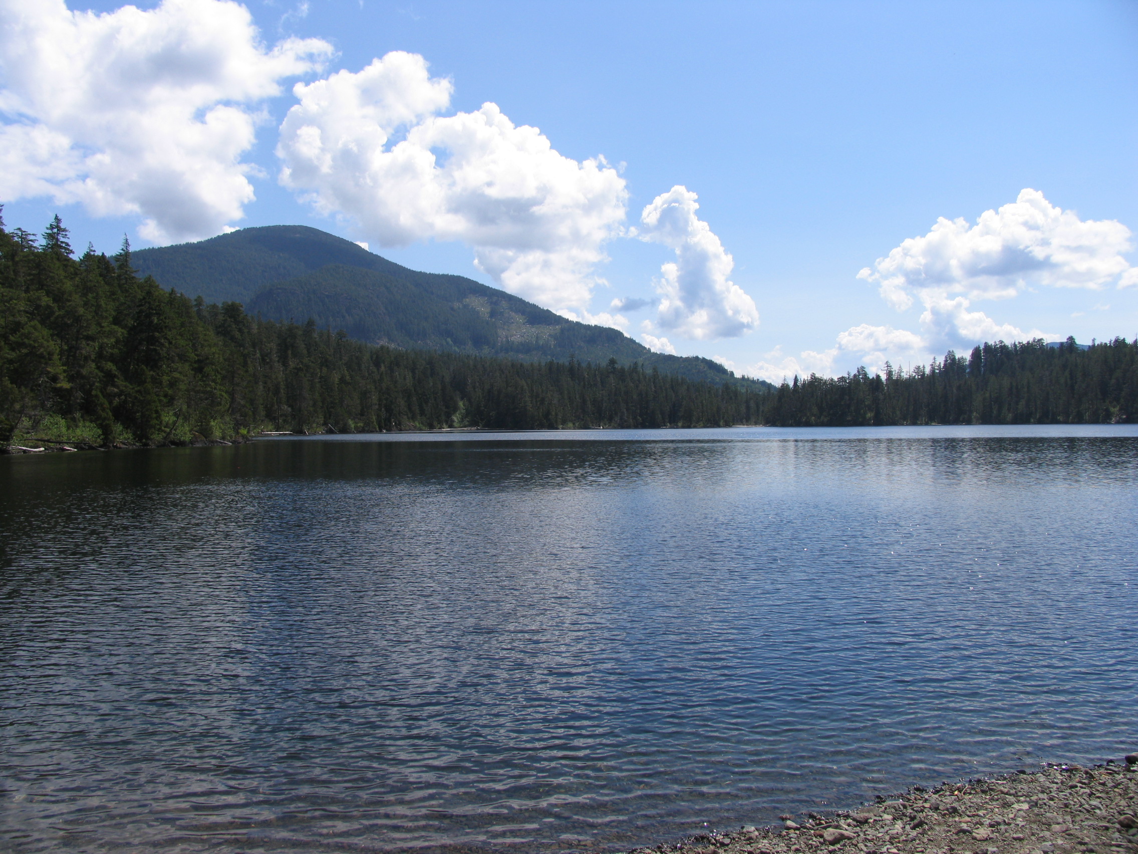
- Directions to the Lake: Elsie Lake is the largest lake in this general area. There are two boat launching and wilderness camping areas on Elsie Lake, both on the eastern end of the lake on either side of the large BC Hydro earth dam. Campsite 1 starts at our CENTRAL POINT, the bridge over the Ash River, 33 kms from the bridge in Port Alberni. Just past the bridge turn right on branch 108A (there is a gate on 108A right at the start that’s usually open) for 7 kms and you will come to a 3-way split in the road, turn right at the big rock pile and go over the earth dam to Elsie Lake. There are numerous wilderness camping spots in this area including a natural trailer boat launch. Total Distance from the PA bridge to campsite 1: 40 kms.
- Campsite 2: Instead of turning left on the Ash River road at our CENTRAL POINT, stay right on the Comox Main road (also called Valley Link road) for 3 kms until you come to another 3-way intersection. Take the middle road (still Comox Main) which has a “gated” sign but it’s well past Elsie Lake so ignore the sign. Look for a left hand turn at the CK 172 sign (49″-28′-07.9 N, 125″-06′-09.5 W) and proceed to CK 110 sign (also called Long Lake road). Turn right and follow the road to the eastern end of BC Hydro’s large earth dam. Total Distance from PA bridge to campsite 2: 44 kms.
- Alternate route to campsite 2: Comox Main can also be reached by taking the Beaver Creek road just past the bridge in Port Alberni and is a shorter route to campsite 2. Total Distance from PA bridge to campsite 2: 36 kms.
- GPS Way Points: Long: 125″-°©‐06’‐ 13.7 W Lat: 49″‐27’‐ 18.7 N [google-map-fb-popup id=”20″]
- Road Conditions: Ash River main and branch 108A are reasonable gravel roads suitable for a car. That being said, if you want to launch a boat from a trailer. a 4 x 4 truck is recommended
- Type of Launch Facilities: Car top/inflatable, trailer (with a truck) are OK as either option 1 or 2
- Camp Sites at Lake: Both option 1 & 2 offer numerous wilderness campsites in a pretty environment
- Species of fish found in the Lake: Cutthroat, Rainbow, Steelhead. No recent stocking information. Average fish 14″ but numerous trout over 3 lb are regularly caught.
- General Information: Elevation: 640′ (195 m), Area: 2,735 acres (1,107 Ha), Max Depth: 68′ (21 m). Lake can be heavily drawn down by BC Hydro in the summer .
- Special Lake Restrictions: No restrictions found but check regulations
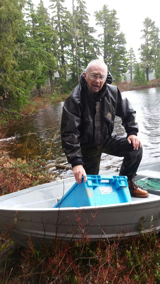
these pictures are of campsite #1
Port Alberni West
Because they are such large, well known lakes we have not included Sproat and Great Central Lakes in this report. As we wanted to stick to the 60-80 minute drive goal as close as possible we stopped at Gracie Lake. (actually about 90 mins depending on your speed) Further down the road past Gracie is Nahmint Lake which is another fairly large lake. The road beyond Gracie gets rougher and a 4×4 truck is advisable.
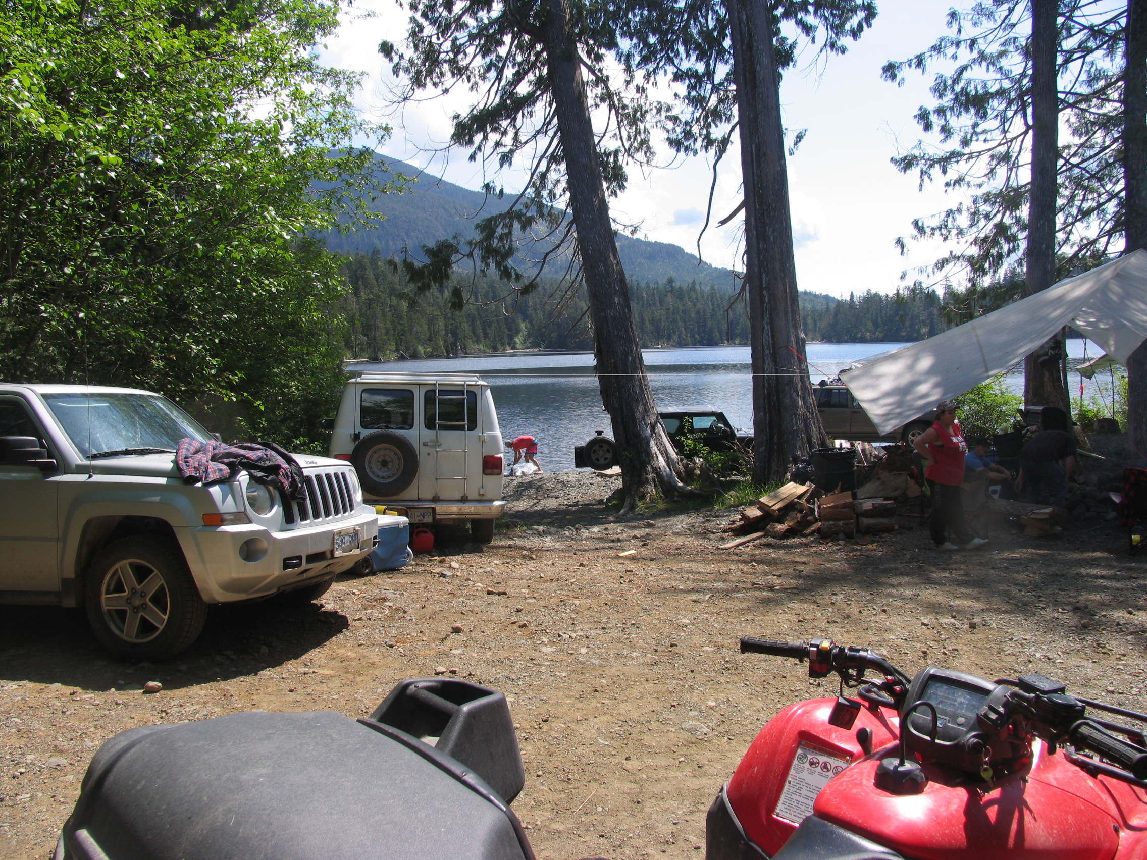
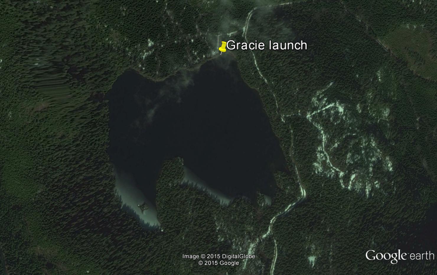
Gracie Lake
- General Area Location: Port Alberni West and south of Sproat Lake
- Directions to the Lake: From the bridge in Port Alberni travel west on Highway 4 for 3 kms turning left on McCoy Lake road then to Stirling Arm Drive. Follow the paved road until you come to the intersection with Herbert Road. Turn left onto the gravel Stirling Arm Main (note: Stirling Arm Drive is paved and carries on to the right). Follow Stirling Arm Main (when you cross a bridge stay right at the “Y” junction) along the south shore of Sproat Lake until you come to the intersection with South Taylor Arm road. Stay left and the road starts to climb for 5 kms to Gracie Lake. Look for the short road on your right that leads down to the lake.
- GPS Way Points: Long: 125″‐05’‐ 00 W Lat: 49″‐13’‐ 00 N [google-map-fb-popup id=”21″]
- Road Conditions: Pavement until Stirling Arm road then decent gravel road
- Type of Launch Facilities: Car top/inflatable only. You can drive quite close to the lake but not with a trailer.
- Camp Sites at Lake: Wilderness camping with no facilities
- Species of fish found in the Lake: Stocked with Rainbow trout every other year since 2004. From 2010 ‐ 2014 2,400 Blackwater Rainbow were planted. Reportedly some very nice sized rainbow in the lake reportedly in the 4 ‐ 5 lb range
- General Information: Small lake considered one of the better rainbow trout fisheries in the southern part of the island. Can be fished throughout the year (as long as no ice). Elevation: 1,283′ (391 m), Area: 94 acres (38 Ha), Max Depth: 141′ (43 m).
- Special Lake Restrictions: Electric motors only
Sumner Lake
- Lake Name: Sumner (Somner) Lake
- General Area Location: Great Central Lake – Ash River Valley
- Directions to the Lake: From Great Central Lake bridge travel on the Ash River main staying right for 5 klms. Turn right when you see on your right a logging road sign marked # 264. Travel down reasonable gravel road for 1.2 klms until you see the lake. Short road on the right leads to boat launch area. Total Distance from PA bridge to lake: 23.2 klms.
- GPS Way Points: Long: 124″- 59′- 24.3 W Lat: 49″- 21′- 35.6 N
- Road Conditions: Ash River main is a reasonable gravel road suitable for a car but a truck is best. The right-hand turn-off to the lake at # 264 is reasonable and a car would be OK but a truck is best.
- Type of Launch Facilities: Car top/inflatable best but a trailer works. Limited turn-around places so if you have a trailer recommend you it down to lake (maybe 100’).
- Camp Sites at Lake: Very beautiful spot but limited camping available.
- Species of fish found in the Lake: Cutthroat, Rainbow. No recent stocking information found.
- General Information: Little information but there are rumours of good sized trout in previous years.
- Special Lake Restrictions: No restrictions found.